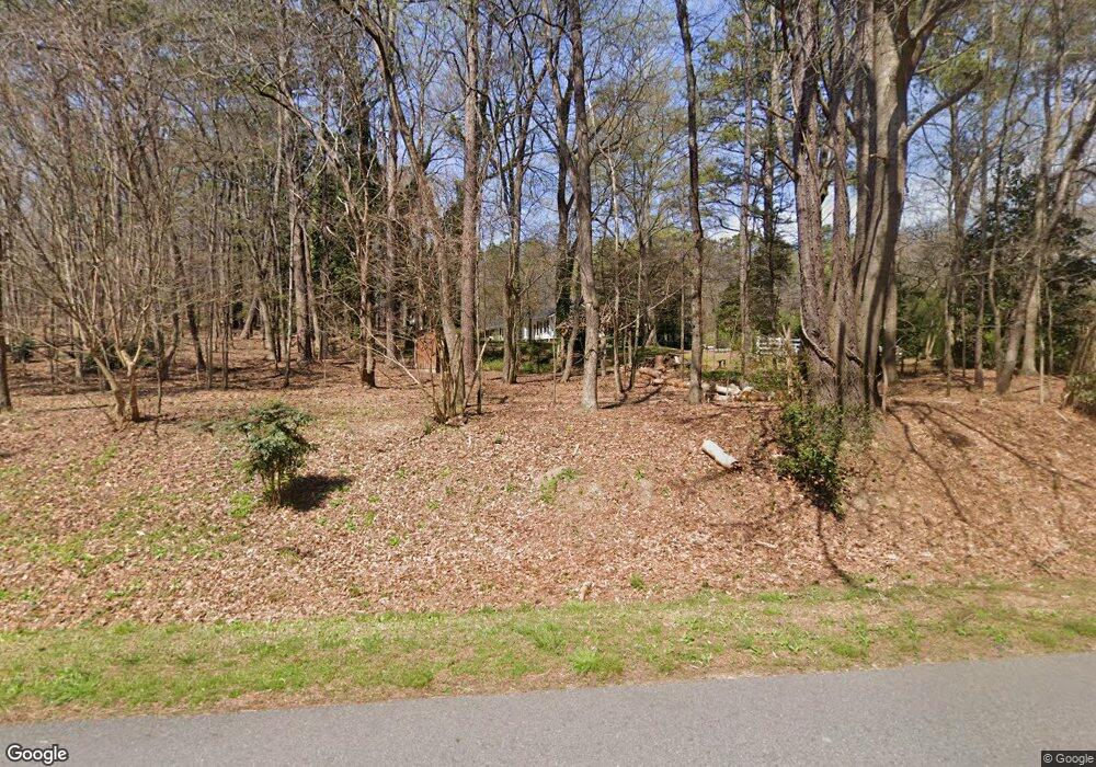
1070 Paris Mountain Rd Rockmart, GA 30153
Estimated Value: $191,000 - $373,000
2
Beds
1
Bath
1,038
Sq Ft
$272/Sq Ft
Est. Value
About This Home
This home is located at 1070 Paris Mountain Rd, Rockmart, GA 30153 and is currently estimated at $282,000, approximately $271 per square foot. 1070 Paris Mountain Rd is a home with nearby schools including Rockmart Middle School.
Ownership History
Date
Name
Owned For
Owner Type
Purchase Details
Closed on
Aug 13, 1988
Sold by
Borders Keith E
Bought by
Gary Ann Goss
Current Estimated Value
Purchase Details
Closed on
Aug 23, 1985
Sold by
Motes Wm R and Motes Sarah N
Bought by
Borders Keith E
Purchase Details
Closed on
Mar 31, 1966
Sold by
Harper W P
Bought by
Motes Wm R and Motes Sarah N
Purchase Details
Closed on
Oct 19, 1965
Sold by
Ballard John L Mrs
Bought by
Harper W P
Purchase Details
Closed on
Aug 27, 1962
Bought by
Ballard John L Mrs
Create a Home Valuation Report for This Property
The Home Valuation Report is an in-depth analysis detailing your home's value as well as a comparison with similar homes in the area
Home Values in the Area
Average Home Value in this Area
Purchase History
| Date | Buyer | Sale Price | Title Company |
|---|---|---|---|
| Gary Ann Goss | $44,500 | -- | |
| Borders Keith E | -- | -- | |
| Motes Wm R | -- | -- | |
| Harper W P | -- | -- | |
| Ballard John L Mrs | -- | -- |
Source: Public Records
Tax History Compared to Growth
Tax History
| Year | Tax Paid | Tax Assessment Tax Assessment Total Assessment is a certain percentage of the fair market value that is determined by local assessors to be the total taxable value of land and additions on the property. | Land | Improvement |
|---|---|---|---|---|
| 2024 | $239 | $13,452 | $5,587 | $7,865 |
| 2023 | $219 | $11,224 | $5,587 | $5,637 |
| 2022 | $161 | $8,804 | $3,725 | $5,079 |
| 2021 | $164 | $8,804 | $3,725 | $5,079 |
| 2020 | $164 | $8,804 | $3,725 | $5,079 |
| 2019 | $301 | $13,223 | $3,725 | $9,498 |
| 2018 | $303 | $12,987 | $3,725 | $9,262 |
| 2017 | $299 | $12,987 | $3,725 | $9,262 |
| 2016 | $323 | $13,855 | $4,593 | $9,262 |
| 2015 | $328 | $14,012 | $4,593 | $9,419 |
| 2014 | $330 | $14,012 | $4,593 | $9,419 |
Source: Public Records
Map
Nearby Homes
- 1044 Hutchings Mountain Rd
- 0 Hutchings Mountain Rd Unit 7653060
- 519 Township Ave
- 521 Township Ave
- 518 Township Ave
- 513 Township Ave
- 62 Woodhaven Path
- 0 Brushy Mountain Unit 7595398
- 780 Government Farm Rd
- 256 Eastwood Path
- 82 Lexie Ct
- 159 Lexie Ct
- 11+AC Vinson Mountain Rd
- 17+AC Vinson Mountain Rd
- 0 Paris Mountain Rd Unit 10466638
- 0 Paris Mountain Rd Unit 10295245
- 0 Paris Mountain Rd Unit 7380930
- 770 Vinson Mountain Rd
- 189 Sycamore St
- 179 Sycamore St
- 1080 Hutchings Mountain Rd
- 998 Hutchings Mountain Rd
- 1061 Government Farm Rd
- 1121 Hutchings Mountain Rd
- 38 Rhinehart Dr
- 1021 Government Farm Rd
- 1005 Hutchings Mountain Rd
- 52 Rhinehart Dr
- 1144 Hutchings Mountain Rd
- 1144 Hutchins Mountain Rd
- 1151 Hutchings Mountain Rd
- 0 Hutchings Mountain Unit 8 3135148
- 0 Hutchings Mountain Unit 8 7094488
- 0 Hutchings Mountain Rd Unit 7121958
- 0 Hutchings Mountain Rd Unit 7122005
- 0 Hutchings Mountain Rd Unit 7201436
- 0 Hutchings Mountain Rd Unit 7591972
- 0 Hutchings Mountain Rd Unit 5167113
- 0 Hutchings Mountain Rd Unit 5234586
- 0 Hutchings Mountain Rd Unit 5649710
