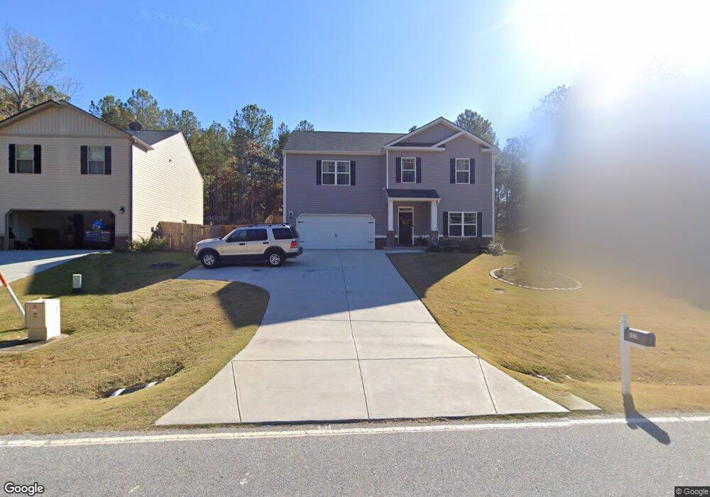
1070 Roxey Maxey Rd Winder, GA 30680
Estimated Value: $398,000 - $462,000
--
Bed
--
Bath
3,202
Sq Ft
$135/Sq Ft
Est. Value
About This Home
This home is located at 1070 Roxey Maxey Rd, Winder, GA 30680 and is currently estimated at $432,533, approximately $135 per square foot. 1070 Roxey Maxey Rd is a home with nearby schools including Yargo Elementary School, Haymon-Morris Middle School, and Apalachee High School.
Ownership History
Date
Name
Owned For
Owner Type
Purchase Details
Closed on
Sep 17, 2019
Sold by
Dr Horton Inc
Bought by
Samuel Nancy K and Samuel Paul E
Current Estimated Value
Home Financials for this Owner
Home Financials are based on the most recent Mortgage that was taken out on this home.
Original Mortgage
$264,414
Outstanding Balance
$231,128
Interest Rate
3.5%
Mortgage Type
FHA
Estimated Equity
$201,405
Purchase Details
Closed on
Oct 5, 2018
Sold by
Reynolds Realty Construction Llc
Bought by
Dr Horton Inc
Purchase Details
Closed on
Apr 9, 2018
Sold by
First Covenant Bank
Bought by
Reynolds Realty Construction L
Purchase Details
Closed on
Dec 12, 2012
Sold by
State Bank And Trust Company
Bought by
First Covenant Bank
Purchase Details
Closed on
Oct 6, 2011
Sold by
Sunrise Development Of Georgia
Bought by
State Bank And Trust Company
Purchase Details
Closed on
Aug 19, 2005
Bought by
Sunrise Development Of Georgia Llc
Create a Home Valuation Report for This Property
The Home Valuation Report is an in-depth analysis detailing your home's value as well as a comparison with similar homes in the area
Home Values in the Area
Average Home Value in this Area
Purchase History
| Date | Buyer | Sale Price | Title Company |
|---|---|---|---|
| Samuel Nancy K | $250,960 | -- | |
| Dr Horton Inc | $120,000 | -- | |
| Reynolds Realty Construction L | $150,000 | -- | |
| First Covenant Bank | -- | -- | |
| First Covenant Bank | $220,000 | -- | |
| State Bank And Trust Company | -- | -- | |
| Sunrise Development Of Georgia Llc | -- | -- |
Source: Public Records
Mortgage History
| Date | Status | Borrower | Loan Amount |
|---|---|---|---|
| Open | Samuel Nancy K | $264,414 |
Source: Public Records
Tax History Compared to Growth
Tax History
| Year | Tax Paid | Tax Assessment Tax Assessment Total Assessment is a certain percentage of the fair market value that is determined by local assessors to be the total taxable value of land and additions on the property. | Land | Improvement |
|---|---|---|---|---|
| 2024 | $2,807 | $167,434 | $28,800 | $138,634 |
| 2023 | $2,355 | $165,916 | $28,800 | $137,116 |
| 2022 | $2,226 | $131,894 | $23,200 | $108,694 |
| 2021 | $3,232 | $108,823 | $18,800 | $90,023 |
| 2020 | $2,986 | $102,288 | $16,000 | $86,288 |
| 2019 | $432 | $16,000 | $16,000 | $0 |
| 2018 | $284 | $7,200 | $7,200 | $0 |
| 2017 | $210 | $7,200 | $7,200 | $0 |
| 2016 | $234 | $5,746 | $5,746 | $0 |
| 2015 | $235 | $5,746 | $5,746 | $0 |
| 2014 | $169 | $3,440 | $3,440 | $0 |
| 2013 | -- | $3,440 | $3,440 | $0 |
Source: Public Records
Map
Nearby Homes
- 79 Holland Cove
- 86 Holland Cove
- 89 Holland Cove
- 62 Holland Cove
- Brandon Plan at Willowbrook
- ANSLEY Express Plan at Willowbrook
- HAYDEN Express Plan at Willowbrook
- ARIA Express Plan at Willowbrook
- Rachel Plan at Willowbrook
- 57 Holland Cove
- 50 Holland Cove
- 47 Holland Cove
- 38 Holland Cove
- 37 Holland Cove
- 1185 Wendy Way
- 921 Roxeywood Dr
- 1898 Roxey Ln
- 32 Livingston Ct
- 138 Livingston Ct
- 721 Loblolly Ln
- 1072 Roxey Maxey Rd
- 1068 Roxey Maxey Rd
- 1095 Roxey Maxey Rd
- 1860 Roxey Ln
- 1016 Roxey Ln
- 1862 Roxey Ln
- 1079 Roxey Maxey Rd Unit 5
- 1864 Roxey Ln
- 1030 Mitchell Dr
- 1866 Roxey Ln
- 1861 Roxey Ln
- 1865 Roxey Ln
- 1868 Roxey Ln
- 1867 Roxey Ln
- 1870 Roxey Ln
- 1869 Roxey Ln
- 98 Livingston Ct
- 1872 Roxey Ln
- 1871 Roxey Ln
- 62 Holland Cove