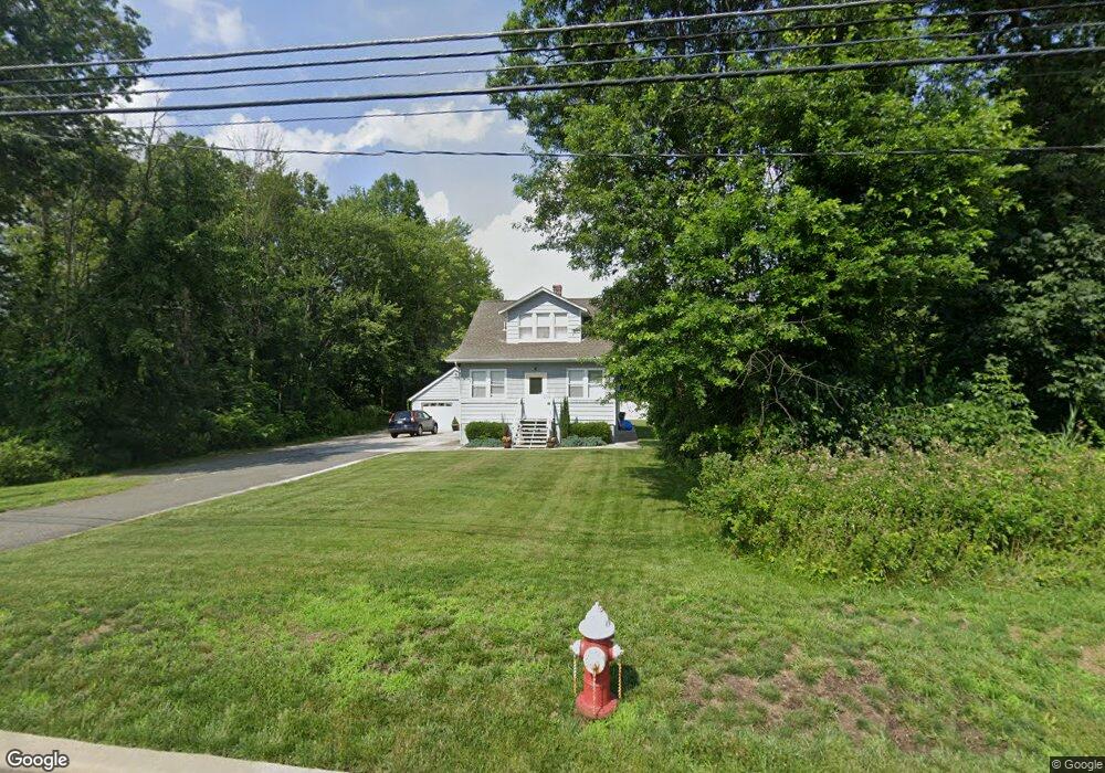
1070 State Route 10 Whippany, NJ 07981
Estimated Value: $428,126 - $464,000
--
Bed
--
Bath
1,089
Sq Ft
$411/Sq Ft
Est. Value
About This Home
This home is located at 1070 State Route 10, Whippany, NJ 07981 and is currently estimated at $447,532, approximately $410 per square foot. 1070 State Route 10 is a home located in Morris County with nearby schools including Whippany Park High School, Unity Charter School, and Arrow Academy.
Ownership History
Date
Name
Owned For
Owner Type
Purchase Details
Closed on
Feb 13, 2004
Sold by
Feid Allan
Bought by
Fidalgo Alexander
Current Estimated Value
Home Financials for this Owner
Home Financials are based on the most recent Mortgage that was taken out on this home.
Original Mortgage
$18,300
Outstanding Balance
$8,577
Interest Rate
5.82%
Estimated Equity
$438,955
Purchase Details
Closed on
Nov 6, 2001
Sold by
Krak Alois
Bought by
Feid Allan
Home Financials for this Owner
Home Financials are based on the most recent Mortgage that was taken out on this home.
Original Mortgage
$147,000
Interest Rate
6.64%
Purchase Details
Closed on
Dec 21, 1995
Sold by
Matlaga Ann and Halabura Michael G
Bought by
Krak Alois and Krak Natalia
Create a Home Valuation Report for This Property
The Home Valuation Report is an in-depth analysis detailing your home's value as well as a comparison with similar homes in the area
Home Values in the Area
Average Home Value in this Area
Purchase History
| Date | Buyer | Sale Price | Title Company |
|---|---|---|---|
| Fidalgo Alexander | $283,000 | -- | |
| Feid Allan | $177,000 | -- | |
| Krak Alois | $119,000 | -- |
Source: Public Records
Mortgage History
| Date | Status | Borrower | Loan Amount |
|---|---|---|---|
| Open | Fidalgo Alexander | $18,300 | |
| Previous Owner | Feid Allan | $147,000 |
Source: Public Records
Tax History Compared to Growth
Tax History
| Year | Tax Paid | Tax Assessment Tax Assessment Total Assessment is a certain percentage of the fair market value that is determined by local assessors to be the total taxable value of land and additions on the property. | Land | Improvement |
|---|---|---|---|---|
| 2025 | $4,918 | $229,700 | $116,100 | $113,600 |
| 2024 | $4,856 | $229,700 | $116,100 | $113,600 |
| 2023 | $4,856 | $229,700 | $116,100 | $113,600 |
| 2022 | $4,442 | $229,700 | $116,100 | $113,600 |
| 2021 | $4,442 | $229,700 | $116,100 | $113,600 |
| 2020 | $4,178 | $229,700 | $116,100 | $113,600 |
| 2019 | $4,392 | $229,700 | $116,100 | $113,600 |
| 2018 | $4,323 | $229,700 | $116,100 | $113,600 |
| 2017 | $4,224 | $229,700 | $116,100 | $113,600 |
| 2016 | $4,160 | $229,700 | $116,100 | $113,600 |
| 2015 | $3,999 | $229,700 | $116,100 | $113,600 |
| 2014 | $3,916 | $229,700 | $116,100 | $113,600 |
Source: Public Records
Map
Nearby Homes
- 709 Brook Hollow Dr Unit 709
- 92 Sunrise Dr
- 26 Gladstone Ct
- 42 Gladstone Ct
- 34 Gladstone Ct
- 14 Gladstone Ct
- Monterey Plan at The Grove - The Monterey Collection
- Pershing Plan at The Grove - The Pershing Collection
- Route 10 E E Route 10 Unit 48 1B
- 96 Parsippany Rd
- 3306 Appleton Way
- 104 Ridgedale Ave
- 22 Karla Dr
- 2003 Vermont Terrace Unit 2003
- 39 Lefke Ln
- 13 Mountview Rd
- 83 Mountain Ave
- 304 Beaverbrook Terrace Unit 304
- 16 Slope Dr
- 45 Polhemus Terrace
- 8 Malapardis Rd
- 10 Malapardis Rd
- 14 Malapardis Rd
- 18 Malapardis Rd
- 250 Alta Vista Dr
- 5 Malapardis Rd
- 22 Malapardis Rd
- 20 Malapardis Rd
- 1025 State Route 10
- 25 Malapardis Rd
- 32 Malapardis Rd
- 34 Malapardis Rd
- 27 Malapardis Rd
- 38 Malapardis Rd
- 6 S Jefferson Rd
- 42 Malapardis Rd
- 33 Malapardis Rd
- 39 Malapardis Rd
- 48 Malapardis Rd
- 50 Malapardis Rd