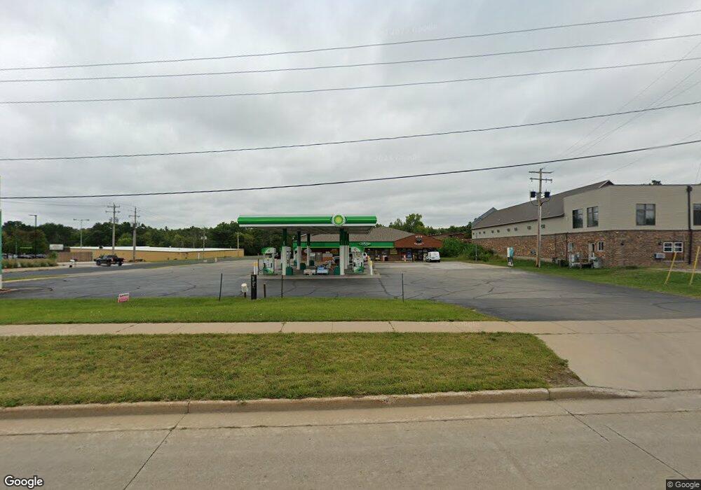
1070 W Fulton St Waupaca, WI 54981
Estimated Value: $883,376
--
Bed
--
Bath
--
Sq Ft
0.91
Acres
About This Home
This home is located at 1070 W Fulton St, Waupaca, WI 54981 and is currently estimated at $883,376. 1070 W Fulton St is a home located in Waupaca County with nearby schools including Waupaca Learning Center Elementary School, Waupaca Middle School, and Waupaca High School.
Ownership History
Date
Name
Owned For
Owner Type
Purchase Details
Closed on
Aug 25, 2006
Sold by
Jww Llc
Bought by
Noor Enterprises Llc
Current Estimated Value
Home Financials for this Owner
Home Financials are based on the most recent Mortgage that was taken out on this home.
Original Mortgage
$750,000
Outstanding Balance
$455,534
Interest Rate
6.88%
Mortgage Type
Purchase Money Mortgage
Estimated Equity
$427,842
Create a Home Valuation Report for This Property
The Home Valuation Report is an in-depth analysis detailing your home's value as well as a comparison with similar homes in the area
Home Values in the Area
Average Home Value in this Area
Purchase History
| Date | Buyer | Sale Price | Title Company |
|---|---|---|---|
| Noor Enterprises Llc | $430,000 | None Available |
Source: Public Records
Mortgage History
| Date | Status | Borrower | Loan Amount |
|---|---|---|---|
| Open | Noor Enterprises Llc | $750,000 |
Source: Public Records
Tax History Compared to Growth
Tax History
| Year | Tax Paid | Tax Assessment Tax Assessment Total Assessment is a certain percentage of the fair market value that is determined by local assessors to be the total taxable value of land and additions on the property. | Land | Improvement |
|---|---|---|---|---|
| 2024 | $9,070 | $540,700 | $260,500 | $280,200 |
| 2023 | $9,070 | $540,700 | $260,500 | $280,200 |
| 2022 | $11,183 | $471,400 | $218,500 | $252,900 |
| 2021 | $11,489 | $471,400 | $218,500 | $252,900 |
| 2020 | $11,931 | $471,400 | $218,500 | $252,900 |
| 2019 | $11,593 | $471,400 | $218,500 | $252,900 |
| 2018 | $12,768 | $471,400 | $218,500 | $252,900 |
| 2017 | $12,449 | $471,400 | $218,500 | $252,900 |
| 2016 | $12,449 | $471,400 | $218,500 | $252,900 |
| 2015 | $13,062 | $471,400 | $218,500 | $252,900 |
| 2014 | $12,727 | $471,400 | $218,500 | $252,900 |
| 2013 | $12,707 | $471,400 | $218,500 | $252,900 |
Source: Public Records
Map
Nearby Homes
- 0 Covered Bridge Rd Unit 50292957
- 1015 W Fulton St
- 210 Country Side Ct Unit C
- E2059 N Westgate Acres Rd
- E2264 Meadow Valley Ct
- 578 Highland Dr
- 602 North St
- 401 Bailey St
- 1500 Foxfire Ct
- 1547 Foxfire Ct
- 1579 Foxfire Ct
- 406 W Fulton St
- 901 Thomas Trail
- 401 Granite St
- 920 Thomas Trail
- 908 Honey Bear Ln
- N2769 Taylor Ct
- 2001 State Rd 54
- 108 E Lake St
- E2086 King Rd
- 210 Joann Ln
- 1066 Covered Bridge Rd
- 998 Covered Bridge Rd
- 0 Covered Bridge Rd Unit 50171474
- 0 Covered Bridge Rd Unit 50058907
- 0 Covered Bridge Rd Unit 50227984
- 0 Covered Bridge Rd Unit 50221767
- 0 Covered Bridge Rd Unit 50029270
- 0 Covered Bridge Rd Unit 50039904
- 0 Covered Bridge Rd Unit 50094134
- 0 Covered Bridge Rd Unit 50191647
- 0 Covered Bridge Rd Unit 50192094
- 0 Covered Bridge Rd Unit 50195625
- 1035 Covered Bridge Rd
- 1060 Covered Bridge Rd
- 115 N Western Ave
- 101 N Western Ave
- 1282 W Fulton St
- 103 N Western Ave
- 1020 Covered Bridge Rd