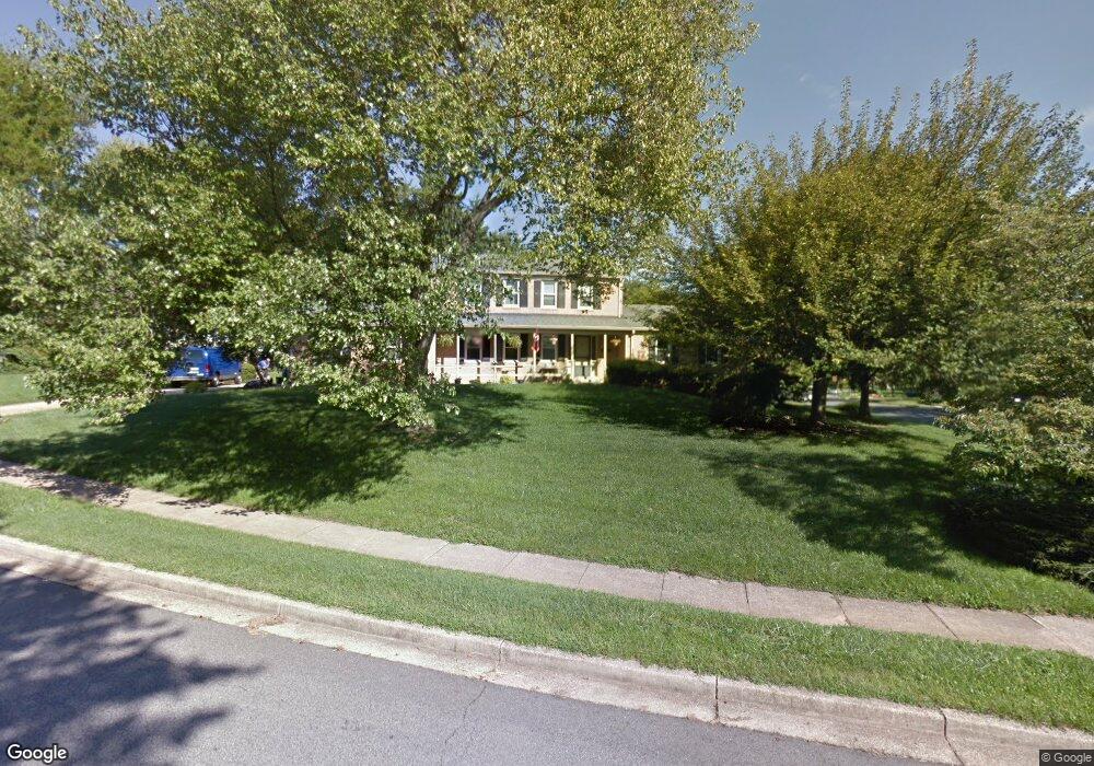
10700 Buckingham Rd Fairfax, VA 22032
Estimated Value: $934,000 - $1,015,000
4
Beds
4
Baths
2,365
Sq Ft
$410/Sq Ft
Est. Value
About This Home
This home is located at 10700 Buckingham Rd, Fairfax, VA 22032 and is currently estimated at $970,005, approximately $410 per square foot. 10700 Buckingham Rd is a home located in Fairfax County with nearby schools including Oak View Elementary School, James W Robinson, Jr. Secondary School, and Trinity Christian School.
Ownership History
Date
Name
Owned For
Owner Type
Purchase Details
Closed on
Mar 24, 2009
Sold by
Johanson Robert M
Bought by
Wieder Steven M
Current Estimated Value
Home Financials for this Owner
Home Financials are based on the most recent Mortgage that was taken out on this home.
Original Mortgage
$487,050
Outstanding Balance
$309,862
Interest Rate
5.14%
Mortgage Type
New Conventional
Estimated Equity
$660,143
Create a Home Valuation Report for This Property
The Home Valuation Report is an in-depth analysis detailing your home's value as well as a comparison with similar homes in the area
Home Values in the Area
Average Home Value in this Area
Purchase History
| Date | Buyer | Sale Price | Title Company |
|---|---|---|---|
| Wieder Steven M | $573,000 | -- |
Source: Public Records
Mortgage History
| Date | Status | Borrower | Loan Amount |
|---|---|---|---|
| Open | Wieder Steven M | $487,050 |
Source: Public Records
Tax History Compared to Growth
Tax History
| Year | Tax Paid | Tax Assessment Tax Assessment Total Assessment is a certain percentage of the fair market value that is determined by local assessors to be the total taxable value of land and additions on the property. | Land | Improvement |
|---|---|---|---|---|
| 2025 | $9,314 | $858,190 | $300,000 | $558,190 |
| 2024 | $9,314 | $803,980 | $280,000 | $523,980 |
| 2023 | $8,697 | $770,640 | $280,000 | $490,640 |
| 2022 | $8,792 | $768,890 | $260,000 | $508,890 |
| 2021 | $8,431 | $718,410 | $235,000 | $483,410 |
| 2020 | $7,958 | $672,400 | $234,000 | $438,400 |
| 2019 | $7,958 | $672,400 | $234,000 | $438,400 |
| 2018 | $7,373 | $641,160 | $215,000 | $426,160 |
| 2017 | $7,641 | $658,150 | $215,000 | $443,150 |
| 2016 | $7,318 | $631,680 | $211,000 | $420,680 |
| 2015 | $6,846 | $613,430 | $205,000 | $408,430 |
| 2014 | $6,600 | $592,720 | $200,000 | $392,720 |
Source: Public Records
Map
Nearby Homes
- 10710 Almond St
- 0 Joshua Davis Ct
- 10708 Rippon Lodge Dr
- 10271 Braddock Rd
- 10255 Braddock Rd
- 10212 Provincetown Ct
- 10919 Spurlock Ct
- 4768 Farndon Ct
- 11123 Popes Head Rd
- 4607 Tapestry Dr
- 10402 Hollyoak Place
- 4773 Farndon Ct
- 4316 Chain Bridge Rd
- 10196 Red Spruce Rd
- 5538 Shooters Hill Ln
- 5503 Fireside Ct
- 10404 Forest Ave
- 10412 Pearl St
- 10388 Hampshire Green Ave
- 10231 Aspen Willow Dr
- 5120 Portsmouth Rd
- 4931 Princess Anne Ct
- 10701 Buckingham Rd
- 10703 Buckingham Rd
- 4927 Princess Anne Ct
- 5121 Portsmouth Rd
- 5123 Portsmouth Rd
- 5119 Portsmouth Rd
- 10707 Buckingham Rd
- 5128 Portsmouth Rd
- 5125 Portsmouth Rd
- 4923 Princess Anne Ct
- 5115 Portsmouth Rd
- 4930 Princess Anne Ct
- 5130 Portsmouth Rd
- 10709 Buckingham Rd
- 10712 Marlborough Rd
- 5129 Portsmouth Rd
- 10708 Marlborough Rd
- 5114 Portsmouth Rd