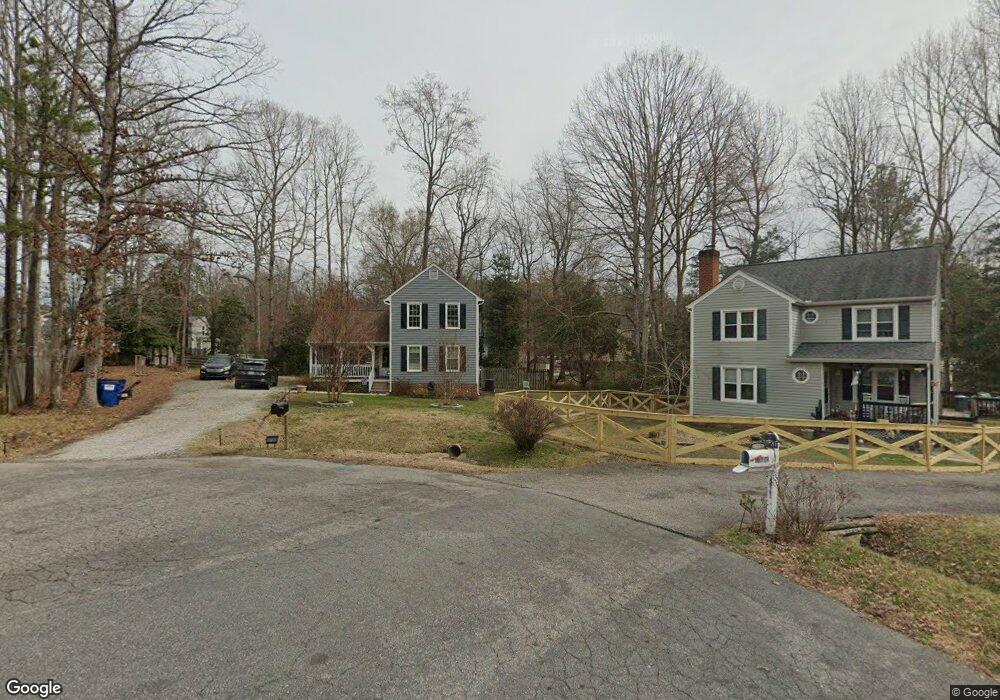
10700 Hunters Landing Ct Chesterfield, VA 23832
Estimated Value: $301,000 - $332,000
3
Beds
2
Baths
1,332
Sq Ft
$242/Sq Ft
Est. Value
About This Home
This home is located at 10700 Hunters Landing Ct, Chesterfield, VA 23832 and is currently estimated at $321,983, approximately $241 per square foot. 10700 Hunters Landing Ct is a home located in Chesterfield County with nearby schools including Thelma Crenshaw Elementary School, Bailey Bridge Middle School, and Manchester High.
Ownership History
Date
Name
Owned For
Owner Type
Purchase Details
Closed on
Jan 8, 2002
Sold by
Taylor Charles R
Bought by
Maclean Sean M and Maclean Rebecca C
Current Estimated Value
Home Financials for this Owner
Home Financials are based on the most recent Mortgage that was taken out on this home.
Original Mortgage
$79,960
Outstanding Balance
$31,931
Interest Rate
6.72%
Mortgage Type
New Conventional
Estimated Equity
$290,052
Create a Home Valuation Report for This Property
The Home Valuation Report is an in-depth analysis detailing your home's value as well as a comparison with similar homes in the area
Home Values in the Area
Average Home Value in this Area
Purchase History
| Date | Buyer | Sale Price | Title Company |
|---|---|---|---|
| Maclean Sean M | $99,950 | -- |
Source: Public Records
Mortgage History
| Date | Status | Borrower | Loan Amount |
|---|---|---|---|
| Open | Maclean Sean M | $79,960 |
Source: Public Records
Tax History Compared to Growth
Tax History
| Year | Tax Paid | Tax Assessment Tax Assessment Total Assessment is a certain percentage of the fair market value that is determined by local assessors to be the total taxable value of land and additions on the property. | Land | Improvement |
|---|---|---|---|---|
| 2025 | $2,477 | $275,500 | $60,000 | $215,500 |
| 2024 | $2,477 | $263,000 | $54,000 | $209,000 |
| 2023 | $2,279 | $250,400 | $51,000 | $199,400 |
| 2022 | $2,119 | $230,300 | $49,000 | $181,300 |
| 2021 | $2,011 | $204,700 | $47,000 | $157,700 |
| 2020 | $1,697 | $178,600 | $45,000 | $133,600 |
| 2019 | $1,678 | $176,600 | $44,000 | $132,600 |
| 2018 | $1,586 | $164,800 | $42,000 | $122,800 |
| 2017 | $1,557 | $157,000 | $42,000 | $115,000 |
| 2016 | $1,401 | $145,900 | $42,000 | $103,900 |
| 2015 | $1,452 | $148,600 | $42,000 | $106,600 |
| 2014 | $1,433 | $146,700 | $42,000 | $104,700 |
Source: Public Records
Map
Nearby Homes
- 4519 Bexwood Dr
- 4533 Overlea Dr
- 10800 Brookridge Way
- 10927 Decoy Ln
- 10556 Braden Woods Ct
- 10810 Ridgerun Rd
- 11130 Poachers Run
- 11118 Sunfield Dr
- 4207 Stigall Dr
- 5124 Rollingway Rd
- 11261 Sunfield Dr
- 5213 Oakforest Dr
- Stanley Plan at Lawson Mill
- Caldwell Plan at Lawson Mill
- Oxford Plan at Lawson Mill
- Cypress Plan at Lawson Mill
- Davidson Plan at Lawson Mill
- Avery Plan at Lawson Mill
- Ellerbe Plan at Lawson Mill
- Raleigh Plan at Lawson Mill
- 10702 Hunters Landing Ct
- 10701 Hunters Landing Ct
- 4412 Bexwood Dr
- 4418 Bexwood Dr
- 4424 Bexwood Dr
- 4500 Bexwood Dr
- 4406 Bexwood Dr
- 10747 Poachers Run
- 10703 Hunters Landing Ct
- 10704 Hunters Landing Ct
- 4506 Bexwood Dr
- 4400 Bexwood Dr
- 10753 Poachers Run
- 10705 Hunters Landing Ct
- 4512 Bexwood Dr
- 4413 Hunters Landing Dr
- 4407 Hunters Landing Dr
- 4519 Hunters Landing Dr
- 4413 Bexwood Dr
- 4419 Bexwood Dr