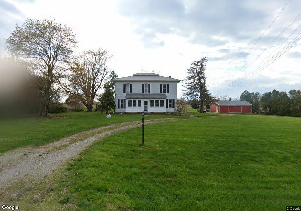
10700 Macon Hwy Tecumseh, MI 49286
Estimated Value: $291,000 - $386,000
6
Beds
2
Baths
2,604
Sq Ft
$126/Sq Ft
Est. Value
About This Home
This home is located at 10700 Macon Hwy, Tecumseh, MI 49286 and is currently estimated at $328,215, approximately $126 per square foot. 10700 Macon Hwy is a home located in Lenawee County with nearby schools including Tecumseh Middle School, Herrick Park Intermediate Learning Center, and Tecumseh High School.
Ownership History
Date
Name
Owned For
Owner Type
Purchase Details
Closed on
May 5, 2021
Sold by
Vandeven Gretchen P
Bought by
Vandeven Douglas
Current Estimated Value
Purchase Details
Closed on
Jul 18, 2005
Sold by
Pitzer Ralph D and Pitzer Sanra J
Bought by
Vandeven Douglas A
Home Financials for this Owner
Home Financials are based on the most recent Mortgage that was taken out on this home.
Original Mortgage
$126,000
Interest Rate
5.68%
Mortgage Type
New Conventional
Purchase Details
Closed on
Mar 20, 1992
Bought by
Vandeven Douglas A and Gretchen Platt Vandeven
Create a Home Valuation Report for This Property
The Home Valuation Report is an in-depth analysis detailing your home's value as well as a comparison with similar homes in the area
Home Values in the Area
Average Home Value in this Area
Purchase History
| Date | Buyer | Sale Price | Title Company |
|---|---|---|---|
| Vandeven Douglas | -- | None Available | |
| Vandeven Douglas A | $149,000 | Absolute Title Inc | |
| Vandeven Douglas A | -- | -- |
Source: Public Records
Mortgage History
| Date | Status | Borrower | Loan Amount |
|---|---|---|---|
| Previous Owner | Vandeven Douglas A | $126,000 |
Source: Public Records
Tax History Compared to Growth
Tax History
| Year | Tax Paid | Tax Assessment Tax Assessment Total Assessment is a certain percentage of the fair market value that is determined by local assessors to be the total taxable value of land and additions on the property. | Land | Improvement |
|---|---|---|---|---|
| 2025 | $2,209 | $134,900 | $0 | $0 |
| 2024 | $1,455 | $124,000 | $0 | $0 |
| 2023 | $2,097 | $109,000 | $0 | $0 |
| 2022 | $1,643 | $94,400 | $0 | $0 |
| 2021 | $2,297 | $85,600 | $0 | $0 |
| 2020 | $2,263 | $84,900 | $0 | $0 |
| 2019 | $199,416 | $71,900 | $0 | $0 |
| 2018 | $2,171 | $71,906 | $0 | $0 |
| 2017 | $2,093 | $97,490 | $0 | $0 |
| 2016 | $2,071 | $91,054 | $0 | $0 |
| 2014 | -- | $85,926 | $0 | $0 |
Source: Public Records
Map
Nearby Homes
- 6070 Clinton MacOn Rd
- 8917 Hawthorne Dr
- Parcel B Fieldstone Dr
- 6 Wheatland Dr
- 10000 Meads Hwy
- 395 Burt St
- 607 Shadow Brooke Ln
- 600 Center Dr
- 13293 E Michigan Ave
- 766 Eagle View Point
- 7957 E Monroe Rd
- 765 Eagle View Point
- 758 Eagle View Way
- 756 Eagle View Way
- 726 Red Mill Point
- 752 Eagle View Way
- 724 Red Mill Point
- 728 Red Mill Point
- 748 Eagle View Way
- 740 Eagle View Way
- 10685 Macon Hwy
- 10680 Macon Hwy
- 10590 Macon Hwy
- 10000 Macon Hwy
- 10520 Macon Hwy
- 7120 Pennington Rd
- 7166 Pennington Rd
- 6643 Pennington Rd
- 11196 Tecumseh Clinton Rd
- 11064 Macon Hwy
- 11064 Tecumseh MacOn Rd
- 11064 Tecumseh MacOn Rd
- 7000 Pennington Rd
- 10266 Macon Hwy
- 7585 Pennington Rd
- 7585 Pennington Rd
- 6800 Pennington Rd
- 7000 Pennington Rd
- 10186 Macon Hwy
- 11230 Macon Hwy