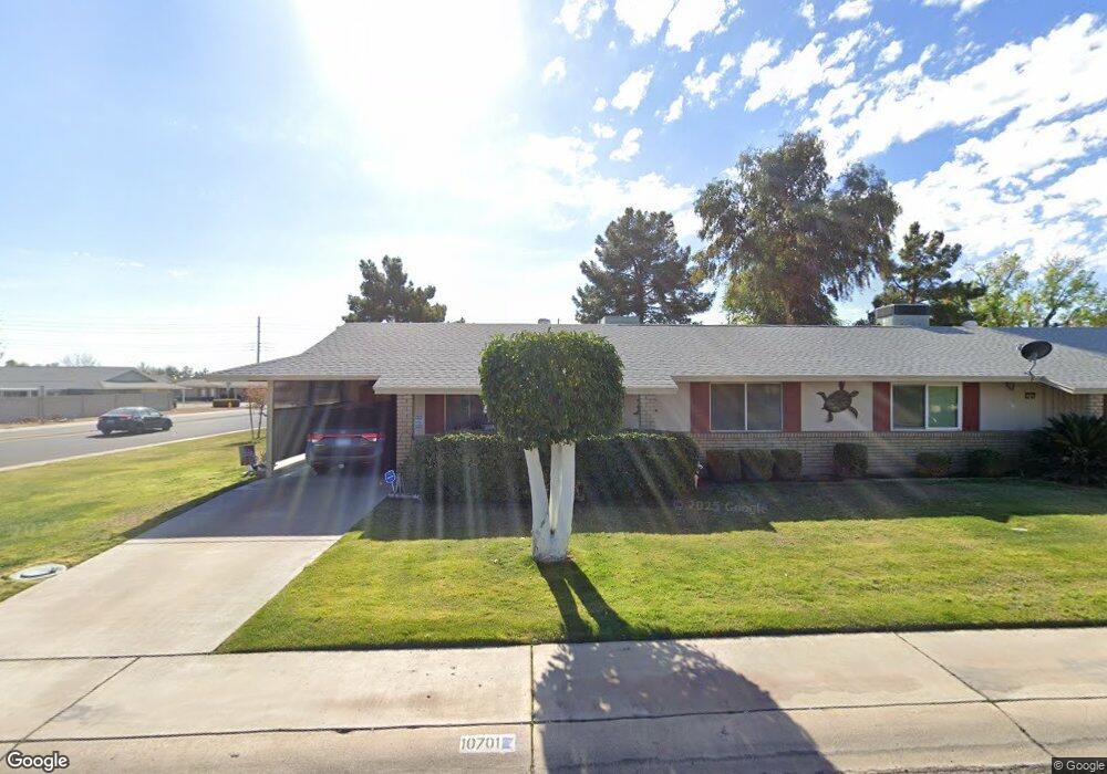
10701 W Kelso Dr Sun City, AZ 85351
Estimated Value: $156,000 - $186,000
2
Beds
1
Bath
1,062
Sq Ft
$167/Sq Ft
Est. Value
About This Home
This home is located at 10701 W Kelso Dr, Sun City, AZ 85351 and is currently estimated at $177,462, approximately $167 per square foot. 10701 W Kelso Dr is a home located in Maricopa County with nearby schools including Ombudsman - Northwest Charter.
Ownership History
Date
Name
Owned For
Owner Type
Purchase Details
Closed on
Nov 23, 2009
Sold by
Smith Larry
Bought by
Shellito Joyce and Shellito Bruce A
Current Estimated Value
Purchase Details
Closed on
Nov 3, 1994
Sold by
Heeren Hazel L
Bought by
Heeren Hazel L and Hazel L Heeren Family Trust
Home Financials for this Owner
Home Financials are based on the most recent Mortgage that was taken out on this home.
Original Mortgage
$33,000
Interest Rate
8.86%
Mortgage Type
New Conventional
Purchase Details
Closed on
Sep 26, 1994
Sold by
Muth Wesley E and Muth Melba J
Bought by
Heeren Hazel L
Home Financials for this Owner
Home Financials are based on the most recent Mortgage that was taken out on this home.
Original Mortgage
$33,000
Interest Rate
8.86%
Mortgage Type
New Conventional
Create a Home Valuation Report for This Property
The Home Valuation Report is an in-depth analysis detailing your home's value as well as a comparison with similar homes in the area
Home Values in the Area
Average Home Value in this Area
Purchase History
| Date | Buyer | Sale Price | Title Company |
|---|---|---|---|
| Shellito Joyce | $54,000 | First American Title Ins Co | |
| Heeren Hazel L | -- | First American Title | |
| Heeren Hazel L | $61,000 | First American Title |
Source: Public Records
Mortgage History
| Date | Status | Borrower | Loan Amount |
|---|---|---|---|
| Previous Owner | Heeren Hazel L | $33,000 |
Source: Public Records
Tax History Compared to Growth
Tax History
| Year | Tax Paid | Tax Assessment Tax Assessment Total Assessment is a certain percentage of the fair market value that is determined by local assessors to be the total taxable value of land and additions on the property. | Land | Improvement |
|---|---|---|---|---|
| 2025 | $595 | $6,636 | -- | -- |
| 2024 | $544 | $6,320 | -- | -- |
| 2023 | $544 | $13,730 | $2,740 | $10,990 |
| 2022 | $510 | $12,100 | $2,420 | $9,680 |
| 2021 | $521 | $10,830 | $2,160 | $8,670 |
| 2020 | $509 | $9,400 | $1,880 | $7,520 |
| 2019 | $502 | $8,220 | $1,640 | $6,580 |
| 2018 | $485 | $6,950 | $1,390 | $5,560 |
| 2017 | $471 | $6,060 | $1,210 | $4,850 |
| 2016 | $263 | $5,120 | $1,020 | $4,100 |
| 2015 | $418 | $4,570 | $910 | $3,660 |
Source: Public Records
Map
Nearby Homes
- 10707 W Mission Ln
- 9202 N 107th Ave Unit 8
- 10726 W Kelso Dr Unit 172
- 10731 W Mission Ln Unit 200
- 10726 W Denham Dr Unit 16
- 10732 W Denham Dr Unit 17
- 10825 W Caron Dr
- 10816 W Venturi Dr
- 10801 W Mountain View Rd
- 8800 N 107th Ave Unit 17
- 8800 N 107th Ave Unit 19
- 8800 N 107th Ave Unit 52
- 8803 N 105th Dr
- 10788 W Cinnebar Ave
- 9802 N 107th Ave
- 11005 W Kelso Dr
- 9415 N 111th Ave
- 10326 W Caron Dr
- 9459 N 111th Ave
- 10754 W Cinnebar Ave Unit 48
- 10705 W Kelso Dr
- 10709 W Kelso Dr Unit 164
- 10702 W Caron Dr Unit 123
- 10706 W Caron Dr
- 10706 W Kelso Dr Unit 9
- 10713 W Kelso Dr
- 10714 W Caron Dr
- 10712 W Kelso Dr Unit 9
- 10648 W Caron Dr
- 10718 W Caron Dr
- 10644 W Kelso Dr
- 10717 W Kelso Dr Unit 162
- 10716 W Kelso Dr
- 10639 W Kelso Dr
- 10722 W Caron Dr
- 10701 W Mission Ln
- 10640 W Caron Dr
- 10721 W Kelso Dr
- 10701 W Caron Dr
- 10638 W Kelso Dr