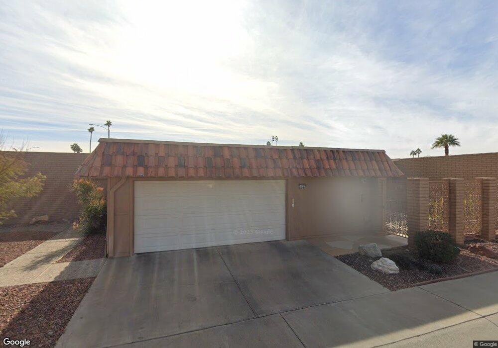
10701 W Topaz Dr Unit 17 Sun City, AZ 85351
Estimated Value: $328,000 - $507,000
2
Beds
2
Baths
1,888
Sq Ft
$200/Sq Ft
Est. Value
About This Home
This home is located at 10701 W Topaz Dr Unit 17, Sun City, AZ 85351 and is currently estimated at $376,826, approximately $199 per square foot. 10701 W Topaz Dr Unit 17 is a home located in Maricopa County with nearby schools including Desert Mirage Elementary School and Ombudsman - Northwest Charter.
Ownership History
Date
Name
Owned For
Owner Type
Purchase Details
Closed on
Aug 13, 2013
Sold by
Lewis Eugenia P
Bought by
Lewis Eugenia Phillips
Current Estimated Value
Purchase Details
Closed on
Aug 22, 2011
Sold by
Federal National Mortgage Association
Bought by
Lewis Eugenia P and Lewis Donald A
Purchase Details
Closed on
Jul 26, 2011
Sold by
Palmer Myron B
Bought by
Federal National Mortgage Association
Purchase Details
Closed on
Sep 7, 2005
Sold by
Gamble Lorraine Louise Dejongh
Bought by
Palmer Myron B
Home Financials for this Owner
Home Financials are based on the most recent Mortgage that was taken out on this home.
Original Mortgage
$188,000
Interest Rate
5.25%
Mortgage Type
Purchase Money Mortgage
Create a Home Valuation Report for This Property
The Home Valuation Report is an in-depth analysis detailing your home's value as well as a comparison with similar homes in the area
Home Values in the Area
Average Home Value in this Area
Purchase History
| Date | Buyer | Sale Price | Title Company |
|---|---|---|---|
| Lewis Eugenia Phillips | -- | None Available | |
| Lewis Eugenia P | $158,000 | First American Title Ins Co | |
| Federal National Mortgage Association | $201,745 | Accommodation | |
| Palmer Myron B | $235,000 | Capital Title Agency Inc |
Source: Public Records
Mortgage History
| Date | Status | Borrower | Loan Amount |
|---|---|---|---|
| Previous Owner | Palmer Myron B | $188,000 |
Source: Public Records
Tax History Compared to Growth
Tax History
| Year | Tax Paid | Tax Assessment Tax Assessment Total Assessment is a certain percentage of the fair market value that is determined by local assessors to be the total taxable value of land and additions on the property. | Land | Improvement |
|---|---|---|---|---|
| 2025 | $1,319 | $16,180 | -- | -- |
| 2024 | $1,194 | $15,409 | -- | -- |
| 2023 | $1,194 | $27,760 | $5,550 | $22,210 |
| 2022 | $1,123 | $22,610 | $4,520 | $18,090 |
| 2021 | $1,159 | $21,270 | $4,250 | $17,020 |
| 2020 | $1,130 | $19,250 | $3,850 | $15,400 |
| 2019 | $1,109 | $17,080 | $3,410 | $13,670 |
| 2018 | $1,076 | $16,150 | $3,230 | $12,920 |
| 2017 | $1,035 | $13,730 | $2,740 | $10,990 |
| 2016 | $538 | $13,200 | $2,640 | $10,560 |
| 2015 | $928 | $12,700 | $2,540 | $10,160 |
Source: Public Records
Map
Nearby Homes
- 13637 N Del Webb Blvd
- 13640 N Del Webb Blvd
- 13605 N Del Webb Blvd
- 13636 N Del Webb Blvd
- 10626 W Emerald Point
- 10614 W Emerald Point
- 13823 N 108th Dr
- 13679 N 108th Dr
- 10601 W Bayside Rd Unit 18A
- 13623 N 108th Dr
- 13857 N 108th Dr
- 10814 W Thunderbird Blvd
- 10855 W Buccaneer Dr
- 13670 N 108th Dr
- 13812 N 108th Dr
- 10838 W Thunderbird Blvd
- 10814 W Cameo Dr Unit 14
- 10720 W Santa fe Dr Unit 15D
- 10502 W Sierra Dawn Dr
- 10863 W Thunderbird Blvd
- 10705 W Topaz Dr
- 13648 N Del Webb Blvd
- 13644 N Del Webb Blvd
- 10709 W Topaz Dr
- 13647 N 107th Ln
- 10702 W Topaz Dr
- 10706 W Topaz Dr
- 13643 N 107th Ln
- 10710 W Topaz Dr
- 13639 N 107th Ln
- 13641 N Del Webb Blvd Unit 14C
- 13633 N Del Webb Blvd
- 13802 N Del Webb Blvd
- 13645 N Del Webb Blvd
- 13629 N Del Webb Blvd
- 13649 N Del Webb Blvd Unit 14C
- 13801 N 107th Ln
- 13625 N Del Webb Blvd
- 13635 N 107th Ln
- 10717 W Topaz Dr