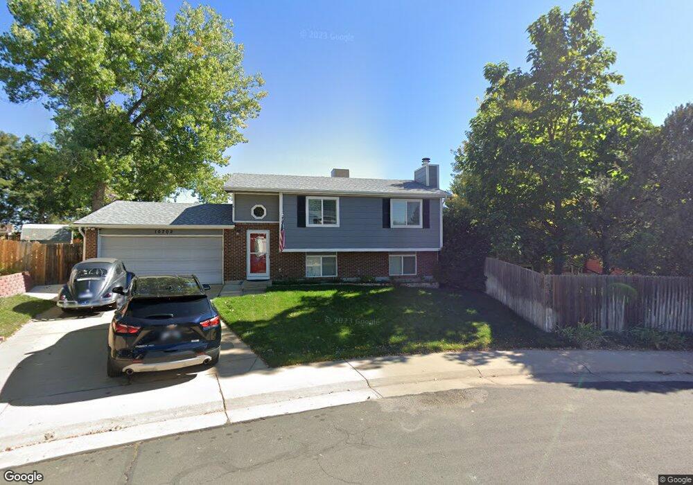
10702 Ash Ct Thornton, CO 80233
Wyndemere NeighborhoodEstimated Value: $469,486 - $522,000
3
Beds
2
Baths
1,702
Sq Ft
$294/Sq Ft
Est. Value
About This Home
This home is located at 10702 Ash Ct, Thornton, CO 80233 and is currently estimated at $500,372, approximately $293 per square foot. 10702 Ash Ct is a home located in Adams County with nearby schools including Riverdale Elementary School, Shadow Ridge Middle School, and Thornton High School.
Ownership History
Date
Name
Owned For
Owner Type
Purchase Details
Closed on
Jun 21, 2004
Sold by
Mcindoo Dean and Mcindoo Debra A
Bought by
Bulinski Crystal J
Current Estimated Value
Home Financials for this Owner
Home Financials are based on the most recent Mortgage that was taken out on this home.
Original Mortgage
$153,040
Outstanding Balance
$76,412
Interest Rate
6.32%
Mortgage Type
Unknown
Estimated Equity
$423,960
Purchase Details
Closed on
Mar 31, 1999
Sold by
Vernon Robert B
Bought by
Mcindoo Dean and Mcindoo Debra A
Home Financials for this Owner
Home Financials are based on the most recent Mortgage that was taken out on this home.
Original Mortgage
$124,160
Interest Rate
6.82%
Create a Home Valuation Report for This Property
The Home Valuation Report is an in-depth analysis detailing your home's value as well as a comparison with similar homes in the area
Home Values in the Area
Average Home Value in this Area
Purchase History
| Date | Buyer | Sale Price | Title Company |
|---|---|---|---|
| Bulinski Crystal J | $191,300 | Guardian Title | |
| Mcindoo Dean | $128,000 | North American Title Co |
Source: Public Records
Mortgage History
| Date | Status | Borrower | Loan Amount |
|---|---|---|---|
| Open | Bulinski Crystal J | $153,040 | |
| Previous Owner | Mcindoo Dean | $124,160 | |
| Closed | Bulinski Crystal J | $38,260 |
Source: Public Records
Tax History Compared to Growth
Tax History
| Year | Tax Paid | Tax Assessment Tax Assessment Total Assessment is a certain percentage of the fair market value that is determined by local assessors to be the total taxable value of land and additions on the property. | Land | Improvement |
|---|---|---|---|---|
| 2024 | $2,976 | $27,820 | $6,630 | $21,190 |
| 2023 | $2,945 | $32,470 | $5,820 | $26,650 |
| 2022 | $2,681 | $24,340 | $5,980 | $18,360 |
| 2021 | $2,771 | $24,340 | $5,980 | $18,360 |
| 2020 | $2,597 | $23,280 | $6,150 | $17,130 |
| 2019 | $2,602 | $23,280 | $6,150 | $17,130 |
| 2018 | $2,139 | $18,590 | $5,760 | $12,830 |
| 2017 | $1,945 | $18,590 | $5,760 | $12,830 |
| 2016 | $1,714 | $15,950 | $3,340 | $12,610 |
| 2015 | $1,712 | $15,950 | $3,340 | $12,610 |
| 2014 | -- | $12,950 | $2,470 | $10,480 |
Source: Public Records
Map
Nearby Homes
- 4310 E 107th Ct
- 10752 Madison St
- 3471 E 107th Ave
- 10513 Madison St
- 4645 E 106th Dr
- 10505 Madison Way
- 3291 E 103rd Place Unit 1507
- 11135 Clermont Dr
- 3271 E 103rd Place Unit 1308
- 3281 E 103rd Place Unit 1403
- 4807 E 110th Place
- 3231 E 103rd Place Unit 308
- 10640 Steele St
- 4970 Homestead Place Unit 20
- 4520 E 112th Place
- 3242 E 103rd Dr Unit 608
- 10899 Grange Creek Dr
- 3916 E 113th Ave
- 4211 E 100th Ave Unit 465
- 10201 Riverdale Rd Unit 90