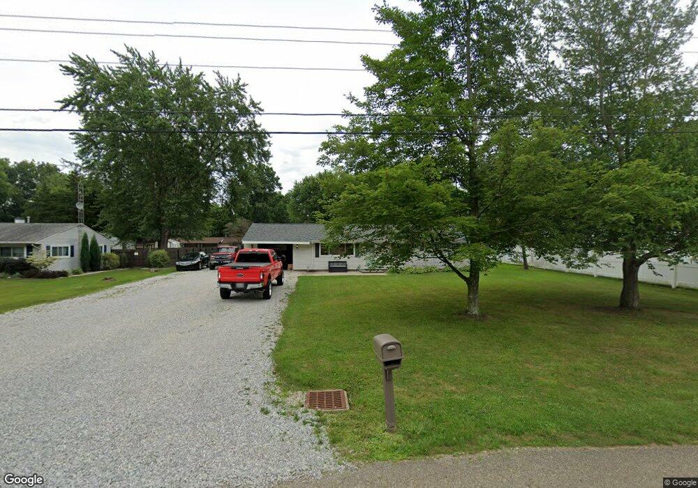
10702 Dot Ave NE Alliance, OH 44601
Estimated Value: $191,245 - $285,000
3
Beds
1
Bath
1,358
Sq Ft
$162/Sq Ft
Est. Value
About This Home
This home is located at 10702 Dot Ave NE, Alliance, OH 44601 and is currently estimated at $220,561, approximately $162 per square foot. 10702 Dot Ave NE is a home located in Stark County with nearby schools including Marlington High School and Regina Coeli/St Joseph School.
Ownership History
Date
Name
Owned For
Owner Type
Purchase Details
Closed on
Jan 30, 2015
Sold by
Crumrine Collin K and Crumrine Rollin D
Bought by
Sickles Brady T
Current Estimated Value
Home Financials for this Owner
Home Financials are based on the most recent Mortgage that was taken out on this home.
Original Mortgage
$71,428
Outstanding Balance
$54,789
Interest Rate
3.8%
Mortgage Type
New Conventional
Estimated Equity
$165,772
Purchase Details
Closed on
May 6, 2013
Sold by
Crumrine Larry E and Crumrine Collin K
Bought by
Crumrine Collin K and Crumrine Rollin D
Purchase Details
Closed on
Jul 14, 2011
Sold by
Estate Of Betty L Crumrine
Bought by
Crumrine Larry E
Create a Home Valuation Report for This Property
The Home Valuation Report is an in-depth analysis detailing your home's value as well as a comparison with similar homes in the area
Purchase History
We collect this data history from publicly available records. To have your information removed, we recommend requesting removal directly through your county’s website.
| Date | Buyer | Sale Price | Title Company |
|---|---|---|---|
| Sickles Brady T | $70,000 | None Available | |
| Crumrine Collin K | -- | None Available | |
| Crumrine Larry E | -- | None Available |
Source: Public Records
Mortgage History
We collect this data history from publicly available records. To have your information removed, we recommend requesting removal directly through your county’s website.
| Date | Status | Borrower | Loan Amount |
|---|---|---|---|
| Open | Sickles Brady T | $71,428 |
Source: Public Records
Tax History
| Year | Tax Paid | Tax Assessment Tax Assessment Total Assessment is a certain percentage of the fair market value that is determined by local assessors to be the total taxable value of land and additions on the property. | Land | Improvement |
|---|---|---|---|---|
| 2025 | -- | $57,090 | $21,880 | $35,210 |
| 2024 | -- | $57,090 | $21,880 | $35,210 |
| 2023 | $1,530 | $43,440 | $11,620 | $31,820 |
| 2022 | $1,535 | $43,440 | $11,620 | $31,820 |
| 2021 | $1,540 | $43,440 | $11,620 | $31,820 |
| 2020 | $1,447 | $36,370 | $10,010 | $26,360 |
| 2019 | $1,437 | $36,370 | $10,010 | $26,360 |
| 2018 | $1,439 | $36,370 | $10,010 | $26,360 |
| 2017 | $1,385 | $32,760 | $9,520 | $23,240 |
| 2016 | $1,385 | $32,760 | $9,520 | $23,240 |
| 2015 | $1,356 | $32,760 | $9,520 | $23,240 |
| 2014 | $1,064 | $23,490 | $7,950 | $15,540 |
| 2013 | $323 | $23,490 | $7,950 | $15,540 |
Source: Public Records
Map
Nearby Homes
- 10770 Dot Ave NE
- 13001 Beeson St NE
- 0 Meadow St NE
- 10930 Heltman Ave NE
- 10636 Clapsaddle Ave NE
- 13004 Edison St NE
- 0 W Main St Unit 5090123
- 1484 Lambert St
- 1250 S Sawburg Ave
- 1350 W Vine St
- 0 Northview Ave Unit 5207308
- 0 Schubert Ave NE
- 550 Johnson Ave
- 432 Johnson Ave
- 1601 Raywood Rd
- 1319 Glamorgan St
- 1114 Briarcliff Ave
- 160 Bonnieview Ave
- 1134 Glamorgan St
- 1715 Western Ave
- 10666 Dot Ave NE
- 10685 Barcus Ave NE
- 10644 Dot Ave NE
- 10722 Dot Ave NE
- 10705 Barcus Ave NE
- 10665 Barcus Ave NE
- 10685 Dot Ave NE
- 10665 Dot Ave NE
- 10705 Dot Ave NE
- 10725 Barcus Ave NE
- 10645 Barcus Ave NE
- 10626 Dot Ave NE
- 10744 Dot Ave NE
- 10645 Dot Ave NE
- 10725 Dot Ave NE
- 10745 Barcus Ave NE
- 10625 Barcus Ave NE
- 10625 Dot Ave NE
- 10745 Dot Ave NE
- 10606 Dot Ave NE
Your Personal Tour Guide
Ask me questions while you tour the home.