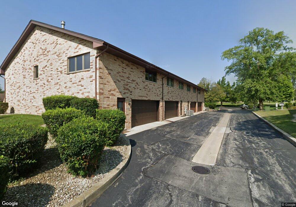
10702 Kentucky Ct Unit 27 Orland Park, IL 60467
Grasslands NeighborhoodEstimated Value: $310,680 - $322,000
2
Beds
2
Baths
1,800
Sq Ft
$176/Sq Ft
Est. Value
About This Home
This home is located at 10702 Kentucky Ct Unit 27, Orland Park, IL 60467 and is currently estimated at $317,420, approximately $176 per square foot. 10702 Kentucky Ct Unit 27 is a home located in Cook County with nearby schools including Meadow Ridge School, Orland Center School, and Century Junior High School.
Ownership History
Date
Name
Owned For
Owner Type
Purchase Details
Closed on
Dec 29, 2005
Sold by
Alberts Joseph F and Alberts Mary Ann
Bought by
Jordan Dino R and Jordan Anita M
Current Estimated Value
Home Financials for this Owner
Home Financials are based on the most recent Mortgage that was taken out on this home.
Original Mortgage
$188,000
Outstanding Balance
$106,108
Interest Rate
6.34%
Mortgage Type
Fannie Mae Freddie Mac
Estimated Equity
$211,312
Create a Home Valuation Report for This Property
The Home Valuation Report is an in-depth analysis detailing your home's value as well as a comparison with similar homes in the area
Home Values in the Area
Average Home Value in this Area
Purchase History
| Date | Buyer | Sale Price | Title Company |
|---|---|---|---|
| Jordan Dino R | $238,000 | Cti |
Source: Public Records
Mortgage History
| Date | Status | Borrower | Loan Amount |
|---|---|---|---|
| Open | Jordan Dino R | $188,000 |
Source: Public Records
Tax History Compared to Growth
Tax History
| Year | Tax Paid | Tax Assessment Tax Assessment Total Assessment is a certain percentage of the fair market value that is determined by local assessors to be the total taxable value of land and additions on the property. | Land | Improvement |
|---|---|---|---|---|
| 2024 | $4,396 | $23,532 | $6,193 | $17,339 |
| 2023 | $4,268 | $23,532 | $6,193 | $17,339 |
| 2022 | $4,268 | $17,669 | $5,087 | $12,582 |
| 2021 | $4,148 | $17,668 | $5,086 | $12,582 |
| 2020 | $4,056 | $17,668 | $5,086 | $12,582 |
| 2019 | $3,416 | $15,873 | $4,644 | $11,229 |
| 2018 | $3,320 | $15,873 | $4,644 | $11,229 |
| 2017 | $3,261 | $15,873 | $4,644 | $11,229 |
| 2016 | $3,128 | $13,709 | $4,202 | $9,507 |
| 2015 | $3,064 | $13,709 | $4,202 | $9,507 |
| 2014 | $3,033 | $13,709 | $4,202 | $9,507 |
| 2013 | $3,104 | $14,740 | $4,202 | $10,538 |
Source: Public Records
Map
Nearby Homes
- 10638 Melissa Dr Unit 104
- 18233 Michigan Ct Unit 73
- 10549 Illinois Ct Unit 184
- 18028 Esther Dr
- 10459 Eagle Ridge Dr Unit 139
- 17926 Alabama Ct Unit 5
- 17921 Alaska Ct Unit 8
- 10935 California Ct Unit 185
- 17816 New Hampshire Ct Unit 137
- 11108 Waters Edge Dr
- 9601 W 179th St
- 11101 W 179th St
- 12 187th St
- 10958 New Mexico Ct Unit 166
- 10754 Canterbury Dr
- 17708 Pennsylvania Ct Unit 211
- 10816 Kimberly Ln Unit 48
- 11151 188th Place
- 10509 San Luis Ln
- 11228 Cameron Pkwy
- 10700 Kentucky Ct Unit 26
- 10704 Kentucky Ct Unit 28
- 10654 Lynn Dr Unit 24
- 10706 Kentucky Ct Unit 29
- 10714 Kentucky Ct Unit 36
- 10705 Kentucky Ct Unit 37
- 10707 Kentucky Ct Unit 36
- 10652 Lynn Dr Unit 23
- 10716 Kentucky Ct Unit 34
- 10701 Eagle Ridge Dr Unit 18
- 10657 Eagle Ridge Dr Unit 17
- 18145 Lynn Dr Unit 113
- 18149 Lynn Dr Unit 112
- 10648 Lynn Dr Unit 21
- 18205 Lynn Dr Unit 107
- 18153 Lynn Dr Unit 111
- 18203 Lynn Dr Unit 108
- 10646 Lynn Dr Unit 20
- 10653 Eagle Ridge Dr Unit 16
- 10712 Louisiana Ct Unit 41