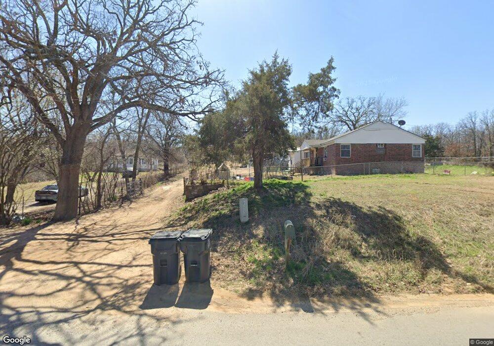
10702 W 71st St S Sapulpa, OK 74066
Estimated Value: $165,000 - $220,000
3
Beds
2
Baths
1,451
Sq Ft
$133/Sq Ft
Est. Value
About This Home
This home is located at 10702 W 71st St S, Sapulpa, OK 74066 and is currently estimated at $193,133, approximately $133 per square foot. 10702 W 71st St S is a home located in Creek County with nearby schools including Allen-Bowden Public School.
Ownership History
Date
Name
Owned For
Owner Type
Purchase Details
Closed on
Mar 25, 2015
Sold by
Jenner Dale B and Jenner Gillian M
Bought by
Thompson Christopher
Current Estimated Value
Purchase Details
Closed on
Jan 20, 2009
Sold by
Parker James S and Parker Carol Ann
Bought by
Shamblin Richard and Shamblin Cynthia
Purchase Details
Closed on
Aug 4, 2008
Sold by
Secretary Of Hud
Bought by
Parker James S
Purchase Details
Closed on
Sep 14, 2007
Sold by
Black James E
Bought by
Citimortgage Inc
Purchase Details
Closed on
Sep 10, 1999
Sold by
Eaton Phillip and Eaton Laura
Purchase Details
Closed on
Nov 2, 1995
Sold by
Green Michael and Green Jennifer
Purchase Details
Closed on
Mar 17, 1993
Sold by
Holloway David and Holloway Kristi
Purchase Details
Closed on
Nov 16, 1989
Create a Home Valuation Report for This Property
The Home Valuation Report is an in-depth analysis detailing your home's value as well as a comparison with similar homes in the area
Home Values in the Area
Average Home Value in this Area
Purchase History
| Date | Buyer | Sale Price | Title Company |
|---|---|---|---|
| Thompson Christopher | $111,000 | -- | |
| Shamblin Richard | $24,500 | -- | |
| Parker James S | -- | None Available | |
| Citimortgage Inc | -- | None Available | |
| -- | $52,000 | -- | |
| -- | $32,000 | -- | |
| -- | $33,000 | -- | |
| -- | $32,500 | -- |
Source: Public Records
Tax History Compared to Growth
Tax History
| Year | Tax Paid | Tax Assessment Tax Assessment Total Assessment is a certain percentage of the fair market value that is determined by local assessors to be the total taxable value of land and additions on the property. | Land | Improvement |
|---|---|---|---|---|
| 2025 | $817 | $9,351 | $675 | $8,676 |
| 2024 | $817 | $9,954 | $675 | $9,279 |
| 2023 | $817 | $13,810 | $675 | $13,135 |
| 2022 | $815 | $10,769 | $675 | $10,094 |
| 2021 | $791 | $10,456 | $675 | $9,781 |
| 2020 | $767 | $10,249 | $675 | $9,574 |
| 2019 | $1,062 | $13,822 | $675 | $13,147 |
| 2018 | $1,043 | $13,419 | $675 | $12,744 |
| 2017 | $1,135 | $13,419 | $675 | $12,744 |
| 2016 | $1,154 | $13,419 | $675 | $12,744 |
| 2015 | -- | $10,525 | $675 | $9,850 |
| 2014 | -- | $10,218 | $780 | $9,438 |
Source: Public Records
Map
Nearby Homes
- 11205 W Tiger Ln
- 6872 S 97th West Ave
- 0 S 97th West Ave
- 6250 S 97th West Ave
- 6250 S 97th West Ave
- 0 S 113th West Ave
- 114 Sherlyn Ln
- 0 Tracie Ln
- 10901 W 57th St S
- 0 S 102nd Ave W Unit 2542522
- 5410 Skylane Dr
- 5320 S Walnut Creek Place
- 5317 Skylane Dr
- 6201 S 80th West Ave
- 5307 Redbud Place
- 5846 S 81st West Ave
- 413 W 54th St
- 5609 S 85th West Ave
- 5802 S 81st Ave W
- 606 W 54th St
- 10702 71st W
- 10656 W 71st St S
- 10582 W 71st St S
- 10870 W 71st St S
- 7126 Cottonwood Rd
- 10579 W 72nd St S
- 7174 Cottonwood Rd
- 10523 W 72nd St S
- 10910 W 71st St S
- 10465 W 71st St S
- 7180 Cottonwood Rd
- 3405 W 72nd St S
- 0 W 72nd St S
- null W 72nd St S
- 10920 W 71st St S
- 7141 Cottonwood Rd
- 10630 W 72nd St S
- 7230 Cottonwood Rd
- 10980 W 71st St S
- 7201 Cottonwood Rd