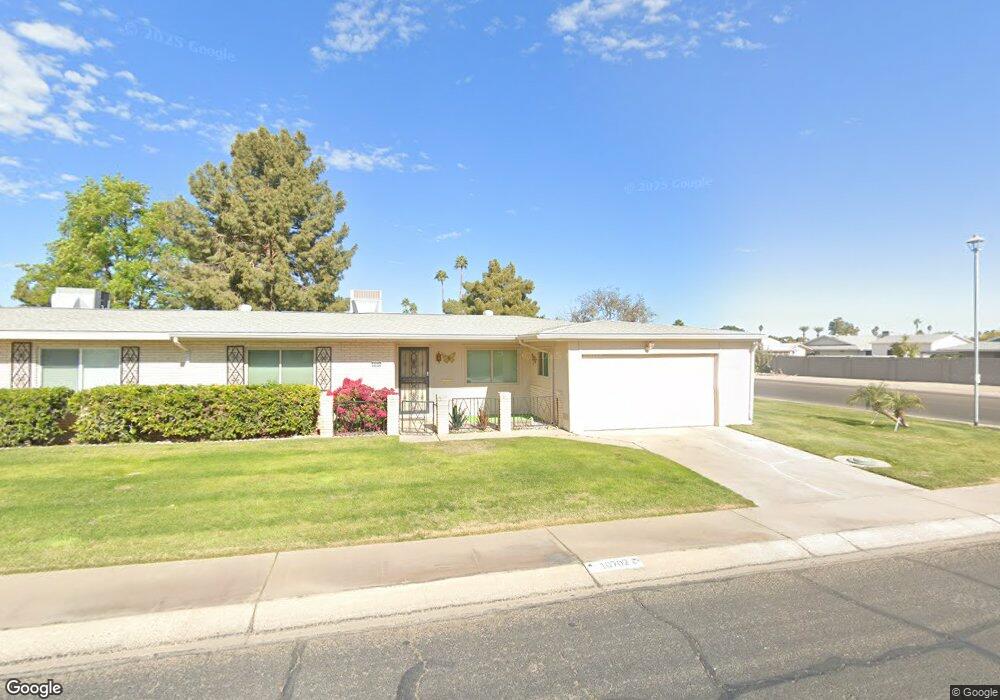
10702 W Caron Dr Unit 123 Sun City, AZ 85351
Estimated Value: $221,485 - $254,000
--
Bed
2
Baths
1,372
Sq Ft
$172/Sq Ft
Est. Value
About This Home
This home is located at 10702 W Caron Dr Unit 123, Sun City, AZ 85351 and is currently estimated at $235,621, approximately $171 per square foot. 10702 W Caron Dr Unit 123 is a home located in Maricopa County with nearby schools including Ombudsman - Northwest Charter and Peoria Accelerated High School.
Ownership History
Date
Name
Owned For
Owner Type
Purchase Details
Closed on
Oct 26, 2017
Sold by
Minick Joseph L and Minick Mary K
Bought by
Waugaman Christine L
Current Estimated Value
Purchase Details
Closed on
Aug 28, 2007
Sold by
Reed Ralph A
Bought by
Minick Joseph L and Minick Mary K
Home Financials for this Owner
Home Financials are based on the most recent Mortgage that was taken out on this home.
Original Mortgage
$100,000
Interest Rate
6.61%
Mortgage Type
Purchase Money Mortgage
Purchase Details
Closed on
Oct 23, 2001
Sold by
Alsten Pearl G and Terrian Marilyn J
Bought by
Reed Ralph A
Home Financials for this Owner
Home Financials are based on the most recent Mortgage that was taken out on this home.
Original Mortgage
$58,400
Interest Rate
6.57%
Mortgage Type
New Conventional
Create a Home Valuation Report for This Property
The Home Valuation Report is an in-depth analysis detailing your home's value as well as a comparison with similar homes in the area
Home Values in the Area
Average Home Value in this Area
Purchase History
| Date | Buyer | Sale Price | Title Company |
|---|---|---|---|
| Waugaman Christine L | -- | None Available | |
| Minick Joseph L | $130,000 | Capital Title Agency Inc | |
| Reed Ralph A | $73,000 | Grand Canyon Title Agency In |
Source: Public Records
Mortgage History
| Date | Status | Borrower | Loan Amount |
|---|---|---|---|
| Previous Owner | Minick Joseph L | $100,000 | |
| Previous Owner | Reed Ralph A | $58,400 |
Source: Public Records
Tax History Compared to Growth
Tax History
| Year | Tax Paid | Tax Assessment Tax Assessment Total Assessment is a certain percentage of the fair market value that is determined by local assessors to be the total taxable value of land and additions on the property. | Land | Improvement |
|---|---|---|---|---|
| 2025 | $759 | $8,466 | -- | -- |
| 2024 | $694 | $8,063 | -- | -- |
| 2023 | $694 | $16,960 | $3,390 | $13,570 |
| 2022 | $650 | $14,500 | $2,900 | $11,600 |
| 2021 | $664 | $13,210 | $2,640 | $10,570 |
| 2020 | $649 | $11,610 | $2,320 | $9,290 |
| 2019 | $640 | $10,370 | $2,070 | $8,300 |
| 2018 | $619 | $8,920 | $1,780 | $7,140 |
| 2017 | $600 | $7,920 | $1,580 | $6,340 |
| 2016 | $564 | $6,720 | $1,340 | $5,380 |
| 2015 | $533 | $6,370 | $1,270 | $5,100 |
Source: Public Records
Map
Nearby Homes
- 10707 W Mission Ln
- 10726 W Kelso Dr Unit 172
- 9202 N 107th Ave Unit 8
- 10731 W Mission Ln Unit 200
- 10825 W Caron Dr
- 10726 W Denham Dr Unit 16
- 10732 W Denham Dr Unit 17
- 8800 N 107th Ave Unit 17
- 8800 N 107th Ave Unit 19
- 8800 N 107th Ave Unit 52
- 8803 N 105th Dr
- 10512 W Ruth Ave
- 10603 W Ruth Ave
- 10326 W Caron Dr
- 8582 N 107th Ln
- 10816 W Venturi Dr
- 10801 W Mountain View Rd
- 11005 W Kelso Dr
- 10788 W Cinnebar Ave
- 8566 N 108th Ln
- 10706 W Caron Dr
- 10714 W Caron Dr
- 10705 W Kelso Dr
- 10701 W Kelso Dr
- 10701 W Caron Dr
- 10648 W Caron Dr
- 10705 W Caron Dr Unit 9
- 10709 W Kelso Dr Unit 164
- 10718 W Caron Dr
- 10711 W Caron Dr
- 10715 W Caron Dr
- 10713 W Kelso Dr
- 10647 W Caron Dr
- 10722 W Caron Dr
- 10640 W Caron Dr
- 10719 W Caron Dr
- 10717 W Kelso Dr Unit 162
- 10639 W Kelso Dr
- 10726 W Caron Dr Unit 128
- 10706 W Kelso Dr Unit 9