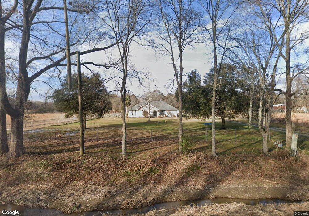
10705 Peairs Rd Zachary, LA 70791
Brownsfield/Central NeighborhoodEstimated Value: $187,491 - $445,000
4
Beds
2
Baths
1,850
Sq Ft
$158/Sq Ft
Est. Value
About This Home
This home is located at 10705 Peairs Rd, Zachary, LA 70791 and is currently estimated at $292,623, approximately $158 per square foot. 10705 Peairs Rd is a home located in East Baton Rouge Parish with nearby schools including Northeast Elementary School, Northeast High School, and Zachary Christian Academy.
Ownership History
Date
Name
Owned For
Owner Type
Purchase Details
Closed on
Jul 26, 2012
Sold by
Morris Klyf J
Bought by
Kuykendall Sandra
Current Estimated Value
Home Financials for this Owner
Home Financials are based on the most recent Mortgage that was taken out on this home.
Original Mortgage
$111,625
Outstanding Balance
$77,510
Interest Rate
3.72%
Mortgage Type
New Conventional
Estimated Equity
$215,113
Create a Home Valuation Report for This Property
The Home Valuation Report is an in-depth analysis detailing your home's value as well as a comparison with similar homes in the area
Home Values in the Area
Average Home Value in this Area
Purchase History
| Date | Buyer | Sale Price | Title Company |
|---|---|---|---|
| Kuykendall Sandra | $117,500 | -- |
Source: Public Records
Mortgage History
| Date | Status | Borrower | Loan Amount |
|---|---|---|---|
| Open | Kuykendall Sandra | $111,625 |
Source: Public Records
Tax History Compared to Growth
Tax History
| Year | Tax Paid | Tax Assessment Tax Assessment Total Assessment is a certain percentage of the fair market value that is determined by local assessors to be the total taxable value of land and additions on the property. | Land | Improvement |
|---|---|---|---|---|
| 2024 | $811 | $13,429 | $1,355 | $12,074 |
| 2023 | $814 | $11,990 | $1,210 | $10,780 |
| 2022 | $1,545 | $11,990 | $1,210 | $10,780 |
| 2021 | $1,519 | $11,990 | $1,210 | $10,780 |
| 2020 | $1,509 | $11,990 | $1,210 | $10,780 |
| 2019 | $1,423 | $10,900 | $1,100 | $9,800 |
| 2018 | $1,407 | $10,900 | $1,100 | $9,800 |
| 2017 | $1,298 | $10,900 | $1,100 | $9,800 |
| 2016 | $32 | $7,470 | $1,100 | $6,370 |
| 2015 | $1,230 | $10,600 | $1,100 | $9,500 |
| 2014 | $1,225 | $10,600 | $1,100 | $9,500 |
| 2013 | -- | $10,600 | $1,100 | $9,500 |
Source: Public Records
Map
Nearby Homes
- 10854 Peairs Rd
- 17626 Blackwater Rd
- 10176 Greenwell Spring Point Hudson Rd
- 10011 Greenwell Spring Point Hudson Rd
- 9776 Deer Run Ave
- 9779 Spike Ridge Ave
- 9749 Spike Ridge Ave
- 19850 Buckhorn Dr
- 9434 Deer Trail Ave
- Tract L-1-C N Joor Rd
- Lot 29 N Deer Creek Ave
- 12175 Peairs Rd
- 17911 Joor Rd
- 18955 Corlis Green Dr
- D-2 Baylin Ave
- 16564 Old Settlement Rd
- 13251 Greenwell Spring Point Hudson Rd
- 8384 Zachary-Deerford Rd
- 9981 Main St
- 19173 Plank Rd Unit LotWP001
- 10755 Peairs Rd
- 10750 Peairs Rd
- 10662 Peairs Rd
- 10662 Peairs Rd
- 9145 Milldale Rd
- 9185 Milldale Rd
- 10657 Peairs Rd
- Lot 3-A Peairs Rd
- 10596 Peairs Rd
- K-1-B Milldale Rd
- K-1-C Milldale Rd
- K-1-D Milldale Rd
- K-1-E Milldale Rd
- Y-2 Peairs Rd
- 10450 Peairs Rd
- 10595 Peairs Rd
- 10874 Peairs Rd
- 10457 Peairs Rd
- 10920 Peairs Rd
- 10575 Greenwell Spg Pt Hudso Rd