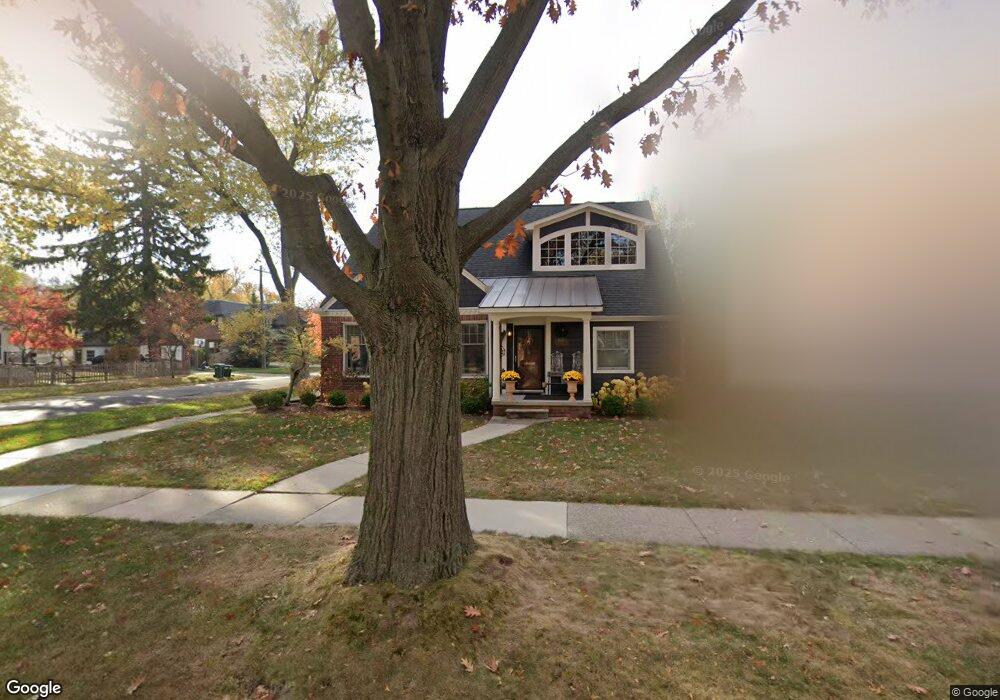
10705 Talbot Ave Unit Bldg-Unit Huntington Woods, MI 48070
Estimated Value: $753,247 - $903,000
5
Beds
4
Baths
2,618
Sq Ft
$316/Sq Ft
Est. Value
About This Home
This home is located at 10705 Talbot Ave Unit Bldg-Unit, Huntington Woods, MI 48070 and is currently estimated at $827,062, approximately $315 per square foot. 10705 Talbot Ave Unit Bldg-Unit is a home located in Oakland County with nearby schools including Burton Elementary School, Norup International School, and Berkley High School.
Ownership History
Date
Name
Owned For
Owner Type
Purchase Details
Closed on
Jul 12, 2018
Sold by
Bullock Marc and Bullock Holly
Bought by
Fouts Terrence T and Kutscher Katherine
Current Estimated Value
Home Financials for this Owner
Home Financials are based on the most recent Mortgage that was taken out on this home.
Original Mortgage
$332,000
Outstanding Balance
$287,728
Interest Rate
4.5%
Mortgage Type
New Conventional
Estimated Equity
$539,334
Purchase Details
Closed on
Aug 3, 2012
Sold by
Annetta Helen E and Annetta Revocable Livi Helen E
Bought by
Bullock Marc and Bullock Holly
Purchase Details
Closed on
Aug 5, 2011
Sold by
Annetta Helen E
Bought by
Annetta Helen E and Helen E Annetta Revocable Trust
Create a Home Valuation Report for This Property
The Home Valuation Report is an in-depth analysis detailing your home's value as well as a comparison with similar homes in the area
Home Values in the Area
Average Home Value in this Area
Purchase History
| Date | Buyer | Sale Price | Title Company |
|---|---|---|---|
| Fouts Terrence T | $582,000 | None Available | |
| Bullock Marc | $189,900 | Liberty Title | |
| Annetta Helen E | -- | Lawyers Title Insurance Corp | |
| Annetta Helen E | -- | None Available | |
| Annetta Helen E | -- | None Available |
Source: Public Records
Mortgage History
| Date | Status | Borrower | Loan Amount |
|---|---|---|---|
| Open | Fouts Terrence T | $332,000 |
Source: Public Records
Tax History Compared to Growth
Tax History
| Year | Tax Paid | Tax Assessment Tax Assessment Total Assessment is a certain percentage of the fair market value that is determined by local assessors to be the total taxable value of land and additions on the property. | Land | Improvement |
|---|---|---|---|---|
| 2024 | $14,101 | $311,160 | $0 | $0 |
| 2023 | $12,867 | $290,230 | $0 | $0 |
| 2022 | $12,832 | $273,560 | $0 | $0 |
| 2021 | $12,743 | $267,310 | $0 | $0 |
| 2020 | $12,209 | $265,750 | $0 | $0 |
| 2019 | $12,140 | $258,280 | $0 | $0 |
| 2018 | $6,947 | $235,080 | $0 | $0 |
| 2017 | $6,806 | $233,600 | $0 | $0 |
| 2016 | $6,646 | $216,150 | $0 | $0 |
| 2015 | -- | $185,190 | $0 | $0 |
| 2014 | -- | $165,990 | $0 | $0 |
| 2011 | -- | $92,220 | $0 | $0 |
Source: Public Records
Map
Nearby Homes
- 10554 Nadine Ave
- 10834 Talbot Ave
- 10425 Elgin Ave
- 10454 Borgman Ave
- 10445 Lincoln Dr
- 10855 Kingston Ave
- 10419 W 11 Mile Rd
- 10024 Borgman Ave
- 1761 Stanford Rd
- 1818 Mortenson Blvd
- 1560 Columbia Rd
- 26725 Humber St
- 8685 Hendrie Blvd
- 1059 Columbia Rd
- 13128 Talbot Ave
- 1977 Princeton Rd
- 1957 Columbia Rd
- 828 Princeton Rd
- 1079 Harvard Rd
- 1896 Cambridge Rd
- 10705 Talbot Ave
- 10715 Talbot Ave
- 10565 Talbot Ave
- 10702 Hart Ave
- 10710 Hart Ave
- 10560 Hart Ave
- 10555 Talbot Ave
- 10735 Talbot Ave
- 10704 Talbot Ave
- 10722 Hart Ave
- 10714 Talbot Ave
- 10724 Talbot Ave
- 10564 Talbot Ave
- 10734 Hart Ave
- 10545 Talbot Ave
- 10540 Hart Ave
- 10745 Talbot Ave
- 10554 Talbot Ave
- 10734 Talbot Ave
- 10535 Talbot Ave