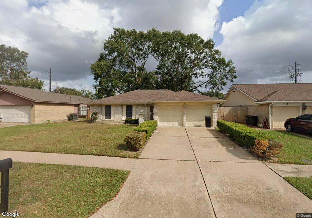
10706 Mackenzie Dr Houston, TX 77086
North Houston NeighborhoodEstimated Value: $207,058 - $245,000
3
Beds
2
Baths
1,476
Sq Ft
$153/Sq Ft
Est. Value
About This Home
This home is located at 10706 Mackenzie Dr, Houston, TX 77086 and is currently estimated at $226,515, approximately $153 per square foot. 10706 Mackenzie Dr is a home located in Harris County with nearby schools including Kujawa EC/Pre-K/K School, Carmichael Elementary School, and Shotwell Middle School.
Ownership History
Date
Name
Owned For
Owner Type
Purchase Details
Closed on
Jun 28, 2002
Sold by
Salazar Roger D
Bought by
Orozco Maria G and Sanchez Sonia
Current Estimated Value
Home Financials for this Owner
Home Financials are based on the most recent Mortgage that was taken out on this home.
Original Mortgage
$82,123
Outstanding Balance
$35,258
Interest Rate
6.89%
Mortgage Type
FHA
Estimated Equity
$191,257
Purchase Details
Closed on
Mar 5, 2002
Sold by
Dood Ted Byron and Dodd Cynthia Ann
Bought by
Salazar Roger D
Create a Home Valuation Report for This Property
The Home Valuation Report is an in-depth analysis detailing your home's value as well as a comparison with similar homes in the area
Home Values in the Area
Average Home Value in this Area
Purchase History
| Date | Buyer | Sale Price | Title Company |
|---|---|---|---|
| Orozco Maria G | -- | First American Title | |
| Salazar Roger D | $59,100 | -- |
Source: Public Records
Mortgage History
| Date | Status | Borrower | Loan Amount |
|---|---|---|---|
| Open | Orozco Maria G | $82,123 |
Source: Public Records
Tax History Compared to Growth
Tax History
| Year | Tax Paid | Tax Assessment Tax Assessment Total Assessment is a certain percentage of the fair market value that is determined by local assessors to be the total taxable value of land and additions on the property. | Land | Improvement |
|---|---|---|---|---|
| 2025 | $1,416 | $203,430 | $39,294 | $164,136 |
| 2024 | $1,416 | $203,430 | $39,294 | $164,136 |
| 2023 | $1,416 | $210,179 | $39,294 | $170,885 |
| 2022 | $3,572 | $176,903 | $33,300 | $143,603 |
| 2021 | $3,240 | $147,716 | $33,300 | $114,416 |
| 2020 | $3,274 | $138,185 | $33,300 | $104,885 |
| 2019 | $3,095 | $132,659 | $16,979 | $115,680 |
| 2018 | $1,080 | $125,661 | $16,979 | $108,682 |
| 2017 | $2,466 | $117,666 | $15,246 | $102,420 |
| 2016 | $2,242 | $105,226 | $15,246 | $89,980 |
| 2015 | $1,570 | $99,247 | $15,246 | $84,001 |
| 2014 | $1,570 | $75,057 | $15,246 | $59,811 |
Source: Public Records
Map
Nearby Homes
- 10711 Heather Hill Dr
- 10723 Mackenzie Dr
- 10614 Mackenzie Dr
- 7218 Winding Trace Dr
- 7222 Northleaf Dr
- 10307 Bammel North Houston Rd
- 7227 Greenyard Dr
- 7023 Sandswept Ln
- 7302 Seton Lake Dr
- 7002 Sandswept Ln
- 7307 Silver Star Dr
- 6911 Silver Star Dr
- 11007 Tobasa Ct
- 6722 Winding Trace Dr
- 5010 Kale Ct
- 6654 Brownie Campbell Rd
- 6822 Dusty Dawn Dr
- 11006 Crinkleawn Dr
- 5103 Dartmoor Ridge Trail
- 9815 Lonsford Dr
- 10710 Mackenzie Dr
- 10702 Mackenzie Dr
- 10707 Heather Hill Dr
- 10714 Mackenzie Dr
- 10703 Heather Hill Dr
- 10722 Mackenzie Dr
- 10707 Mackenzie Dr
- 10711 Mackenzie Dr
- 10715 Heather Hill Dr
- 10622 Mackenzie Dr
- 10703 Mackenzie Dr
- 10715 Mackenzie Dr
- 10619 Heather Hill Dr
- 10726 Mackenzie Dr
- 10719 Heather Hill Dr
- 10719 Mackenzie Dr
- 10618 Mackenzie Dr
- 10623 Mackenzie Dr
- 10615 Heather Hill Dr
- 10702 Heather Hill Dr