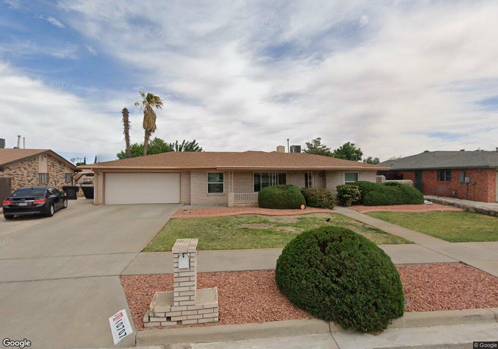
10707 Camaro Ct El Paso, TX 79935
Vista Del Sol NeighborhoodEstimated Value: $259,096 - $328,000
--
Bed
2
Baths
1,750
Sq Ft
$163/Sq Ft
Est. Value
About This Home
This home is located at 10707 Camaro Ct, El Paso, TX 79935 and is currently estimated at $284,524, approximately $162 per square foot. 10707 Camaro Ct is a home located in El Paso County with nearby schools including Vista Hills Elementary School, J M Hanks High School, and St. Raphael School.
Ownership History
Date
Name
Owned For
Owner Type
Purchase Details
Closed on
Sep 18, 2014
Sold by
Calleros David L
Bought by
Calleros Liza
Current Estimated Value
Home Financials for this Owner
Home Financials are based on the most recent Mortgage that was taken out on this home.
Original Mortgage
$120,000
Outstanding Balance
$91,732
Interest Rate
4.1%
Mortgage Type
Purchase Money Mortgage
Estimated Equity
$192,792
Purchase Details
Closed on
Oct 15, 2003
Sold by
Diaz Henry and Diaz Blanca E
Bought by
Calleros David L and Calleros Liza
Home Financials for this Owner
Home Financials are based on the most recent Mortgage that was taken out on this home.
Original Mortgage
$117,800
Interest Rate
6.42%
Mortgage Type
Purchase Money Mortgage
Create a Home Valuation Report for This Property
The Home Valuation Report is an in-depth analysis detailing your home's value as well as a comparison with similar homes in the area
Home Values in the Area
Average Home Value in this Area
Purchase History
| Date | Buyer | Sale Price | Title Company |
|---|---|---|---|
| Calleros Liza | -- | None Available | |
| Calleros David L | -- | -- |
Source: Public Records
Mortgage History
| Date | Status | Borrower | Loan Amount |
|---|---|---|---|
| Open | Calleros Liza | $120,000 | |
| Closed | Calleros David L | $117,800 |
Source: Public Records
Tax History Compared to Growth
Tax History
| Year | Tax Paid | Tax Assessment Tax Assessment Total Assessment is a certain percentage of the fair market value that is determined by local assessors to be the total taxable value of land and additions on the property. | Land | Improvement |
|---|---|---|---|---|
| 2025 | $4,367 | $248,748 | $43,074 | $205,674 |
| 2024 | $4,367 | $227,020 | -- | -- |
| 2023 | $4,086 | $206,382 | $0 | $0 |
| 2022 | $5,826 | $187,620 | $0 | $0 |
| 2021 | $5,544 | $170,564 | $28,671 | $141,893 |
| 2020 | $5,230 | $165,581 | $28,671 | $136,910 |
| 2018 | $5,001 | $160,816 | $28,671 | $132,145 |
| 2017 | $4,632 | $151,539 | $28,671 | $122,868 |
| 2016 | $4,632 | $151,539 | $28,671 | $122,868 |
| 2015 | $3,935 | $151,539 | $28,671 | $122,868 |
| 2014 | $3,935 | $162,086 | $28,671 | $133,415 |
Source: Public Records
Map
Nearby Homes
- 1955 Trawood Dr Unit 12
- 2109 Febrero Dr
- 1909 Crow Dr
- 2105 Pacheco Dr
- 2000 Solano Dr
- 2153 Trawood Dr
- 1730 Bara Dr
- 2201 Trawood Dr
- 1644 Lomaland Dr Unit 169
- 2224 Escarpa Dr
- 1844 Jack Nicklaus Dr Unit 1846
- 1649 Lomaland Dr
- 10313 Byway Dr
- 2313 Frank Beard Dr
- 10233 Byway Dr
- 10304 Woodruff Ct
- 10309 Woodruff Ct
- 10533 Springwood Dr
- 10512 Album Ave
- 2705 Fierro Dr
- 10709 Camaro Ct
- 10703 Camaro Ct
- 10712 Alta Loma Dr
- 10708 Alta Loma Dr
- 10716 Alta Loma Dr
- 10713 Camaro Ct
- 10708 Camaro Ct
- 10701 Camaro Ct
- 10704 Alta Loma Dr
- 10700 Camaro Ct
- 10712 Camaro Ct
- 10720 Alta Loma Dr
- 10700 Alta Loma Dr
- 10717 Camaro Ct
- 10713 Alta Loma Dr
- 10709 Alta Loma Dr
- 10716 Camaro Ct
- 10717 Alta Loma Dr
- 10705 Alta Loma Dr
- 10703 La Subida Dr