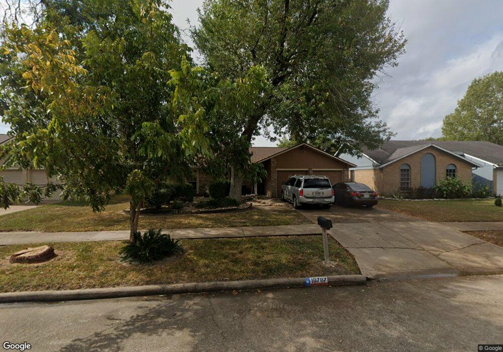
10707 Mackenzie Dr Houston, TX 77086
North Houston NeighborhoodEstimated Value: $204,136 - $251,000
3
Beds
2
Baths
1,405
Sq Ft
$166/Sq Ft
Est. Value
About This Home
This home is located at 10707 Mackenzie Dr, Houston, TX 77086 and is currently estimated at $232,534, approximately $165 per square foot. 10707 Mackenzie Dr is a home located in Harris County with nearby schools including Kujawa EC/Pre-K/K School, Carmichael Elementary School, and Shotwell Middle School.
Ownership History
Date
Name
Owned For
Owner Type
Purchase Details
Closed on
Oct 12, 1999
Sold by
Martinez Maria Dejesus
Bought by
Delariva Jose Luis and Gonzalez Lorenza Cruz
Current Estimated Value
Home Financials for this Owner
Home Financials are based on the most recent Mortgage that was taken out on this home.
Original Mortgage
$35,800
Outstanding Balance
$10,760
Interest Rate
7.77%
Mortgage Type
Seller Take Back
Estimated Equity
$221,774
Purchase Details
Closed on
May 9, 1997
Sold by
Garza Juana Maria
Bought by
Martinez Maria Dejesus
Purchase Details
Closed on
Mar 27, 1995
Sold by
Widmark Peter O and Brandon Andrew E
Bought by
Garza Juana Maria
Home Financials for this Owner
Home Financials are based on the most recent Mortgage that was taken out on this home.
Original Mortgage
$35,800
Interest Rate
8.72%
Create a Home Valuation Report for This Property
The Home Valuation Report is an in-depth analysis detailing your home's value as well as a comparison with similar homes in the area
Home Values in the Area
Average Home Value in this Area
Purchase History
| Date | Buyer | Sale Price | Title Company |
|---|---|---|---|
| Delariva Jose Luis | -- | -- | |
| Martinez Maria Dejesus | -- | -- | |
| Garza Juana Maria | -- | -- |
Source: Public Records
Mortgage History
| Date | Status | Borrower | Loan Amount |
|---|---|---|---|
| Open | Delariva Jose Luis | $35,800 | |
| Previous Owner | Garza Juana Maria | $35,800 | |
| Closed | Martinez Maria Dejesus | $0 |
Source: Public Records
Tax History Compared to Growth
Tax History
| Year | Tax Paid | Tax Assessment Tax Assessment Total Assessment is a certain percentage of the fair market value that is determined by local assessors to be the total taxable value of land and additions on the property. | Land | Improvement |
|---|---|---|---|---|
| 2025 | $4,671 | $201,961 | $39,397 | $162,564 |
| 2024 | $4,671 | $201,961 | $39,397 | $162,564 |
| 2023 | $4,671 | $208,875 | $39,397 | $169,478 |
| 2022 | $4,282 | $175,922 | $33,388 | $142,534 |
| 2021 | $3,571 | $147,069 | $33,388 | $113,681 |
| 2020 | $3,714 | $137,575 | $33,388 | $104,187 |
| 2019 | $3,707 | $132,070 | $17,021 | $115,049 |
| 2018 | $1,798 | $125,212 | $17,021 | $108,191 |
| 2017 | $3,176 | $117,357 | $15,285 | $102,072 |
| 2016 | $2,882 | $106,505 | $15,285 | $91,220 |
| 2015 | $1,918 | $100,513 | $15,285 | $85,228 |
| 2014 | $1,918 | $70,786 | $15,285 | $55,501 |
Source: Public Records
Map
Nearby Homes
- 10723 Mackenzie Dr
- 10711 Heather Hill Dr
- 10614 Mackenzie Dr
- 10307 Bammel North Houston Rd
- 7302 Seton Lake Dr
- 7218 Winding Trace Dr
- 7222 Northleaf Dr
- 7227 Greenyard Dr
- 7023 Sandswept Ln
- 7307 Silver Star Dr
- 7002 Sandswept Ln
- 6911 Silver Star Dr
- 11007 Tobasa Ct
- 6722 Winding Trace Dr
- 5010 Kale Ct
- 6822 Dusty Dawn Dr
- 6654 Brownie Campbell Rd
- 9815 Lonsford Dr
- 5103 Dartmoor Ridge Trail
- 11006 Crinkleawn Dr
- 10711 Mackenzie Dr
- 10703 Mackenzie Dr
- 10715 Mackenzie Dr
- 10719 Mackenzie Dr
- 10706 Mackenzie Dr
- 10702 Mackenzie Dr
- 10710 Mackenzie Dr
- 10623 Mackenzie Dr
- 7302 Rogue River Dr
- 10714 Mackenzie Dr
- 10619 Mackenzie Dr
- 10622 Mackenzie Dr
- 10722 Mackenzie Dr
- 7306 Rogue River Dr
- 10622 Canyoncrest Ln
- 10707 Heather Hill Dr
- 10703 Heather Hill Dr
- 10727 Mackenzie Dr
- 10618 Mackenzie Dr
- 10726 Mackenzie Dr