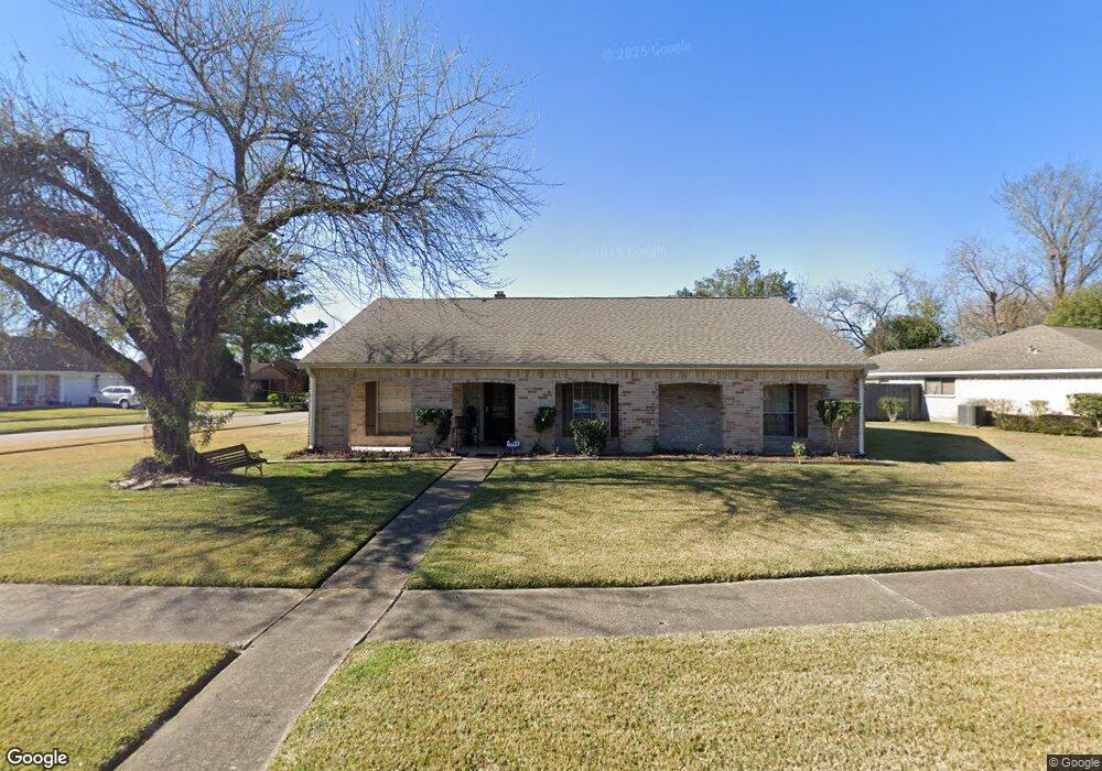
10707 Misty Summit Dr Houston, TX 77086
North Houston NeighborhoodEstimated Value: $237,000 - $255,000
3
Beds
2
Baths
1,862
Sq Ft
$132/Sq Ft
Est. Value
About This Home
This home is located at 10707 Misty Summit Dr, Houston, TX 77086 and is currently estimated at $246,381, approximately $132 per square foot. 10707 Misty Summit Dr is a home located in Harris County with nearby schools including Kujawa EC/Pre-K/K School, Carmichael Elementary School, and Shotwell Middle School.
Ownership History
Date
Name
Owned For
Owner Type
Purchase Details
Closed on
Nov 2, 2001
Sold by
Hunt Richard E and Hunt Mary Ann
Bought by
Bowman Clara
Current Estimated Value
Home Financials for this Owner
Home Financials are based on the most recent Mortgage that was taken out on this home.
Original Mortgage
$82,400
Outstanding Balance
$32,182
Interest Rate
6.71%
Estimated Equity
$214,199
Create a Home Valuation Report for This Property
The Home Valuation Report is an in-depth analysis detailing your home's value as well as a comparison with similar homes in the area
Home Values in the Area
Average Home Value in this Area
Purchase History
| Date | Buyer | Sale Price | Title Company |
|---|---|---|---|
| Bowman Clara | -- | Chicago Title Insurance Co |
Source: Public Records
Mortgage History
| Date | Status | Borrower | Loan Amount |
|---|---|---|---|
| Open | Bowman Clara | $82,400 | |
| Closed | Bowman Clara | $9,700 |
Source: Public Records
Tax History Compared to Growth
Tax History
| Year | Tax Paid | Tax Assessment Tax Assessment Total Assessment is a certain percentage of the fair market value that is determined by local assessors to be the total taxable value of land and additions on the property. | Land | Improvement |
|---|---|---|---|---|
| 2025 | $1,010 | $247,505 | $43,253 | $204,252 |
| 2024 | $1,010 | $251,219 | $43,253 | $207,966 |
| 2023 | $1,010 | $255,970 | $43,253 | $212,717 |
| 2022 | $4,250 | $215,023 | $36,655 | $178,368 |
| 2021 | $3,855 | $178,671 | $36,655 | $142,016 |
| 2020 | $3,896 | $168,927 | $36,655 | $132,272 |
| 2019 | $3,682 | $162,065 | $18,622 | $143,443 |
| 2018 | $574 | $153,283 | $18,622 | $134,661 |
| 2017 | $2,934 | $143,648 | $16,722 | $126,926 |
| 2016 | $2,667 | $130,067 | $16,722 | $113,345 |
| 2015 | $1,906 | $120,847 | $16,722 | $104,125 |
| 2014 | $1,906 | $90,789 | $16,722 | $74,067 |
Source: Public Records
Map
Nearby Homes
- 11007 Tobasa Ct
- 6654 Brownie Campbell Rd
- 6722 Winding Trace Dr
- 11006 Crinkleawn Dr
- 7002 Sandswept Ln
- 6630 Brownie Campbell Rd
- 11021 Crenchrus Ct
- 7023 Sandswept Ln
- 6610 Northleaf Dr
- 7218 Winding Trace Dr
- 11009 Panicum Ct
- 6615 Winding Trace Dr
- 7222 Northleaf Dr
- 7227 Greenyard Dr
- 6911 Silver Star Dr
- 10522 Northview Dr
- 10614 Mackenzie Dr
- 10711 Heather Hill Dr
- 10307 Bammel North Houston Rd
- 6502 Trail Valley Way
- 10711 Misty Summit Dr
- 6910 Canyon Way Dr
- 6907 Canyon Way Dr
- 6903 Canyon Way Dr
- 10706 Misty Summit Dr
- 10702 Misty Summit Dr
- 6911 Canyon Way Dr
- 10710 Misty Summit Dr
- 6914 Canyon Way Dr
- 6819 Canyon Way Dr
- 10714 Misty Summit Dr
- 6915 Canyon Way Dr
- 6815 Canyon Way Dr
- 10802 Misty Summit Dr
- 6918 Canyon Way Dr
- 6903 Northleaf Dr
- 6907 Northleaf Dr
- 6906 Winding Trace Dr
- 6911 Northleaf Dr
- 6902 Winding Trace Dr