Estimated Value: $304,000 - $318,871
3
Beds
2
Baths
2,241
Sq Ft
$138/Sq Ft
Est. Value
About This Home
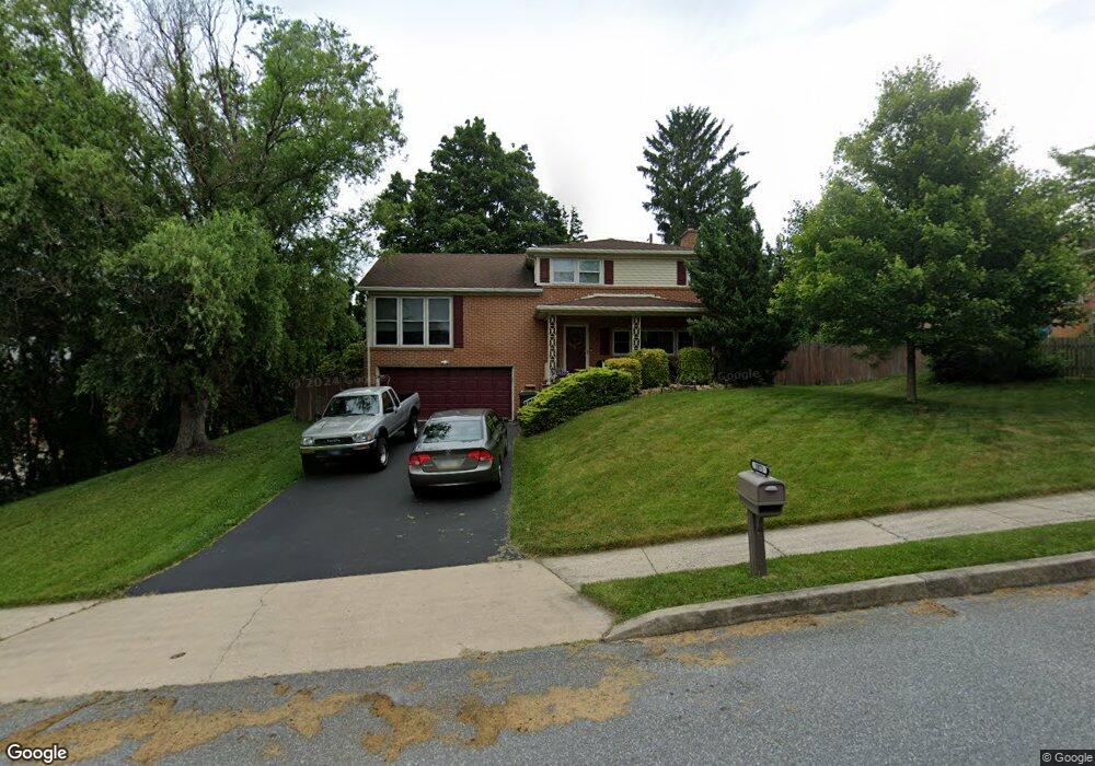
This home is located at 1071 Berkley Rd, York, PA 17402 and is currently estimated at $309,718, approximately $138 per square foot. 1071 Berkley Rd is a home located in York County with nearby schools including York Suburban Middle School, York Suburban Senior High School, and St Joseph School.
Ownership History
Date
Name
Owned For
Owner Type
Purchase Details
Closed on
Jul 31, 2008
Sold by
Winstead Sharon J and Winstead Victor L
Bought by
Bedford Robert W
Current Estimated Value
Home Financials for this Owner
Home Financials are based on the most recent Mortgage that was taken out on this home.
Original Mortgage
$176,505
Outstanding Balance
$116,638
Interest Rate
6.47%
Mortgage Type
Purchase Money Mortgage
Estimated Equity
$193,080
Purchase Details
Closed on
Jun 30, 1998
Sold by
Chud Claire F
Bought by
Delzangle Sharon J
Home Financials for this Owner
Home Financials are based on the most recent Mortgage that was taken out on this home.
Original Mortgage
$107,353
Interest Rate
7.04%
Create a Home Valuation Report for This Property
The Home Valuation Report is an in-depth analysis detailing your home's value as well as a comparison with similar homes in the area
Home Values in the Area
Average Home Value in this Area
Purchase History
| Date | Buyer | Sale Price | Title Company |
|---|---|---|---|
| Bedford Robert W | $177,900 | None Available | |
| Delzangle Sharon J | $117,000 | First American Title Ins Co |
Source: Public Records
Mortgage History
| Date | Status | Borrower | Loan Amount |
|---|---|---|---|
| Open | Bedford Robert W | $176,505 | |
| Previous Owner | Delzangle Sharon J | $107,353 |
Source: Public Records
Tax History Compared to Growth
Tax History
| Year | Tax Paid | Tax Assessment Tax Assessment Total Assessment is a certain percentage of the fair market value that is determined by local assessors to be the total taxable value of land and additions on the property. | Land | Improvement |
|---|---|---|---|---|
| 2025 | $5,368 | $153,450 | $43,520 | $109,930 |
| 2024 | $4,510 | $153,450 | $43,520 | $109,930 |
| 2023 | $5,101 | $153,450 | $43,520 | $109,930 |
| 2022 | $5,101 | $153,450 | $43,520 | $109,930 |
| 2021 | $4,882 | $153,450 | $43,520 | $109,930 |
| 2020 | $4,882 | $153,450 | $43,520 | $109,930 |
| 2019 | $4,708 | $153,450 | $43,520 | $109,930 |
| 2018 | $4,642 | $153,450 | $43,520 | $109,930 |
| 2017 | $4,498 | $153,450 | $43,520 | $109,930 |
| 2016 | $0 | $153,450 | $43,520 | $109,930 |
| 2015 | -- | $153,450 | $43,520 | $109,930 |
| 2014 | -- | $153,450 | $43,520 | $109,930 |
Source: Public Records
Map
Nearby Homes
- 1000 Sundale Dr
- 2764 Fairway Dr Unit 2764
- 56 Jayme Dr Unit 9
- 565 Maywood Rd
- 741 S Russell St
- 3045 Round Hill Rd
- 350 S Royal St
- 445 Quaker Dr
- 500 S Kershaw St
- 2724 Fairway Dr Unit 2724
- 1167 Lady Bug Ln Unit 40
- 2559 Fairway Dr Unit 2559
- 889 Heritage Hills Dr
- 2224 Eastern Blvd Unit B
- 2999 Legacy Ln
- 415 Folkstone Ct
- 409 White Rose Ln
- 142 S Vernon St
- 1620 Leslynn Rd
- 1298 Toann Rd
- 2610 Carlton Ct
- 2605 Eastwood Dr
- 2620 Carlton Ct
- 2615 Eastwood Dr
- 2588 Stanford Dr
- 2595 Eastwood Dr
- 2625 Eastwood Dr
- 2595 Stanford Dr
- 2630 Carlton Ct
- 2578 Stanford Dr
- 2585 Eastwood Dr
- 2635 Eastwood Dr
- 2625 Carlton Ct
- 2615 Carlton Ct
- 2580 Auburn Rd
- 2608 Eastwood Dr
- 2600 Eastwood Dr
- 2635 Carlton Ct
- 2585 Stanford Dr
- 2616 Eastwood Dr