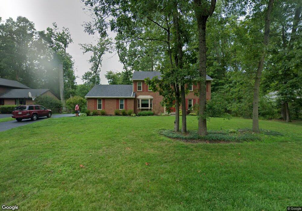
1071 Bridlepath Ln Loveland, OH 45140
Outer Loveland NeighborhoodEstimated Value: $440,078 - $487,000
4
Beds
3
Baths
2,238
Sq Ft
$208/Sq Ft
Est. Value
About This Home
This home is located at 1071 Bridlepath Ln, Loveland, OH 45140 and is currently estimated at $466,270, approximately $208 per square foot. 1071 Bridlepath Ln is a home located in Clermont County with nearby schools including Milford Senior High School, Milford Christian Academy, and St. Andrew - St. Elizabeth Ann Seton School.
Ownership History
Date
Name
Owned For
Owner Type
Purchase Details
Closed on
Oct 12, 2005
Sold by
Moranz Thomas L and Moranz Kimberly S
Bought by
Mackey John B and Mackey Carol
Current Estimated Value
Home Financials for this Owner
Home Financials are based on the most recent Mortgage that was taken out on this home.
Original Mortgage
$202,800
Outstanding Balance
$108,958
Interest Rate
5.82%
Mortgage Type
Fannie Mae Freddie Mac
Estimated Equity
$357,312
Purchase Details
Closed on
Jul 1, 1987
Purchase Details
Closed on
May 1, 1986
Create a Home Valuation Report for This Property
The Home Valuation Report is an in-depth analysis detailing your home's value as well as a comparison with similar homes in the area
Home Values in the Area
Average Home Value in this Area
Purchase History
| Date | Buyer | Sale Price | Title Company |
|---|---|---|---|
| Mackey John B | $253,500 | Prominent Title Agency Llc | |
| -- | $145,900 | -- | |
| -- | $132,900 | -- |
Source: Public Records
Mortgage History
| Date | Status | Borrower | Loan Amount |
|---|---|---|---|
| Open | Mackey John B | $202,800 |
Source: Public Records
Tax History Compared to Growth
Tax History
| Year | Tax Paid | Tax Assessment Tax Assessment Total Assessment is a certain percentage of the fair market value that is determined by local assessors to be the total taxable value of land and additions on the property. | Land | Improvement |
|---|---|---|---|---|
| 2024 | $5,398 | $116,450 | $21,910 | $94,540 |
| 2023 | $5,453 | $116,450 | $21,910 | $94,540 |
| 2022 | $4,966 | $80,500 | $15,750 | $64,750 |
| 2021 | $4,971 | $80,500 | $15,750 | $64,750 |
| 2020 | $4,769 | $80,500 | $15,750 | $64,750 |
| 2019 | $5,410 | $87,050 | $17,960 | $69,090 |
| 2018 | $5,412 | $87,050 | $17,960 | $69,090 |
| 2017 | $5,132 | $87,050 | $17,960 | $69,090 |
| 2016 | $5,214 | $76,370 | $15,750 | $60,620 |
| 2015 | $4,788 | $76,370 | $15,750 | $60,620 |
| 2014 | $4,788 | $76,370 | $15,750 | $60,620 |
| 2013 | $4,439 | $68,670 | $17,500 | $51,170 |
Source: Public Records
Map
Nearby Homes
- 1513 Charleston Ln
- 1113 Clover Field Dr
- 6141 Brandywine Ct
- 6211 Cook Rd
- 6149 Century Farm Dr
- 6379 Derbyshire Ln
- 5933 Firm Stance Dr
- 1140 Weber Rd
- 6365 Ironwood Dr
- 2013 Weber Rd
- 1331 Harbor Cove
- 1803 Wheatfield Way
- 6661 Paxton Guinea Rd
- 6211 Spires Dr
- 1706 Cottontail Dr
- 899 Murle Ln
- 709 Middleton Way
- 6320 Ashford Dr
- 802 Andrea Dr
- 945 Paul Vista Dr
- 1073 Bridlepath Ln
- 1069 Bridlepath Ln
- 1076 Tumbleweed Dr
- 1078 Tumbleweed Dr
- 1075 Bridlepath Ln
- 1074 Tumbleweed Dr
- 1072 Bridlepath Ln
- 1074 Bridlepath Ln
- 1070 Bridlepath Ln
- 1080 Tumbleweed Dr
- 1077 Bridlepath Ln
- 1068 Bridlepath Ln
- 1076 Bridlepath Ln
- 1062 Bridlepath Ln
- 1060 Bridlepath Ln
- 1064 Bridlepath Ln
- 1058 Bridlepath Ln
- 1090 Tumbleweed Dr
- 1088 Tumbleweed Dr
- 1075 Tumbleweed Dr