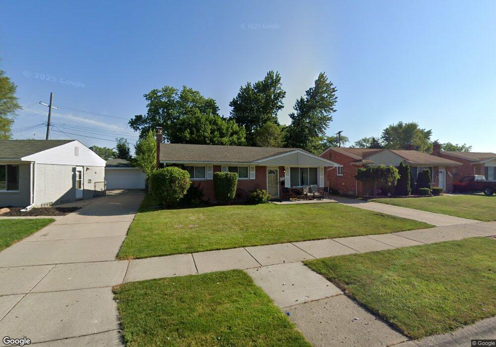
1071 Easley Dr Westland, MI 48186
Estimated Value: $192,456 - $217,000
3
Beds
2
Baths
958
Sq Ft
$214/Sq Ft
Est. Value
About This Home
This home is located at 1071 Easley Dr, Westland, MI 48186 and is currently estimated at $204,864, approximately $213 per square foot. 1071 Easley Dr is a home located in Wayne County with nearby schools including Alexander Hamilton Elementary School, Adams Middle School, and Benjamin Franklin Middle School.
Ownership History
Date
Name
Owned For
Owner Type
Purchase Details
Closed on
Feb 7, 2025
Sold by
Slessor Deborah and Zylka James A
Bought by
Zylka Trust and Zylka
Current Estimated Value
Purchase Details
Closed on
Sep 20, 2007
Sold by
Straker Larry J and Straker Linda
Bought by
Christiana Bank & Trust Co and Sequoia Funding Trust
Purchase Details
Closed on
Apr 12, 2006
Sold by
Straker Larry J and Straker Linda
Bought by
Straker Larry
Home Financials for this Owner
Home Financials are based on the most recent Mortgage that was taken out on this home.
Original Mortgage
$97,000
Interest Rate
6.48%
Mortgage Type
New Conventional
Create a Home Valuation Report for This Property
The Home Valuation Report is an in-depth analysis detailing your home's value as well as a comparison with similar homes in the area
Home Values in the Area
Average Home Value in this Area
Purchase History
| Date | Buyer | Sale Price | Title Company |
|---|---|---|---|
| Zylka Trust | -- | None Listed On Document | |
| Zylka Trust | -- | None Listed On Document | |
| Christiana Bank & Trust Co | $84,900 | None Available | |
| Straker Larry | -- | None Available |
Source: Public Records
Mortgage History
| Date | Status | Borrower | Loan Amount |
|---|---|---|---|
| Previous Owner | Straker Larry | $97,000 |
Source: Public Records
Tax History Compared to Growth
Tax History
| Year | Tax Paid | Tax Assessment Tax Assessment Total Assessment is a certain percentage of the fair market value that is determined by local assessors to be the total taxable value of land and additions on the property. | Land | Improvement |
|---|---|---|---|---|
| 2025 | $2,317 | $81,700 | $0 | $0 |
| 2024 | $2,317 | $77,400 | $0 | $0 |
| 2023 | $2,211 | $67,800 | $0 | $0 |
| 2022 | $2,458 | $59,700 | $0 | $0 |
| 2021 | $2,404 | $56,900 | $0 | $0 |
| 2020 | $2,378 | $52,100 | $0 | $0 |
| 2019 | $2,306 | $51,800 | $0 | $0 |
| 2018 | $1,868 | $43,300 | $0 | $0 |
| 2017 | $646 | $40,300 | $0 | $0 |
| 2016 | $2,225 | $40,100 | $0 | $0 |
| 2015 | $3,157 | $35,970 | $0 | $0 |
| 2013 | $3,058 | $31,960 | $0 | $0 |
| 2012 | $2,078 | $30,780 | $0 | $0 |
Source: Public Records
Map
Nearby Homes
- 1163 Denice St
- 754 Alvin St
- 32732 Glen St
- 32508 Avondale St
- 0000 Barrington Ave
- 32411 Grandview Ave
- 711 S Hawthorne St
- 183 Daniel Ave Unit 6
- 34114 Avondale St
- 535 S Hubbard St
- 00000 Cherry Hill Rd
- 33532 Leona St
- 451 Darwin St
- 32111 Birchwood Ave
- 32154 Melton St
- 32155 Melton St
- 32025 Birchwood St
- 366 S Wildwood St
- 123 N Hawthorne St
- 2075 Alanson St
- 1059 Easley Dr
- 1081 Easley Dr
- 33205 Avondale St
- 33145 Avondale St
- 1045 Easley Dr
- 1103 Easley Dr
- 33217 Avondale St
- 33125 Avondale St
- 33131 Avondale St
- 1124 Denice St
- 1029 Easley Dr
- 1125 Denice St
- 1115 Easley Dr
- 1015 Easley Dr
- 1117 Alvin St
- 1142 Denice St
- 1132 Denice St
- 1133 Denice St
- 1127 Easley Dr
- 1135 Easley Dr