Estimated Value: $576,000 - $1,043,924
4
Beds
5
Baths
4,041
Sq Ft
$196/Sq Ft
Est. Value
About This Home
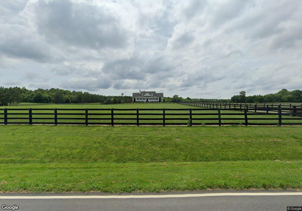
This home is located at 1071 Richards Rd NE, White, GA 30184 and is currently estimated at $793,481, approximately $196 per square foot. 1071 Richards Rd NE is a home with nearby schools including Pine Log Elementary School, Adairsville Middle School, and Adairsville High School.
Ownership History
Date
Name
Owned For
Owner Type
Purchase Details
Closed on
Jun 25, 2009
Sold by
Robinson William Rodney
Bought by
Underwood Kenneth
Current Estimated Value
Purchase Details
Closed on
Aug 29, 2007
Sold by
Branscomb Louisa P
Bought by
Robinson William Rodney
Home Financials for this Owner
Home Financials are based on the most recent Mortgage that was taken out on this home.
Original Mortgage
$156,000
Interest Rate
7.5%
Mortgage Type
New Conventional
Create a Home Valuation Report for This Property
The Home Valuation Report is an in-depth analysis detailing your home's value as well as a comparison with similar homes in the area
Home Values in the Area
Average Home Value in this Area
Purchase History
| Date | Buyer | Sale Price | Title Company |
|---|---|---|---|
| Underwood Kenneth | $190,000 | -- | |
| Robinson William Rodney | $200,000 | -- |
Source: Public Records
Mortgage History
| Date | Status | Borrower | Loan Amount |
|---|---|---|---|
| Previous Owner | Robinson William Rodney | $156,000 |
Source: Public Records
Tax History
| Year | Tax Paid | Tax Assessment Tax Assessment Total Assessment is a certain percentage of the fair market value that is determined by local assessors to be the total taxable value of land and additions on the property. | Land | Improvement |
|---|---|---|---|---|
| 2025 | $8,043 | $334,426 | $80,000 | $254,426 |
| 2024 | $8,043 | $335,170 | $80,000 | $255,170 |
| 2023 | $8,145 | $324,768 | $80,000 | $244,768 |
| 2022 | $8,151 | $321,014 | $80,000 | $241,014 |
| 2021 | $7,069 | $264,985 | $80,000 | $184,985 |
| 2020 | $6,444 | $234,585 | $49,600 | $184,985 |
| 2019 | $6,074 | $218,820 | $47,930 | $170,890 |
| 2018 | $6,102 | $219,008 | $39,942 | $179,066 |
| 2017 | $6,045 | $215,880 | $55,600 | $160,280 |
| 2016 | $6,090 | $215,880 | $55,600 | $160,280 |
| 2015 | $1,571 | $55,600 | $55,600 | $0 |
| 2014 | $2,287 | $78,360 | $78,360 | $0 |
| 2013 | -- | $78,360 | $78,360 | $0 |
Source: Public Records
Map
Nearby Homes
- 798 Mount Pleasant Rd
- 158 Palisade Dr
- 115 Palisade Dr
- 157 Palisade Dr
- 131 Palisade Dr
- 141 Palisade Dr
- 303 Eminence Peak
- 57 Nally Rd
- 0 Mansfield Rd NE Unit 10681022
- 119 Kirk Rd NW
- 0 Kirk Rd NW Unit 7629564
- 0 Kirk Rd NW Unit 24442149
- 0 Pine Ridge Rd NW Unit 10665426
- 00 Pine Ridge Rd NW
- 0 Timberwood Rd NW Unit 2 10582836
- 0 Timberwood Rd NW Unit 1 10517504
- 0 Timberwood Rd NW Unit 7574559
- 0 Timberwood Rd NW Unit 7575380
- 0 Timberwood Rd NW Unit 7575270
- 0 Timberwood Rd NW Unit 3 10517596
- 1035 Richards Rd NE
- 70 Bowen Rd NE
- 1056 Richards Rd NE
- 30 Bowen Rd NE Unit 9
- 50 Bowen Rd NE
- 30 Bowen Rd NE
- 1031 Richards Rd NE
- 20 Bowen Rd NE
- 80 Bowen Rd NE
- 100 Bowen Rd NE
- 1044 Richards Rd NE
- 31 Bowen Rd NE
- 150 Bowen Rd NE
- 1001 Richards Rd NE
- 1016 Richards Rd NE
- 0 Bowen Rd NE
- 0000 Bowen Rd NE
- 0 Bowen Rd NE Unit 7467934
- 0 Bowen Rd NE Unit 4236456
- 1021 Cass Pine Log Rd
Your Personal Tour Guide
Ask me questions while you tour the home.