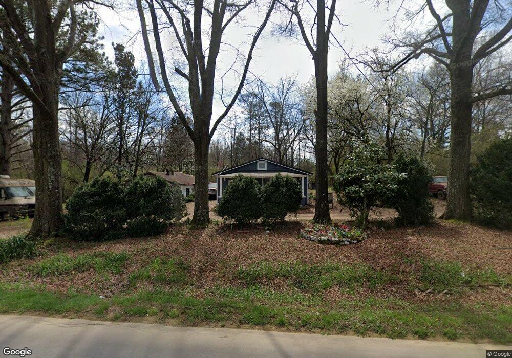
1071 Shiloh Rd Cedartown, GA 30125
Estimated Value: $87,215 - $1,289,000
2
Beds
1
Bath
1,066
Sq Ft
$498/Sq Ft
Est. Value
About This Home
This home is located at 1071 Shiloh Rd, Cedartown, GA 30125 and is currently estimated at $530,405, approximately $497 per square foot. 1071 Shiloh Rd is a home.
Ownership History
Date
Name
Owned For
Owner Type
Purchase Details
Closed on
Feb 25, 2020
Sold by
Davis Lacy A
Bought by
Davis Andrew
Current Estimated Value
Purchase Details
Closed on
Jan 22, 2018
Sold by
Forrister Glenda Nell
Bought by
Davis Andrew W and Davis Lacy A
Purchase Details
Closed on
Jul 12, 2016
Sold by
Edward Dewey
Bought by
Forrister Glenda Nell
Purchase Details
Closed on
Apr 27, 2010
Sold by
Prior Emily Lee
Bought by
Forrister James C and Forrister* Dewey E
Purchase Details
Closed on
Apr 17, 1953
Sold by
Prior Joe A Jr Mrs
Bought by
Prior Emily Lee
Create a Home Valuation Report for This Property
The Home Valuation Report is an in-depth analysis detailing your home's value as well as a comparison with similar homes in the area
Home Values in the Area
Average Home Value in this Area
Purchase History
| Date | Buyer | Sale Price | Title Company |
|---|---|---|---|
| Davis Andrew | -- | -- | |
| Davis Andrew W | -- | -- | |
| Forrister Glenda Nell | -- | -- | |
| Forrister Dewey E | -- | -- | |
| Forrister James C | -- | -- | |
| Prior Emily Lee | -- | -- |
Source: Public Records
Tax History Compared to Growth
Tax History
| Year | Tax Paid | Tax Assessment Tax Assessment Total Assessment is a certain percentage of the fair market value that is determined by local assessors to be the total taxable value of land and additions on the property. | Land | Improvement |
|---|---|---|---|---|
| 2024 | $283 | $13,526 | $1,940 | $11,586 |
| 2023 | $225 | $9,470 | $1,940 | $7,530 |
| 2022 | $185 | $7,816 | $1,294 | $6,522 |
| 2021 | $188 | $7,816 | $1,294 | $6,522 |
| 2020 | $193 | $8,024 | $1,294 | $6,730 |
| 2019 | $229 | $8,523 | $1,294 | $7,229 |
| 2018 | $200 | $7,274 | $1,294 | $5,980 |
| 2017 | $198 | $7,274 | $1,294 | $5,980 |
| 2016 | $42 | $7,780 | $1,800 | $5,980 |
| 2015 | $43 | $7,882 | $1,800 | $6,082 |
| 2014 | $43 | $7,882 | $1,800 | $6,082 |
Source: Public Records
Map
Nearby Homes
- 0 Treat Mountain Rd Unit 7643015
- 0 Treat Mountain Rd Unit 7634123
- 0 Treat Mountain Rd Unit 10586157
- 440 Treat Mountain Rd
- 745 Brewster Field Rd
- TR 2 Culp Lake Rd
- TR 3 Culp Lake Rd
- 812 Brewster Field Rd
- 8702 Us Highway 278
- 0 Prior Station Rd Unit 7655613
- 0 Prior Station Rd Unit TRACT 1 10612520
- 0 Prior Station Rd Unit 23482404
- 0 Prior Station Rd Unit 10506511
- 0 Prior Station Rd Unit 7565415
- 0 Prior Station Rd Unit TRACT 4 10493804
- 0 Prior Station Rd Unit 7553984
- 0 Prior Station Rd Unit LotWP001 21901671
- 13670 County Road 8
- 4244 Prior Station Rd
- 0 Culp Lake Rd (Tract 3)
- 1045 Shiloh Rd
- 467 Lumpkin Rd
- 1097 Shiloh Rd
- 997 Shiloh Rd
- 449 Lumpkin Rd
- 1033 Shiloh Rd
- 424 Lumpkin Rd
- 983 Shiloh Rd
- 971 Shiloh Rd
- 969 Shiloh Rd
- 0 Lumpkin Rd Unit 7348831
- 0 Lumpkin Rd Unit 3241810
- 0 Lumpkin Rd Unit 8707148
- 0 Lumpkin Rd Unit 8618515
- 0 Lumpkin Rd Unit 8363436
- 0 Lumpkin Rd Unit 8306946
- 0 Lumpkin Rd Unit 8142851
- 0 Lumpkin Rd Unit 7640147
- 0 Lumpkin Rd Unit 2880378
- 0 Lumpkin Rd Unit 7081277