

1071 Vail Rd Parsippany, NJ 07054
Highlights
- Spa
- Wood Flooring
- 2 Car Attached Garage
- Rockaway Meadow School Rated A-
- Corner Lot
- Central Air
About This Home
This home is located at 1071 Vail Rd, Parsippany, NJ 07054 and is currently priced at $4,250. This property was built in 1970. 1071 Vail Rd is a home located in Morris County with nearby schools including Rockaway Meadow School, Central Middle School, and Parsippany High School.
Listing Agent
MANSOORA SULTANI
WEICHERT REALTORS Brokerage Phone: 718-724-4904 Listed on: 10/01/2025
Home Details
Home Type
- Single Family
Est. Annual Taxes
- $11,068
Year Built
- Built in 1970 | Remodeled
Lot Details
- 0.35 Acre Lot
- Fenced
- Corner Lot
Parking
- 2 Car Attached Garage
- Private Driveway
Home Design
- Tile
Interior Spaces
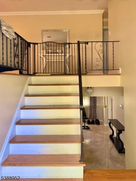
- 2-Story Property
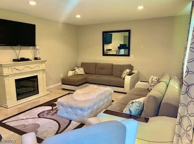
- Wood Flooring
- Laundry in unit
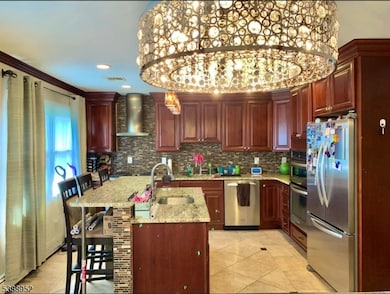
Kitchen
- Built-In Gas Oven
- Dishwasher
Bedrooms and Bathrooms
- 4 Bedrooms
- Primary bedroom located on second floor
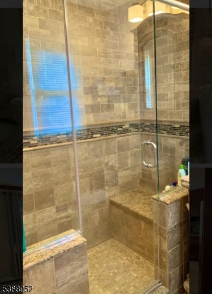
- 3 Full Bathrooms
Home Security
- Storm Doors
- Carbon Monoxide Detectors
Outdoor Features
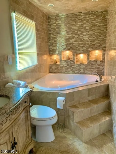
- Spa
- Storage Shed
Schools
- Rckmeadow Elementary School
- Central Middle School
- Parsippany High School
Utilities
- Central Air
- Heating System Powered By Leased Propane
Listing and Financial Details
- Tenant pays for electric, gas, heat, hot water, maintenance-common area, maintenance-lawn, snow removal, water
- Assessor Parcel Number 2329-00698-0000-00058-0000-
Map
Source: Garden State MLS
MLS Number: 3990540
APN: 29-00698-0000-00058
Disclaimer: Certain information contained herein is derived from information provided by parties other than Homes.com. All information provided is deemed reliable, but is not guaranteed to be accurate and should be independently verified.
![]() The data relating to real estate for sale on this website comes in part from the IDX Program of Garden State Multiple Listing Service, L.L.C. Real estate listings held by other brokerage firms are marked as IDX Listing.
The data relating to real estate for sale on this website comes in part from the IDX Program of Garden State Multiple Listing Service, L.L.C. Real estate listings held by other brokerage firms are marked as IDX Listing.
Information deemed reliable but not guaranteed.
Copyright © 2025 Garden State Multiple Listing Service, L.L.C. All rights reserved.
Notice: The dissemination of listings on this website does not constitute the consent required by N.J.A.C. 11:5.6.1 (n) for the advertisement of listings exclusively for sale by another broker. Any such consent must be obtained in writing from the listing broker.
This information is being provided for Consumers’ personal, non-commercial use and may not be used for any purpose other than to identify prospective properties Consumers may be interested in purchasing.
- 188 Edwards Rd
- 2 Colony Ct
- 15 Carlson Place
- 53 Gordon Cir Unit 53
- 12 Cherokee Ave
- 193 Crown Point Rd Unit 193
- 123 Cardigan Ct Unit 123
- 122 Lake Shore Dr
- 21 Nokomis Ave
- 96 Ball Ave
- 42 Minnehaha Blvd
- 60 White Oak Rd
- 5 Twin Oaks Ct
- 61 Minnehaha Blvd
- 54 Wenonah Ave
- 41 Mohawk Ave
- 30 Madison Ave
- 159 Ball Ave
- 204 Lake Shore Dr
- 6 Hancock Ct
- 29 Manito Ave
- 28 Gordon Cir Unit 28
- 15 Sweetwood Ct
- 46 Gordon Cir Unit 46
- 179 Crown Point Rd Unit 179
- 162 Fairview Ave Unit 1
- 12 Independence Ct
- 39 Chesapeake Ave
- 101 N Beverwyck Rd
- 114 11 N Beverwyck Rd Unit 11
- 350 Baldwin Rd
- 3 Barbara St
- 270 Baldwin Rd
- 200 Baldwin Rd
- 191 N Beverwyck Rd Unit 1
- 1480 Us Highway 46
- 107 Konner Ave
- 63 Dafrack Dr
- 199 N Beverwyck Rd Unit 17
- 212 N Beverwyck Rd