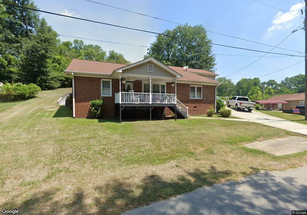
1071 Veal St SW Conyers, GA 30012
Estimated Value: $246,546 - $315,000
3
Beds
2
Baths
2,970
Sq Ft
$93/Sq Ft
Est. Value
About This Home
This home is located at 1071 Veal St SW, Conyers, GA 30012 and is currently estimated at $275,637, approximately $92 per square foot. 1071 Veal St SW is a home located in Rockdale County with nearby schools including Hicks Elementary School, Edwards Middle School, and Salem High School.
Ownership History
Date
Name
Owned For
Owner Type
Purchase Details
Closed on
Aug 20, 2001
Sold by
Scott Yoriko C
Bought by
Williams Darren L
Current Estimated Value
Create a Home Valuation Report for This Property
The Home Valuation Report is an in-depth analysis detailing your home's value as well as a comparison with similar homes in the area
Home Values in the Area
Average Home Value in this Area
Purchase History
| Date | Buyer | Sale Price | Title Company |
|---|---|---|---|
| Williams Darren L | -- | -- |
Source: Public Records
Tax History Compared to Growth
Tax History
| Year | Tax Paid | Tax Assessment Tax Assessment Total Assessment is a certain percentage of the fair market value that is determined by local assessors to be the total taxable value of land and additions on the property. | Land | Improvement |
|---|---|---|---|---|
| 2024 | $3,231 | $89,400 | $9,200 | $80,200 |
| 2023 | $2,657 | $76,000 | $9,200 | $66,800 |
| 2022 | $1,752 | $50,280 | $6,400 | $43,880 |
| 2021 | $1,711 | $47,440 | $3,560 | $43,880 |
| 2020 | $1,768 | $46,680 | $2,800 | $43,880 |
| 2019 | $1,801 | $46,680 | $2,800 | $43,880 |
| 2018 | $979 | $46,640 | $2,800 | $43,840 |
| 2017 | $1,449 | $41,560 | $2,800 | $38,760 |
| 2016 | $1,394 | $41,560 | $2,800 | $38,760 |
| 2015 | $549 | $33,920 | $2,800 | $31,120 |
| 2014 | $444 | $31,960 | $2,800 | $29,160 |
| 2013 | -- | $34,520 | $3,600 | $30,920 |
Source: Public Records
Map
Nearby Homes
- 954 Bryant St SW
- 988 Huff St SW
- 1110 Oakland Ave SE
- 871 Malcom St SE
- 990 Oakland Ave SE
- 2022 Appaloosa Way
- 948 Peek St NW
- 214 Seward St Unit 94
- 2048 Appaloosa Way
- 998 Highland Cir SE
- 1360 Flora Dr
- 1356 Flora Dr
- 997 Highland Cir SE
- 1070 Barton St NW
- 1735 Prospect Way
- 902 Andrews Dr NW
- 1700 Prospect Way
- 1081 Veal St SW
- 1041 Bryant St SW
- 1089 Veal St SW
- 1088 Taylor St SW
- 1080 Loyd St SW
- 1095 Veal St SW
- 1115 Veal St SW
- 1100 Taylor St SW
- 1022 Bryant St SW
- 1078 Loyd St SW
- 1121 Veal St SW
- 0 Veal St
- 1100 Veal St SW
- 1106 Veal St SW
- 1077 Loyd St SW
- 1001 Bryant St SW
- 1001 Bryant St SW
- 1074 Loyd St SW
- 1112 Veal St SW
- 1008 Bryant St SW