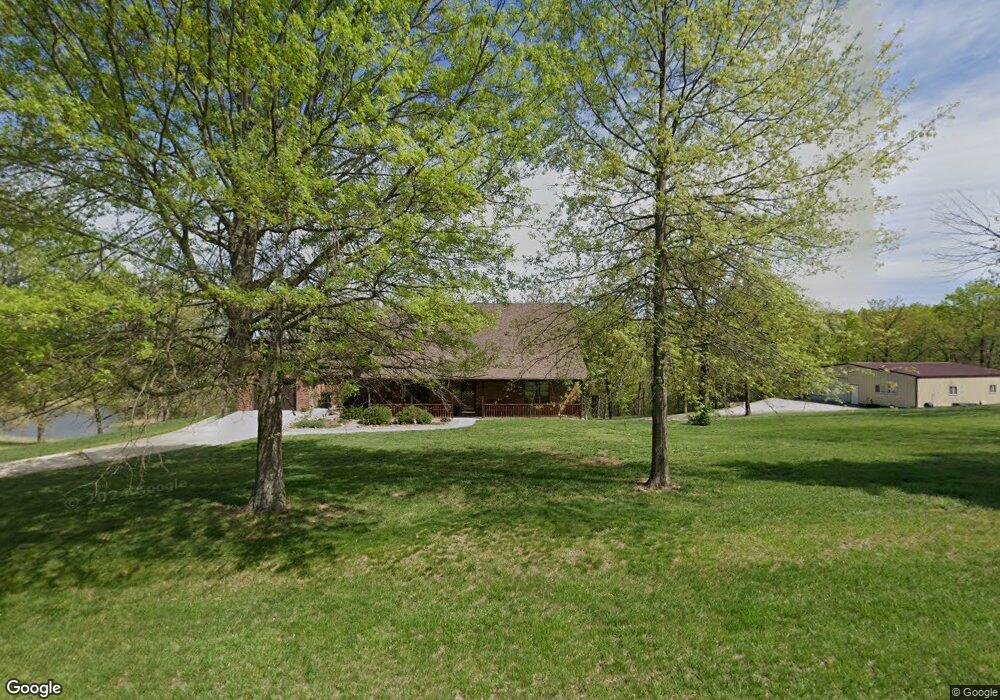
10711 Route W Jefferson City, MO 65101
Estimated Value: $275,000 - $542,106
4
Beds
3
Baths
1,619
Sq Ft
$273/Sq Ft
Est. Value
About This Home
This home is located at 10711 Route W, Jefferson City, MO 65101 and is currently estimated at $441,527, approximately $272 per square foot. 10711 Route W is a home located in Cole County with nearby schools including Blair Oaks Elementary School, Blair Oaks Middle School, and Blair Oaks High School.
Ownership History
Date
Name
Owned For
Owner Type
Purchase Details
Closed on
Dec 6, 2024
Sold by
Wilbers Steven M and Wilbers Brenda R
Bought by
Wilbers Family Trust and Wilbers
Current Estimated Value
Purchase Details
Closed on
Dec 31, 2020
Sold by
Norman Norman J and Norman T
Bought by
Wilbers Ft
Purchase Details
Closed on
Jun 26, 2020
Sold by
Wilbers Steven M
Bought by
Norman Norman J and Norman T
Create a Home Valuation Report for This Property
The Home Valuation Report is an in-depth analysis detailing your home's value as well as a comparison with similar homes in the area
Home Values in the Area
Average Home Value in this Area
Purchase History
| Date | Buyer | Sale Price | Title Company |
|---|---|---|---|
| Wilbers Family Trust | -- | None Listed On Document | |
| Wilbers Ft | -- | None Available | |
| Wilbers Ft | -- | None Available | |
| Norman Norman J | -- | None Available |
Source: Public Records
Tax History Compared to Growth
Tax History
| Year | Tax Paid | Tax Assessment Tax Assessment Total Assessment is a certain percentage of the fair market value that is determined by local assessors to be the total taxable value of land and additions on the property. | Land | Improvement |
|---|---|---|---|---|
| 2025 | $2,448 | $49,350 | $3,730 | $45,620 |
| 2024 | $2,448 | $44,450 | $0 | $44,450 |
| 2023 | $2,315 | $44,450 | $0 | $44,450 |
| 2022 | $2,323 | $44,450 | $0 | $44,450 |
| 2021 | $2,321 | $44,450 | $0 | $44,450 |
| 2020 | $2,322 | $44,450 | $3,730 | $40,720 |
| 2019 | $2,326 | $44,450 | $3,730 | $40,720 |
| 2018 | $1,885 | $38,278 | $3,742 | $34,536 |
| 2017 | $1,774 | $38,278 | $3,742 | $34,536 |
| 2016 | -- | $38,278 | $3,742 | $34,536 |
| 2015 | $1,630 | $0 | $0 | $0 |
| 2014 | $1,630 | $40,280 | $3,800 | $36,480 |
Source: Public Records
Map
Nearby Homes
- 9504 State Highway B
- 7221 Castle Rock Rd
- 7307 State Route W
- 3510 Christian Ridge
- 3708 Christian Ridge
- 3814 Pear Tree Ct
- 5610 Roling Rd
- 5608 Birch Creek Ln
- 5607 Birch Creek Ln
- 816 Friendship Rd
- 5919 Falcon Crest Ln
- 5009 Silo Hill Ln
- 5710 Tanner Bridge Rd
- 5413 Aberdeen Waye
- 5413 Aberdeen
- 121 Highland Waye
- 517 Whispering Cedars Ln
- 601 Whispering Cedars Ln
- 605 Whispering Cedars Ln
- 510 Whispering Cedars Ln
- 10706 Route W
- 10814 Route W
- 10703 Route W
- 10913 Route W
- 10917 Route W
- 2807 Tanoah Valley Ln
- 2720 Tanoah Valley Ln
- 10313 Route W
- 2515 Siebeneck Ln
- 2910 Tanoah Valley Ln
- 10304 Route W
- 11121 Route W
- 11125 Route W
- 10207 Route W
- 3100 Tanoah Valley Ln
- 11120 Route W
- 10112 Route W
- 2700 Wilbers Ln
- 11208 Route W
- 2101 Siebeneck Ln