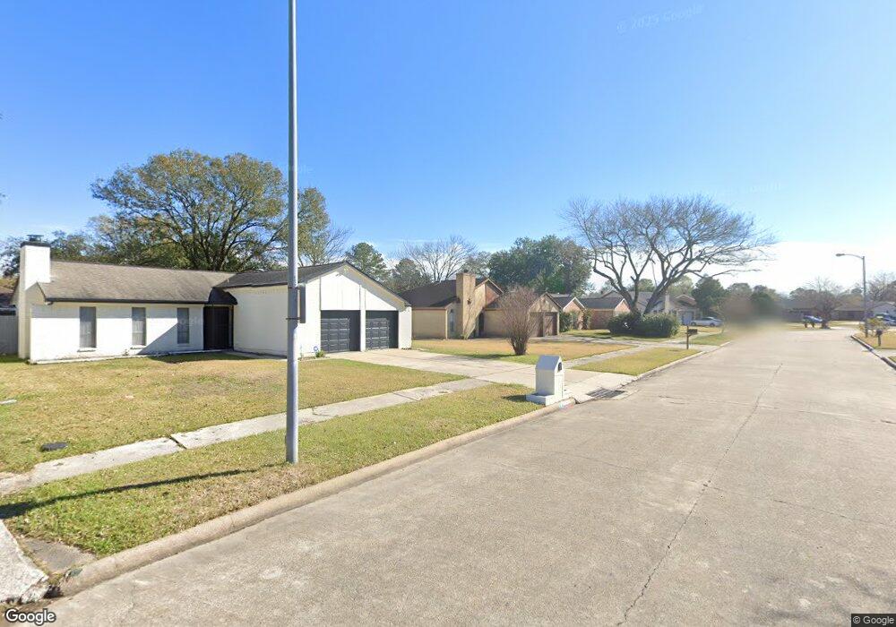
10714 Misty Summit Dr Houston, TX 77086
North Houston NeighborhoodEstimated Value: $198,644 - $224,000
3
Beds
2
Baths
1,284
Sq Ft
$166/Sq Ft
Est. Value
About This Home
This home is located at 10714 Misty Summit Dr, Houston, TX 77086 and is currently estimated at $212,911, approximately $165 per square foot. 10714 Misty Summit Dr is a home located in Harris County with nearby schools including Kujawa EC/Pre-K/K School, Carmichael Elementary School, and Shotwell Middle School.
Ownership History
Date
Name
Owned For
Owner Type
Purchase Details
Closed on
Feb 1, 2008
Sold by
Patel Bachubhai and Patel Taraben
Bought by
Payne Charles
Current Estimated Value
Home Financials for this Owner
Home Financials are based on the most recent Mortgage that was taken out on this home.
Original Mortgage
$84,800
Outstanding Balance
$52,417
Interest Rate
5.68%
Mortgage Type
Purchase Money Mortgage
Estimated Equity
$160,494
Create a Home Valuation Report for This Property
The Home Valuation Report is an in-depth analysis detailing your home's value as well as a comparison with similar homes in the area
Home Values in the Area
Average Home Value in this Area
Purchase History
| Date | Buyer | Sale Price | Title Company |
|---|---|---|---|
| Payne Charles | -- | Startex Title |
Source: Public Records
Mortgage History
| Date | Status | Borrower | Loan Amount |
|---|---|---|---|
| Open | Payne Charles | $84,800 |
Source: Public Records
Tax History Compared to Growth
Tax History
| Year | Tax Paid | Tax Assessment Tax Assessment Total Assessment is a certain percentage of the fair market value that is determined by local assessors to be the total taxable value of land and additions on the property. | Land | Improvement |
|---|---|---|---|---|
| 2025 | $735 | $187,665 | $39,394 | $148,271 |
| 2024 | $735 | $190,360 | $39,394 | $150,966 |
| 2023 | $735 | $193,808 | $39,394 | $154,414 |
| 2022 | $3,294 | $163,404 | $33,385 | $130,019 |
| 2021 | $2,987 | $137,078 | $33,385 | $103,693 |
| 2020 | $3,019 | $130,162 | $33,385 | $96,777 |
| 2019 | $2,854 | $121,973 | $17,020 | $104,953 |
| 2018 | $495 | $115,736 | $17,020 | $98,716 |
| 2017 | $2,274 | $108,328 | $15,283 | $93,045 |
| 2016 | $2,067 | $98,373 | $15,283 | $83,090 |
| 2015 | $647 | $91,617 | $15,283 | $76,334 |
| 2014 | $647 | $69,692 | $15,283 | $54,409 |
Source: Public Records
Map
Nearby Homes
- 6654 Brownie Campbell Rd
- 6722 Winding Trace Dr
- 6630 Brownie Campbell Rd
- 11006 Crinkleawn Dr
- 11007 Tobasa Ct
- 6610 Northleaf Dr
- 11009 Panicum Ct
- 11021 Crenchrus Ct
- 7002 Sandswept Ln
- 6615 Winding Trace Dr
- 7023 Sandswept Ln
- 10522 Northview Dr
- 7218 Winding Trace Dr
- 6911 Silver Star Dr
- 6502 Trail Valley Way
- 7222 Northleaf Dr
- 7227 Greenyard Dr
- 10614 Mackenzie Dr
- 10306 Jillana Kaye Dr
- 6822 Dusty Dawn Dr
- 10802 Misty Summit Dr
- 10710 Misty Summit Dr
- 10803 Coralstone Rd
- 10719 Coralstone Rd
- 10806 Misty Summit Dr
- 10807 Coralstone Rd
- 10706 Misty Summit Dr
- 10715 Coralstone Rd
- 10711 Misty Summit Dr
- 10811 Coralstone Rd
- 10711 Coralstone Rd
- 10810 Misty Summit Dr
- 6903 Northleaf Dr
- 10707 Misty Summit Dr
- 10702 Misty Summit Dr
- 10707 Coralstone Rd
- 6907 Northleaf Dr
- 6910 Canyon Way Dr
- 10815 Coralstone Rd
- 10902 Misty Summit Dr