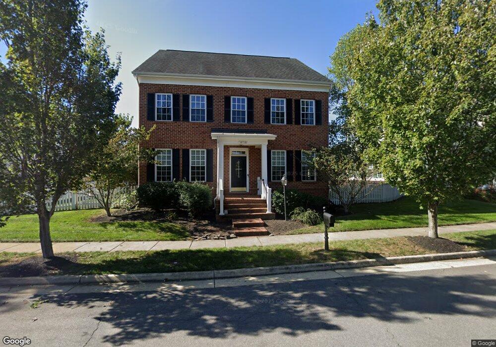
10716 General Kirkland Dr Bristow, VA 20136
Estimated Value: $767,008 - $825,000
4
Beds
3
Baths
--
Sq Ft
8,276
Sq Ft Lot
About This Home
This home is located at 10716 General Kirkland Dr, Bristow, VA 20136 and is currently estimated at $800,502. 10716 General Kirkland Dr is a home located in Prince William County with nearby schools including T. Clay Wood Elementary School, E.H. Marsteller Middle School, and Brentsville District High School.
Ownership History
Date
Name
Owned For
Owner Type
Purchase Details
Closed on
Oct 12, 2009
Sold by
Centex Homes
Bought by
Marple Brian Matthew and Marple Radka
Current Estimated Value
Home Financials for this Owner
Home Financials are based on the most recent Mortgage that was taken out on this home.
Original Mortgage
$400,157
Outstanding Balance
$260,227
Interest Rate
5%
Mortgage Type
VA
Estimated Equity
$540,275
Create a Home Valuation Report for This Property
The Home Valuation Report is an in-depth analysis detailing your home's value as well as a comparison with similar homes in the area
Home Values in the Area
Average Home Value in this Area
Purchase History
| Date | Buyer | Sale Price | Title Company |
|---|---|---|---|
| Marple Brian Matthew | $391,735 | Commerce Title Insurance Co |
Source: Public Records
Mortgage History
| Date | Status | Borrower | Loan Amount |
|---|---|---|---|
| Open | Marple Brian Matthew | $400,157 |
Source: Public Records
Tax History Compared to Growth
Tax History
| Year | Tax Paid | Tax Assessment Tax Assessment Total Assessment is a certain percentage of the fair market value that is determined by local assessors to be the total taxable value of land and additions on the property. | Land | Improvement |
|---|---|---|---|---|
| 2025 | -- | $731,600 | $208,400 | $523,200 |
| 2024 | -- | $670,600 | $198,400 | $472,200 |
| 2023 | $6,560 | $630,500 | $164,200 | $466,300 |
| 2022 | $6,636 | $588,900 | $164,200 | $424,700 |
| 2021 | $6,306 | $517,500 | $142,100 | $375,400 |
| 2020 | $7,505 | $484,200 | $142,100 | $342,100 |
| 2019 | $7,118 | $459,200 | $142,100 | $317,100 |
| 2018 | $5,634 | $466,600 | $142,100 | $324,500 |
| 2017 | $5,729 | $465,700 | $142,100 | $323,600 |
| 2016 | $5,562 | $456,300 | $135,700 | $320,600 |
| 2015 | $5,197 | $448,100 | $128,400 | $319,700 |
| 2014 | $5,197 | $416,700 | $118,800 | $297,900 |
Source: Public Records
Map
Nearby Homes
- 11823 Whitworth Cannon Ln
- 11650 Iron Brigade Unit Ave
- 10554 Andrew Humphreys Ct
- 11688 Camp Jones Ct
- 10505 Blazing Star Loop
- 12021 Spring Beauty Rd
- 12054 Nokesville Rd
- 12002 Fitzgerald Way
- 12203 Aster Rd
- 12171 Open Meadow Ln
- The Sienna Plan at Woodlawn Estates
- The Jocelyn Plan at Woodlawn Estates
- The Lawrence Plan at Woodlawn Estates
- The Emma Plan at Woodlawn Estates
- 9923 Bagpipe Ct
- 12360 Corncrib Ct
- 11862 Arcari Dr
- 10024 Darnaway Ct
- 12410 Iona Sound Dr
- 14058 Hawkeye Run Ct
- 10720 General Kirkland Dr
- 10708 General Kirkland Dr
- 10724 General Kirkland Dr
- 10704 General Kirkland Dr
- 10698 General Kirkland Dr
- 11728 Alexander Hays Rd
- 10700 General Kirkland Dr
- 11732 Alexander Hays Rd
- 10732 General Kirkland Dr
- 11736 Alexander Hays Rd
- 11724 Alexander Hays Rd
- 11740 Alexander Hays Rd
- 10696 General Kirkland Dr
- 11772 Robert e Lee Dr
- 11744 Alexander Hays Rd
- 10740 General Kirkland Dr
- 11770 Robert e Lee Dr
- 11768 Robert e Lee Dr
- 11766 Robert e Lee Dr
- 11727 Alexander Hays Rd