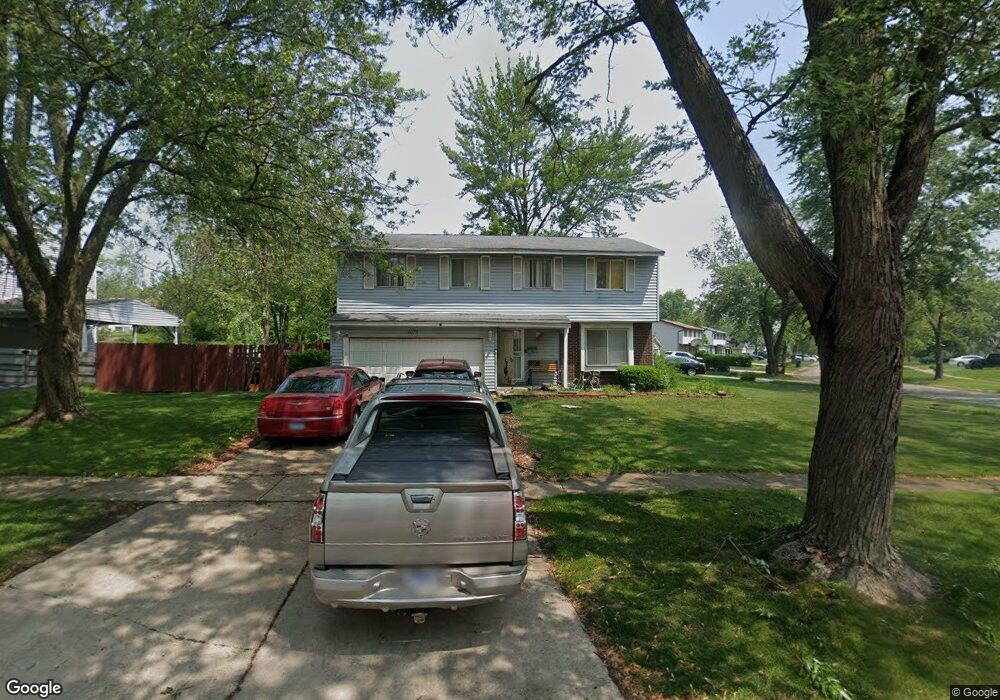
1072 Amherst Ln University Park, IL 60484
Estimated Value: $167,468 - $296,000
--
Bed
1
Bath
2,384
Sq Ft
$101/Sq Ft
Est. Value
About This Home
This home is located at 1072 Amherst Ln, University Park, IL 60484 and is currently estimated at $241,117, approximately $101 per square foot. 1072 Amherst Ln is a home located in Will County with nearby schools including Balmoral Elementary School, Crete-Monee Middle School, and Crete-Monee High School.
Ownership History
Date
Name
Owned For
Owner Type
Purchase Details
Closed on
Jun 11, 2021
Sold by
Bell Jesse and Bell Shirley
Bought by
Bell Jesse and Bell Shirley
Current Estimated Value
Home Financials for this Owner
Home Financials are based on the most recent Mortgage that was taken out on this home.
Original Mortgage
$88,237
Interest Rate
3.75%
Mortgage Type
FHA
Purchase Details
Closed on
Mar 5, 1999
Sold by
Hud
Bought by
Bell Jesse
Home Financials for this Owner
Home Financials are based on the most recent Mortgage that was taken out on this home.
Original Mortgage
$59,400
Interest Rate
7.17%
Purchase Details
Closed on
Nov 19, 1997
Sold by
Pullums
Bought by
Hud
Purchase Details
Closed on
Feb 4, 1994
Sold by
Nelson Timothy A and Nelson Suzanne P
Bought by
Pullums Kedgrick E
Home Financials for this Owner
Home Financials are based on the most recent Mortgage that was taken out on this home.
Original Mortgage
$80,340
Interest Rate
7.22%
Mortgage Type
FHA
Create a Home Valuation Report for This Property
The Home Valuation Report is an in-depth analysis detailing your home's value as well as a comparison with similar homes in the area
Home Values in the Area
Average Home Value in this Area
Purchase History
| Date | Buyer | Sale Price | Title Company |
|---|---|---|---|
| Bell Jesse | -- | New Title Company Name | |
| Bell Jesse | -- | Stewart Title | |
| Hud | -- | -- | |
| Pullums Kedgrick E | $81,000 | -- |
Source: Public Records
Mortgage History
| Date | Status | Borrower | Loan Amount |
|---|---|---|---|
| Previous Owner | Bell Jesse | $88,237 | |
| Previous Owner | Bell Jesse | $59,400 | |
| Previous Owner | Pullums Kedgrick E | $80,340 |
Source: Public Records
Tax History Compared to Growth
Tax History
| Year | Tax Paid | Tax Assessment Tax Assessment Total Assessment is a certain percentage of the fair market value that is determined by local assessors to be the total taxable value of land and additions on the property. | Land | Improvement |
|---|---|---|---|---|
| 2024 | $6,663 | $69,089 | $8,402 | $60,687 |
| 2023 | $6,663 | $59,559 | $7,243 | $52,316 |
| 2022 | $5,833 | $52,391 | $6,371 | $46,020 |
| 2021 | $3,427 | $47,700 | $5,852 | $41,848 |
| 2020 | $5,313 | $46,154 | $5,662 | $40,492 |
| 2019 | $5,314 | $43,768 | $5,369 | $38,399 |
| 2018 | $3,845 | $42,040 | $5,255 | $36,785 |
| 2017 | $4,926 | $40,119 | $5,138 | $34,981 |
| 2016 | $3,938 | $37,991 | $4,941 | $33,050 |
| 2015 | $3,880 | $34,716 | $4,503 | $30,213 |
| 2014 | $3,880 | $34,237 | $4,441 | $29,796 |
| 2013 | $3,880 | $35,850 | $4,650 | $31,200 |
Source: Public Records
Map
Nearby Homes
- 1039 Abbot Ln
- 1032 Samson Dr
- 1109 Abbot Ln
- 1029 Samson Dr
- 1039 Barrow Ct
- 613 Farmview Rd
- 1244 Harvest Ln
- 537 Nathan Rd
- 1031 Blackhawk Dr
- 740 Mission St
- 543 Regent Rd
- 607 Sullivan Ln
- 903 Blackhawk Dr
- 608 Sullivan Ln
- 815 Blackhawk Dr
- 655 Sullivan Ln
- 807 Blackhawk Dr
- 662 Sullivan Ln
- 735 Union Dr
- 610 Sandra Dr
- 1048 Ashridge Ln
- 1074 Amherst Ln
- 1066 Amherst Ln
- 1075 Amherst Ln
- 1073 Amherst Ln
- 1077 Amherst Ln
- 1071 Amherst Ln
- 1047 Ashridge Ln
- 1044 Ashridge Ln
- 1057 Abbott Ln
- 1079 Amherst Ln
- 1080 Amherst Ln
- 1055 Abbott Ln
- 1069 Amherst Ln
- 1055 Abbot Ln
- 1045 Ashridge Ln
- 1082 Amherst Ln
- 1064 Amherst Ln
- 1042 Ashridge Ln