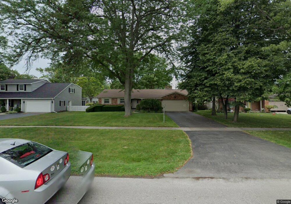
1072 Mulberry St Perrysburg, OH 43551
Estimated Value: $258,000 - $305,000
3
Beds
2
Baths
1,496
Sq Ft
$188/Sq Ft
Est. Value
About This Home
This home is located at 1072 Mulberry St, Perrysburg, OH 43551 and is currently estimated at $281,129, approximately $187 per square foot. 1072 Mulberry St is a home located in Wood County with nearby schools including Frank Elementary School, Perrysburg Junior High School, and Perrysburg High School.
Ownership History
Date
Name
Owned For
Owner Type
Purchase Details
Closed on
Jul 30, 2015
Sold by
Szymanski Nicholas A and Szymanski Amy L
Bought by
Szymanski Nicholas A and Nicholas A Szymanski Revocable Trust
Current Estimated Value
Purchase Details
Closed on
Aug 30, 2000
Sold by
Green Steven A
Bought by
Szymanski Nicholas A and Szymanski Amy L
Home Financials for this Owner
Home Financials are based on the most recent Mortgage that was taken out on this home.
Original Mortgage
$127,500
Outstanding Balance
$46,996
Interest Rate
8.26%
Estimated Equity
$234,133
Purchase Details
Closed on
Apr 18, 1994
Sold by
Meinders Edward B
Bought by
Green Steven A and Green Elise M
Purchase Details
Closed on
Jan 1, 1990
Bought by
Meinders Edward B
Create a Home Valuation Report for This Property
The Home Valuation Report is an in-depth analysis detailing your home's value as well as a comparison with similar homes in the area
Home Values in the Area
Average Home Value in this Area
Purchase History
| Date | Buyer | Sale Price | Title Company |
|---|---|---|---|
| Szymanski Nicholas A | -- | Attorney | |
| Szymanski Nicholas A | $150,000 | -- | |
| Green Steven A | $97,500 | -- | |
| Meinders Edward B | -- | -- |
Source: Public Records
Mortgage History
| Date | Status | Borrower | Loan Amount |
|---|---|---|---|
| Open | Szymanski Nicholas A | $127,500 |
Source: Public Records
Tax History Compared to Growth
Tax History
| Year | Tax Paid | Tax Assessment Tax Assessment Total Assessment is a certain percentage of the fair market value that is determined by local assessors to be the total taxable value of land and additions on the property. | Land | Improvement |
|---|---|---|---|---|
| 2024 | $4,293 | $73,990 | $12,705 | $61,285 |
| 2023 | $4,293 | $74,000 | $12,710 | $61,290 |
| 2021 | $3,730 | $59,150 | $10,990 | $48,160 |
| 2020 | $3,709 | $59,150 | $10,990 | $48,160 |
| 2019 | $3,262 | $50,470 | $10,990 | $39,480 |
| 2018 | $2,897 | $50,470 | $10,990 | $39,480 |
| 2017 | $2,803 | $50,470 | $10,990 | $39,480 |
| 2016 | $2,824 | $47,360 | $9,770 | $37,590 |
| 2015 | $2,824 | $47,360 | $9,770 | $37,590 |
| 2014 | $2,848 | $47,360 | $9,770 | $37,590 |
| 2013 | $2,913 | $47,360 | $9,770 | $37,590 |
Source: Public Records
Map
Nearby Homes
- 412 W South Boundary St
- 229 Twinbrook Dr
- 865 Mulberry St
- 1016 Walnut St
- 872 Cherry St
- 320 Southwood Dr
- 533 W 8th St
- 11966 Eckel Junction Rd
- 333 Southwood Dr
- 204 W 8th St
- 622 Turnbury Ln Unit 622
- 866 Louisiana Ave
- 1085 Birch Dr
- 135 Birchcrest Dr
- 375 Edgewood Dr
- 832 Turnbury Ln Unit 28
- 430 W 5th St
- 14 Hawthorne Crossing
- 122 W 6th St
- 1031 Maple St
- 1066 Mulberry St
- 1078 Mulberry St
- 1073 Eastbrook Dr
- 1060 Mulberry St
- 1067 Eastbrook Dr
- 1079 Eastbrook Dr
- 1084 Mulberry St
- 1061 Eastbrook Dr
- 1085 Eastbrook Dr
- 1090 Mulberry St
- 1050 Mulberry St
- 1055 Eastbrook Dr
- 1091 Eastbrook Dr
- 1046 Mulberry St
- 1072 Eastbrook Dr
- 0 Mulberry St
- 1066 Eastbrook Dr
- 1049 Eastbrook Dr
- 1084 Eastbrook Dr
- 1054 Eastbrook Dr