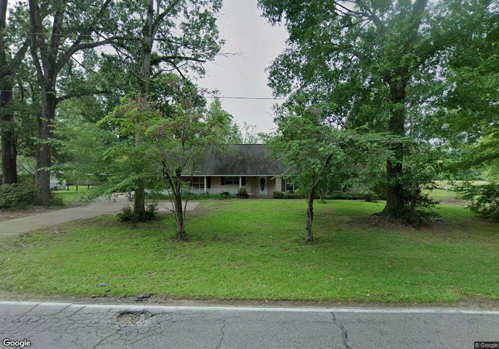
1072 Rollins Rd Zachary, LA 70791
Estimated Value: $220,473 - $334,000
--
Bed
--
Bath
1,914
Sq Ft
$143/Sq Ft
Est. Value
About This Home
This home is located at 1072 Rollins Rd, Zachary, LA 70791 and is currently estimated at $272,868, approximately $142 per square foot. 1072 Rollins Rd is a home located in East Baton Rouge Parish with nearby schools including Northwestern Elementary School, Rollins Place Elementary School, and Zachary Elementary School.
Ownership History
Date
Name
Owned For
Owner Type
Purchase Details
Closed on
Mar 31, 2025
Sold by
Revo Louis and Revo Jeanette
Bought by
White Loron and White Dorothy Honore
Current Estimated Value
Purchase Details
Closed on
Nov 15, 2023
Sold by
Barnes Barbara Jean Daniel and Barnes Rodney
Bought by
Ruckus Ranch Cattle Company Llc
Home Financials for this Owner
Home Financials are based on the most recent Mortgage that was taken out on this home.
Original Mortgage
$381,000
Interest Rate
7.49%
Mortgage Type
New Conventional
Create a Home Valuation Report for This Property
The Home Valuation Report is an in-depth analysis detailing your home's value as well as a comparison with similar homes in the area
Home Values in the Area
Average Home Value in this Area
Purchase History
| Date | Buyer | Sale Price | Title Company |
|---|---|---|---|
| White Loron | $520,000 | Cypress Title | |
| White Loron | $520,000 | Cypress Title | |
| Ruckus Ranch Cattle Company Llc | $175,000 | Bayou Title | |
| Ruckus Ranch Cattle Co Llc | $175,000 | Bayou Title |
Source: Public Records
Mortgage History
| Date | Status | Borrower | Loan Amount |
|---|---|---|---|
| Previous Owner | Ruckus Ranch Cattle Co Llc | $381,000 |
Source: Public Records
Tax History Compared to Growth
Tax History
| Year | Tax Paid | Tax Assessment Tax Assessment Total Assessment is a certain percentage of the fair market value that is determined by local assessors to be the total taxable value of land and additions on the property. | Land | Improvement |
|---|---|---|---|---|
| 2024 | $574 | $11,700 | $2,700 | $9,000 |
| 2023 | $574 | $11,700 | $2,700 | $9,000 |
| 2022 | $1,467 | $11,700 | $2,700 | $9,000 |
| 2021 | $1,467 | $11,700 | $2,700 | $9,000 |
| 2020 | $1,481 | $11,700 | $2,700 | $9,000 |
| 2019 | $1,629 | $11,700 | $2,700 | $9,000 |
| 2018 | $1,635 | $11,700 | $2,700 | $9,000 |
| 2017 | $1,635 | $11,700 | $2,700 | $9,000 |
| 2016 | $616 | $11,700 | $2,700 | $9,000 |
| 2015 | $588 | $11,700 | $2,700 | $9,000 |
| 2014 | $587 | $11,700 | $2,700 | $9,000 |
| 2013 | -- | $11,700 | $2,700 | $9,000 |
Source: Public Records
Map
Nearby Homes
- 21915 Old Scenic Hwy
- 1540 Rollins Rd
- 2120 Clark Ave
- 2008 Clark Ave
- 2434 Lewis Loop
- 2020 Clark Ave
- 2430 Lewis Loop
- 2432 Lewis Loop
- 2013 Clark Ave
- 2004 Clark Ave
- Lot B-1-B Old Scenic Hwy
- B-1-A Old Scenic Hwy
- 2014 Clark Ave
- 2005 Clark Ave
- Evergreen Plan at Meadow View - Zachary Trails
- Cameron Plan at Meadow View - Zachary Trails
- Ashland Plan at Meadow View - Zachary Trails
- Eastwood Plan at Meadow View - Zachary Trails
- Oakdale Plan at Meadow View - Zachary Trails
- Lacombe Plan at Meadow View - Zachary Trails
- 1132 Rollins Rd
- 6760 Old Scenic Hwy
- 1001 Rollins Rd
- 1174 Rollins Rd
- 1234 Rollins Rd
- 21831 Old Scenic Hwy
- 1276 Rollins Rd
- 6910 Old Scenic Hwy
- 6720 Old Scenic Hwy
- 1302 Rollins Rd
- 21670 Old Scenic Hwy
- 1344 Rollins Rd
- 6729 Martin Dr
- 21851 Old Scenic Hwy
- 1203 Olde Oaks Dr Unit 1
- 1205 Olde Oaks Dr
- 1207 Olde Oaks Dr
- 1209 Olde Oaks Dr
- 1211 Olde Oaks Dr
- 1213 Olde Oaks Dr Unit 6