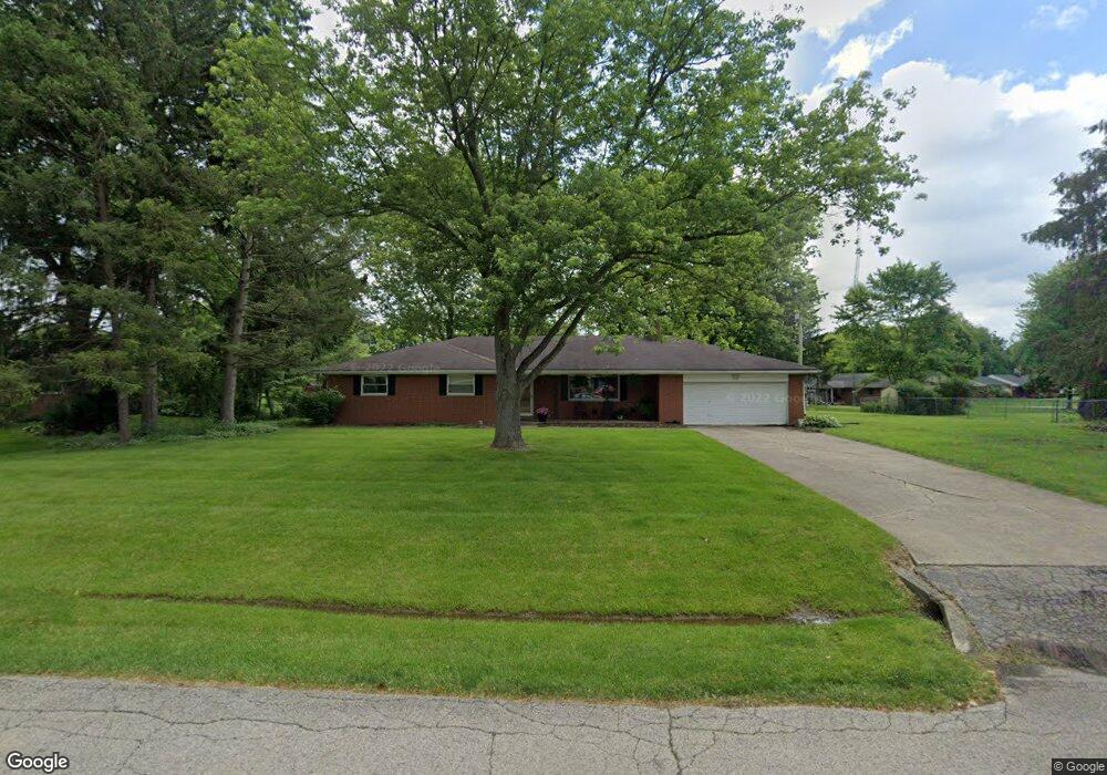
1072 Rosendale Dr Beavercreek, OH 45430
Estimated Value: $295,388 - $329,000
3
Beds
2
Baths
1,944
Sq Ft
$160/Sq Ft
Est. Value
About This Home
This home is located at 1072 Rosendale Dr, Beavercreek, OH 45430 and is currently estimated at $311,847, approximately $160 per square foot. 1072 Rosendale Dr is a home located in Greene County with nearby schools including Valley Elementary School, Herman K Ankeney Middle School, and Beavercreek High School.
Ownership History
Date
Name
Owned For
Owner Type
Purchase Details
Closed on
Feb 7, 2024
Sold by
Sturwold Karen Ann
Bought by
Sturwold Karen Ann
Current Estimated Value
Home Financials for this Owner
Home Financials are based on the most recent Mortgage that was taken out on this home.
Original Mortgage
$189,255
Outstanding Balance
$185,777
Interest Rate
6.69%
Mortgage Type
FHA
Estimated Equity
$126,070
Purchase Details
Closed on
Apr 6, 2004
Sold by
Kuntz Randall G
Bought by
Sturwold Kuntz Karen A and Kuntz Karen A
Home Financials for this Owner
Home Financials are based on the most recent Mortgage that was taken out on this home.
Original Mortgage
$124,000
Interest Rate
5.63%
Mortgage Type
New Conventional
Purchase Details
Closed on
Apr 1, 1993
Bought by
Kuntz Karen A Sturwold
Create a Home Valuation Report for This Property
The Home Valuation Report is an in-depth analysis detailing your home's value as well as a comparison with similar homes in the area
Home Values in the Area
Average Home Value in this Area
Purchase History
| Date | Buyer | Sale Price | Title Company |
|---|---|---|---|
| Sturwold Karen Ann | -- | None Listed On Document | |
| Sturwold Kuntz Karen A | -- | -- | |
| Kuntz Karen A Sturwold | $101,000 | -- |
Source: Public Records
Mortgage History
| Date | Status | Borrower | Loan Amount |
|---|---|---|---|
| Open | Sturwold Karen Ann | $189,255 | |
| Previous Owner | Sturwold Kuntz Karen A | $124,000 |
Source: Public Records
Tax History Compared to Growth
Tax History
| Year | Tax Paid | Tax Assessment Tax Assessment Total Assessment is a certain percentage of the fair market value that is determined by local assessors to be the total taxable value of land and additions on the property. | Land | Improvement |
|---|---|---|---|---|
| 2024 | $6,068 | $91,130 | $17,160 | $73,970 |
| 2023 | $6,068 | $91,130 | $17,160 | $73,970 |
| 2022 | $5,235 | $67,910 | $12,710 | $55,200 |
| 2021 | $5,254 | $67,910 | $12,710 | $55,200 |
| 2020 | $5,497 | $67,910 | $12,710 | $55,200 |
| 2019 | $4,948 | $56,770 | $9,460 | $47,310 |
| 2018 | $4,658 | $56,770 | $9,460 | $47,310 |
| 2017 | $4,032 | $56,770 | $9,460 | $47,310 |
| 2016 | $4,061 | $50,630 | $9,460 | $41,170 |
| 2015 | $5,653 | $50,630 | $9,460 | $41,170 |
| 2014 | $3,553 | $50,630 | $9,460 | $41,170 |
Source: Public Records
Map
Nearby Homes
- 1010 Renown Rd
- 3998 Willowcrest Rd
- 4020 E Patterson Rd
- 3667 Creekwood Ct
- 3917 E Summit Ridge Dr
- 720 Talowood Dr
- 1285 Wallaby Dr
- 3880 Southview Ave
- 1617 N Central Dr
- 615 Bendwood Way
- 1668 N Central Dr
- 4174 White Hawk Ct
- 3785 Frostwood Dr
- 1641 Woods Dr
- 4235 Straight Arrow Rd
- 611 Cape Cod Ct
- 3330 Fair Oaks Dr
- 4274 Straight Arrow Rd Unit 4274
- 4174 Mapleview Dr
- 564 Plattner Trail
- 1086 Rosendale Dr
- 1056 Rosendale Dr
- 1103 Regal Hill Ct
- 1113 Regal Hill Ct
- 3872 Rexford Rd
- 1093 Rosendale Dr
- 1111 Rosendale Dr
- 1131 Rosendale Dr
- 1100 Rosendale Dr
- 3911 Rexford Rd
- 1125 Regal Hill Ct
- 3919 Rockfield Dr
- 3940 Largo Ln
- 1098 Regal Hill Ct
- 1071 Rockdell Ct
- 3942 Largo Ln
- 3910 Rexford Rd
- 1110 Regal Hill Ct
- 3930 Largo Ln
- 1133 Regal Hill Ct