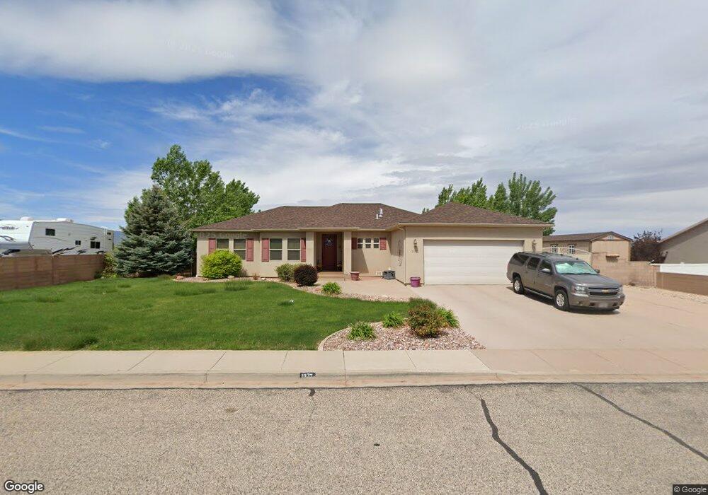
1072 S 4425 W Cedar City, UT 84720
Estimated Value: $571,555 - $625,000
5
Beds
2
Baths
3,580
Sq Ft
$171/Sq Ft
Est. Value
About This Home
This home is located at 1072 S 4425 W, Cedar City, UT 84720 and is currently estimated at $610,639, approximately $170 per square foot. 1072 S 4425 W is a home located in Iron County with nearby schools including Iron Springs School, Cedar Middle School, and Cedar City High School.
Ownership History
Date
Name
Owned For
Owner Type
Purchase Details
Closed on
Apr 27, 2007
Sold by
Tribe Dale and Tribe Heidi
Bought by
Moore Kenneth M and Moore Karen
Current Estimated Value
Home Financials for this Owner
Home Financials are based on the most recent Mortgage that was taken out on this home.
Original Mortgage
$263,200
Outstanding Balance
$159,572
Interest Rate
6.11%
Mortgage Type
New Conventional
Estimated Equity
$451,068
Purchase Details
Closed on
Aug 19, 2005
Sold by
Northridge At Cross Hollow Development I
Bought by
Tribe Dale and Tribe Heidi
Home Financials for this Owner
Home Financials are based on the most recent Mortgage that was taken out on this home.
Original Mortgage
$204,000
Interest Rate
5.56%
Mortgage Type
Unknown
Create a Home Valuation Report for This Property
The Home Valuation Report is an in-depth analysis detailing your home's value as well as a comparison with similar homes in the area
Home Values in the Area
Average Home Value in this Area
Purchase History
| Date | Buyer | Sale Price | Title Company |
|---|---|---|---|
| Moore Kenneth M | -- | -- | |
| Tribe Dale | -- | -- |
Source: Public Records
Mortgage History
| Date | Status | Borrower | Loan Amount |
|---|---|---|---|
| Open | Moore Kenneth M | $263,200 | |
| Previous Owner | Tribe Dale | $204,000 |
Source: Public Records
Tax History Compared to Growth
Tax History
| Year | Tax Paid | Tax Assessment Tax Assessment Total Assessment is a certain percentage of the fair market value that is determined by local assessors to be the total taxable value of land and additions on the property. | Land | Improvement |
|---|---|---|---|---|
| 2025 | $2,556 | $327,808 | $71,670 | $256,138 |
| 2023 | $2,536 | $378,955 | $68,255 | $310,700 |
| 2022 | $2,998 | $335,165 | $56,880 | $278,285 |
| 2021 | $2,103 | $235,110 | $28,440 | $206,670 |
| 2020 | $2,161 | $213,930 | $28,440 | $185,490 |
| 2019 | $2,197 | $208,515 | $26,335 | $182,180 |
| 2018 | $2,054 | $190,450 | $23,100 | $167,350 |
| 2017 | $2,080 | $178,955 | $21,450 | $157,505 |
| 2016 | $1,927 | $161,555 | $19,800 | $141,755 |
| 2015 | $1,958 | $156,565 | $0 | $0 |
| 2014 | $1,857 | $140,180 | $0 | $0 |
Source: Public Records
Map
Nearby Homes
- 1151 S 4475 W
- 51 S 4375 W Unit 24
- 51 S 4375 W Unit 4
- 51 S 4375 W Unit 7
- 51 S 4375 W Unit 21
- 51 S 4375 W Unit 6
- 51 S 4375 W Unit 23
- 51 S 4375 W Unit 15
- 51 S 4375 W Unit 18
- 51 S 4375 W Unit 9
- 51 S 4375 W Unit 5
- 51 S 4375 W Unit 8
- 51 S 4375 W Unit 25
- 51 S 4375 W Unit 22
- 51 S 4375 W Unit 17
- 51 S 4375 W Unit 26
- 51 S 4375 W Unit 16
- 51 S 4375 W Unit 13
- 51 S 4375 W Unit 3
- 1220 S Laurie Ln
- 1090 S 4425 W
- 1073 S 4425 W
- 1046 S 4425 W
- 1046 S 4425 W Unit 3E
- 1071 S 4475 W
- 1091 S 4475 W
- 1045 S 4475 W
- 1115 S 4475 W
- 1030 S 4425 W
- 1030 S 4425 W Unit 2E
- 1114 S 4425 W
- 1089 S 4425 W Unit III
- 1117 S 4425 W
- 1031 S 4425 W
- 1136 S 4425 W Unit 3
- 1088 S 4475 W Unit 3
- 1048 S 4475 W
- 1048 S 4475 W Unit 5
- 1133 S 4475 W
- 1021 S 4475 W