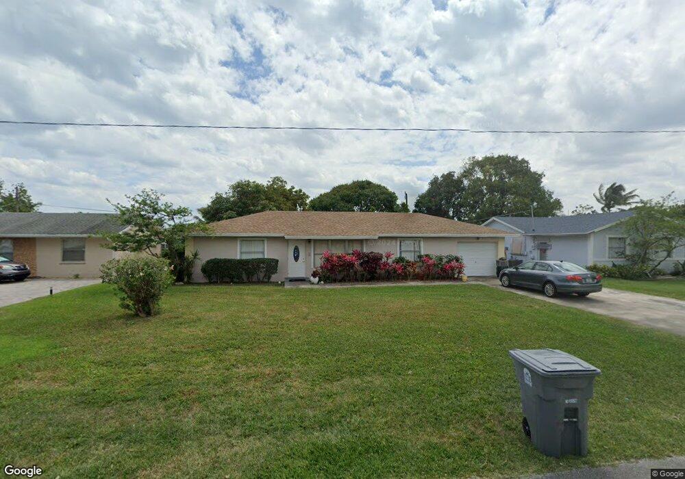
1072 Seagrape Rd Lantana, FL 33462
San Castle NeighborhoodEstimated Value: $362,000 - $401,000
3
Beds
2
Baths
1,448
Sq Ft
$261/Sq Ft
Est. Value
About This Home
This home is located at 1072 Seagrape Rd, Lantana, FL 33462 and is currently estimated at $377,500, approximately $260 per square foot. 1072 Seagrape Rd is a home located in Palm Beach County with nearby schools including Rolling Green Elementary School, Boynton Beach Community High School, and Congress Community Middle School.
Ownership History
Date
Name
Owned For
Owner Type
Purchase Details
Closed on
Mar 25, 2005
Sold by
Pierre Wilther and Pierre Evania
Bought by
Louis Charles Cerest and Alibe Gladice
Current Estimated Value
Home Financials for this Owner
Home Financials are based on the most recent Mortgage that was taken out on this home.
Original Mortgage
$180,500
Outstanding Balance
$105,522
Interest Rate
8%
Mortgage Type
Fannie Mae Freddie Mac
Estimated Equity
$271,978
Purchase Details
Closed on
Nov 20, 2002
Sold by
Andre Saint Jean
Bought by
Pierre Wilther and Pierre Evania
Create a Home Valuation Report for This Property
The Home Valuation Report is an in-depth analysis detailing your home's value as well as a comparison with similar homes in the area
Home Values in the Area
Average Home Value in this Area
Purchase History
| Date | Buyer | Sale Price | Title Company |
|---|---|---|---|
| Louis Charles Cerest | $190,000 | -- | |
| Pierre Wilther | -- | -- |
Source: Public Records
Mortgage History
| Date | Status | Borrower | Loan Amount |
|---|---|---|---|
| Open | Louis Charles Cerest | $180,500 |
Source: Public Records
Tax History Compared to Growth
Tax History
| Year | Tax Paid | Tax Assessment Tax Assessment Total Assessment is a certain percentage of the fair market value that is determined by local assessors to be the total taxable value of land and additions on the property. | Land | Improvement |
|---|---|---|---|---|
| 2024 | $3,289 | $110,494 | -- | -- |
| 2023 | $2,962 | $100,449 | $86,384 | $158,260 |
| 2022 | $2,935 | $91,317 | $0 | $0 |
| 2021 | $2,522 | $188,804 | $56,498 | $132,306 |
| 2020 | $2,307 | $166,827 | $66,000 | $100,827 |
| 2019 | $2,156 | $151,344 | $44,000 | $107,344 |
| 2018 | $1,826 | $124,581 | $22,315 | $102,266 |
| 2017 | $1,689 | $112,942 | $13,947 | $98,995 |
| 2016 | $1,547 | $51,545 | $0 | $0 |
| 2015 | $1,507 | $46,859 | $0 | $0 |
| 2014 | $1,310 | $42,599 | $0 | $0 |
Source: Public Records
Map
Nearby Homes
- 591 Seagrape Rd
- 590 Brown Rd
- 7772 Loomis St
- 7376 W Oakridge Cir Unit C
- 7823 Loomis St
- 3313 Grove Rd
- 1076 Highview Rd
- 7880 Griswold St
- 1191 Highview Rd
- 1170 Highview Rd
- 00 Highland Rd
- 7891 Loomis St Unit 7891/7893
- 600 Scotia Dr Unit 104
- 3260 E Atlantic Dr
- 700 Scotia Dr Unit 303
- 700 Scotia Dr Unit 202
- 1199 Highland Rd
- 900 Scotia 105 Dr Unit 105
- 7937 Coral St
- 1228 Highview Rd
- 1086 Seagrape Rd
- 1058 Seagrape Rd
- 1071 Oleander Rd
- 1085 Oleander Rd
- 1059 Oleander Rd
- 1098 Seagrape Rd
- 1044 Seagrape Rd
- 1071 Seagrape Rd
- 1099 Oleander Rd
- 1043 Oleander Rd
- 1057 Seagrape Rd
- 1085 Seagrape Rd
- 1030 Seagrape Rd
- 1043 Seagrape Rd
- 1099 Seagrape Rd
- 1112 Seagrape Rd
- 1029 Oleander Rd
- 1113 Oleander Rd
- 1072 Oleander Rd
- 1072 Mentone Rd