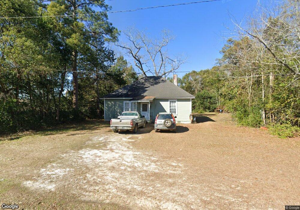
1072 Stegall St Metcalf, GA 31792
Estimated Value: $36,265 - $145,000
--
Bed
1
Bath
1,280
Sq Ft
$65/Sq Ft
Est. Value
About This Home
This home is located at 1072 Stegall St, Metcalf, GA 31792 and is currently estimated at $83,755, approximately $65 per square foot. 1072 Stegall St is a home located in Thomas County with nearby schools including Hand in Hand Primary School, Garrison-Pilcher Elementary School, and Cross Creek Elementary School.
Ownership History
Date
Name
Owned For
Owner Type
Purchase Details
Closed on
Jul 1, 2024
Sold by
Butler Judson A
Bought by
Strait Mahlon L
Current Estimated Value
Home Financials for this Owner
Home Financials are based on the most recent Mortgage that was taken out on this home.
Original Mortgage
$22,500
Outstanding Balance
$18,851
Interest Rate
7.22%
Mortgage Type
New Conventional
Estimated Equity
$64,904
Purchase Details
Closed on
Jun 14, 1989
Bought by
Butler Judson A
Create a Home Valuation Report for This Property
The Home Valuation Report is an in-depth analysis detailing your home's value as well as a comparison with similar homes in the area
Home Values in the Area
Average Home Value in this Area
Purchase History
| Date | Buyer | Sale Price | Title Company |
|---|---|---|---|
| Strait Mahlon L | $25,000 | -- | |
| Butler Judson A | $10,500 | -- |
Source: Public Records
Mortgage History
| Date | Status | Borrower | Loan Amount |
|---|---|---|---|
| Open | Strait Mahlon L | $22,500 |
Source: Public Records
Tax History Compared to Growth
Tax History
| Year | Tax Paid | Tax Assessment Tax Assessment Total Assessment is a certain percentage of the fair market value that is determined by local assessors to be the total taxable value of land and additions on the property. | Land | Improvement |
|---|---|---|---|---|
| 2024 | $348 | $16,882 | $2,843 | $14,039 |
| 2023 | $317 | $15,746 | $2,843 | $12,903 |
| 2022 | $305 | $13,696 | $2,369 | $11,327 |
| 2021 | $309 | $12,612 | $2,369 | $10,243 |
| 2020 | $318 | $12,675 | $2,369 | $10,306 |
| 2019 | $321 | $12,647 | $2,369 | $10,278 |
| 2018 | $326 | $12,584 | $2,369 | $10,215 |
| 2017 | $334 | $12,707 | $2,108 | $10,599 |
| 2016 | $334 | $12,607 | $2,108 | $10,498 |
| 2015 | $391 | $14,524 | $1,966 | $12,558 |
| 2014 | $386 | $14,293 | $1,966 | $12,327 |
| 2013 | -- | $14,293 | $1,966 | $12,327 |
Source: Public Records
Map
Nearby Homes
- 1049 Hancock St
- 2860 Stringer Rd
- 00 57 Acres Off Stringer Rd Off Metcalf-Beachton Rd
- 7500 U S 19
- 304 Bellingham Dr
- 215 Plantation Ln
- 104 Stratford Way
- 9261 U S 19
- 6908 Metcalf Rd
- 333 Shallowbrook Farms Rd
- 113 Harrogate Ln
- 396 Meander Trace
- 9700 Old Magnolia Rd
- 00 Harrogate Ln
- Lot 25 A Avalon Way Unit 25-A
- 10119 Springhill Rd
- 10087 Springhill Rd
- 113 Elijah Hill Ln
- 206 E Live Oak Cir
- 22 Inwood Place
- 1078 Stegall St
- 1075 Stegall St
- 2007 Magnolia St
- 1080 Randolph St
- 2057 Broad St
- 000 Broad St
- 1106 Broad St
- 2089 Broad St
- 1036 Manning St
- 1019 Manning St
- 1060 N Broad St
- 1014 S John St
- 1015 N Reynolds St
- 1054 S Reynolds St
- 1042 N Reynolds St
- 1018 N Reynolds St
- 1010 N Reynolds St
- 3030 Broad St
- 1058 N John St
- 1048 S John St