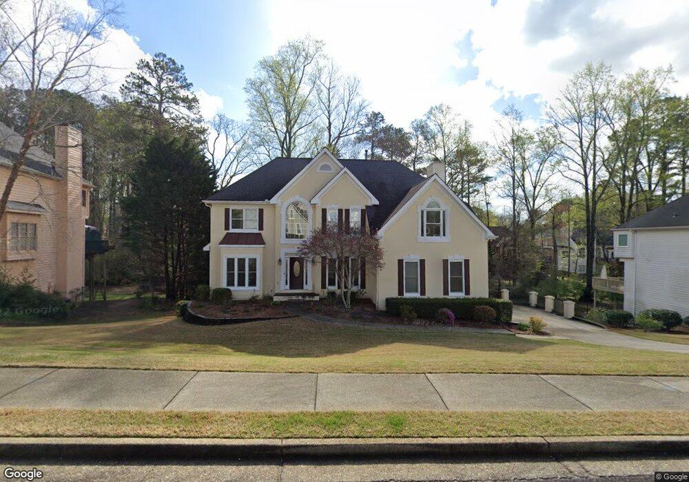
10720 Branham Fields Rd Unit 2B Duluth, GA 30097
Estimated Value: $620,000 - $688,000
4
Beds
5
Baths
2,439
Sq Ft
$265/Sq Ft
Est. Value
About This Home
This home is located at 10720 Branham Fields Rd Unit 2B, Duluth, GA 30097 and is currently estimated at $647,456, approximately $265 per square foot. 10720 Branham Fields Rd Unit 2B is a home located in Fulton County with nearby schools including Medlock Bridge Elementary School, River Trail Middle School, and Northview High School.
Ownership History
Date
Name
Owned For
Owner Type
Purchase Details
Closed on
May 15, 1998
Sold by
Porter Michael N and Porter Alison
Bought by
Farrell Patrick L and Farrell Rosann M
Current Estimated Value
Home Financials for this Owner
Home Financials are based on the most recent Mortgage that was taken out on this home.
Original Mortgage
$105,000
Outstanding Balance
$17,914
Interest Rate
5.62%
Mortgage Type
New Conventional
Estimated Equity
$629,542
Purchase Details
Closed on
Mar 28, 1994
Sold by
Elliott E Robert Elizabeth
Bought by
Porter Michael W Alison
Home Financials for this Owner
Home Financials are based on the most recent Mortgage that was taken out on this home.
Original Mortgage
$160,000
Interest Rate
7.1%
Create a Home Valuation Report for This Property
The Home Valuation Report is an in-depth analysis detailing your home's value as well as a comparison with similar homes in the area
Purchase History
| Date | Buyer | Sale Price | Title Company |
|---|---|---|---|
| Farrell Patrick L | $230,000 | -- | |
| Porter Michael W Alison | $200,000 | -- |
Source: Public Records
Mortgage History
| Date | Status | Borrower | Loan Amount |
|---|---|---|---|
| Open | Farrell Patrick L | $105,000 | |
| Previous Owner | Porter Michael W Alison | $160,000 |
Source: Public Records
Tax History
| Year | Tax Paid | Tax Assessment Tax Assessment Total Assessment is a certain percentage of the fair market value that is determined by local assessors to be the total taxable value of land and additions on the property. | Land | Improvement |
|---|---|---|---|---|
| 2025 | $2,359 | $196,840 | $50,120 | $146,720 |
| 2023 | $5,642 | $199,880 | $50,120 | $149,760 |
| 2022 | $1,678 | $164,080 | $41,520 | $122,560 |
| 2021 | $1,630 | $175,400 | $32,840 | $142,560 |
| 2020 | $1,605 | $147,320 | $32,960 | $114,360 |
| 2019 | $425 | $144,680 | $32,360 | $112,320 |
| 2018 | $3,937 | $141,280 | $31,600 | $109,680 |
| 2017 | $3,456 | $114,040 | $26,760 | $87,280 |
| 2016 | $3,383 | $114,040 | $26,760 | $87,280 |
| 2015 | $3,419 | $114,040 | $26,760 | $87,280 |
| 2014 | $3,546 | $115,560 | $26,760 | $88,800 |
Source: Public Records
Map
Nearby Homes
- 10015 Ruppel Ln
- 10005 Ruppel Ln
- 10025 Ruppel Ln
- 10635 Stonefield Landing Unit 1
- 10475 Medlock Bridge Rd Unit 900
- 10567 Bent Tree View
- 3052 Brindale Dr
- 4259 Baden Aly
- 6053 Galewind Ct
- 540 Abbotts Mill Dr
- 795 Abbotts Mill Ct Unit 73
- 755 Abbotts Mill Ct Unit 69
- 850 Abbotts Mill Ct Unit 79
- 275 Abbotts Mill Dr Unit 18
- 406 Colonsay Dr
- 120 Creekside Park Dr
- 10844 Yorkwood St
- 6273 Clapham Ln
- 5490 Grove Point Rd
- 4099 Abbotts Bridge Rd
- 10710 Branham Fields Rd Unit 2B
- 10730 Branham Fields Rd
- 810 Lake Medlock Dr Unit 8
- 820 Lake Medlock Dr
- 800 Lake Medlock Dr
- 830 Lake Medlock Dr Unit 8
- 10700 Branham Fields Rd
- 10740 Branham Fields Rd
- 10645 Branham Fields Rd
- 10655 Branham Fields Rd Unit 2B
- 790 Lake Medlock Dr
- 200 Halverson Way
- 200 Halverson Way
- 840 Lake Medlock Dr Unit 8
- 780 Lake Medlock Dr Unit 8
- 10690 Branham Fields Rd
- 210 Halverson Way
- 10750 Branham Fields Rd
- 10665 Branham Fields Rd Unit 2B
- 770 Lake Medlock Dr
Your Personal Tour Guide
Ask me questions while you tour the home.