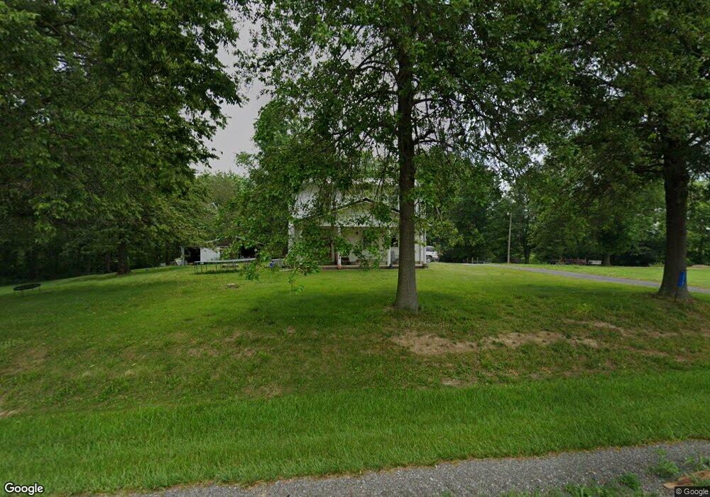
10720 State Route 153 Coulterville, IL 62237
Estimated Value: $122,000 - $226,000
3
Beds
2
Baths
1,600
Sq Ft
$106/Sq Ft
Est. Value
About This Home
This home is located at 10720 State Route 153, Coulterville, IL 62237 and is currently estimated at $169,474, approximately $105 per square foot. 10720 State Route 153 is a home located in Randolph County with nearby schools including Coulterville CUSD 1, Coulterville Junior High School, and Coulterville High School.
Ownership History
Date
Name
Owned For
Owner Type
Purchase Details
Closed on
Sep 2, 2011
Sold by
Vuichard Ronald G and Vuichard Diana
Bought by
Weber Nicholas and Weber Jessica
Current Estimated Value
Home Financials for this Owner
Home Financials are based on the most recent Mortgage that was taken out on this home.
Original Mortgage
$85,850
Outstanding Balance
$59,459
Interest Rate
4.5%
Mortgage Type
FHA
Estimated Equity
$110,015
Create a Home Valuation Report for This Property
The Home Valuation Report is an in-depth analysis detailing your home's value as well as a comparison with similar homes in the area
Home Values in the Area
Average Home Value in this Area
Purchase History
| Date | Buyer | Sale Price | Title Company |
|---|---|---|---|
| Weber Nicholas | $95,000 | Nations Title Agency Of Miss |
Source: Public Records
Mortgage History
| Date | Status | Borrower | Loan Amount |
|---|---|---|---|
| Open | Weber Nicholas | $85,850 |
Source: Public Records
Tax History Compared to Growth
Tax History
| Year | Tax Paid | Tax Assessment Tax Assessment Total Assessment is a certain percentage of the fair market value that is determined by local assessors to be the total taxable value of land and additions on the property. | Land | Improvement |
|---|---|---|---|---|
| 2024 | $2,222 | $39,095 | $2,865 | $36,230 |
| 2023 | $2,035 | $36,320 | $2,660 | $33,660 |
| 2022 | $1,903 | $34,875 | $2,175 | $32,700 |
| 2021 | $1,908 | $34,420 | $2,145 | $32,275 |
| 2020 | $2,187 | $35,419 | $2,209 | $33,210 |
| 2019 | $2,128 | $35,160 | $2,195 | $32,965 |
| 2018 | $2,147 | $38,764 | $2,420 | $36,344 |
| 2017 | $1,924 | $35,475 | $2,215 | $33,260 |
| 2016 | $1,812 | $34,185 | $2,135 | $32,050 |
| 2015 | $2,009 | $34,185 | $2,135 | $32,050 |
| 2014 | $2,009 | $34,850 | $2,175 | $32,675 |
| 2013 | $1,975 | $35,295 | $2,205 | $33,090 |
Source: Public Records
Map
Nearby Homes
- 115 S 4th St
- 521 Cherry St
- 302 Walnut St
- 378 Butler St
- 2076 Carter Rd
- 751 Torrens St
- 718 N Illinois St
- 331 N Minnie Ave
- 9199 Schupbach Rd
- 143 Taft St
- 2821 N Market St
- 2125 N Market St
- 1821 Mark Dr
- 151 Doc Lin Dr
- 1019 E Broadway St
- 712 E Harrison St
- 1125 N Market St
- 7544 Geranium Rd
- 520 E Mound St
- 321 Sunset Dr
- 10776 State Route 153
- 13196 City Lake Rd
- 10603 State Route 153
- 10516 State Route 153
- 10605 State Route 153
- 10681 Poplar St
- 10506 State Route 153
- 105 E Armstrong St
- 13226 Talbert Ln
- 10712 Poplar St
- 13229 Talbert Ln
- 813 N 5th St
- 211 E Armstrong St
- 202 E Armstrong St
- 10502 State Route 153
- 13108 Talbert Ln
- 805 N 5th St
- 301 E Armstrong St
- 811 N 4th St
- 804 N 5th St