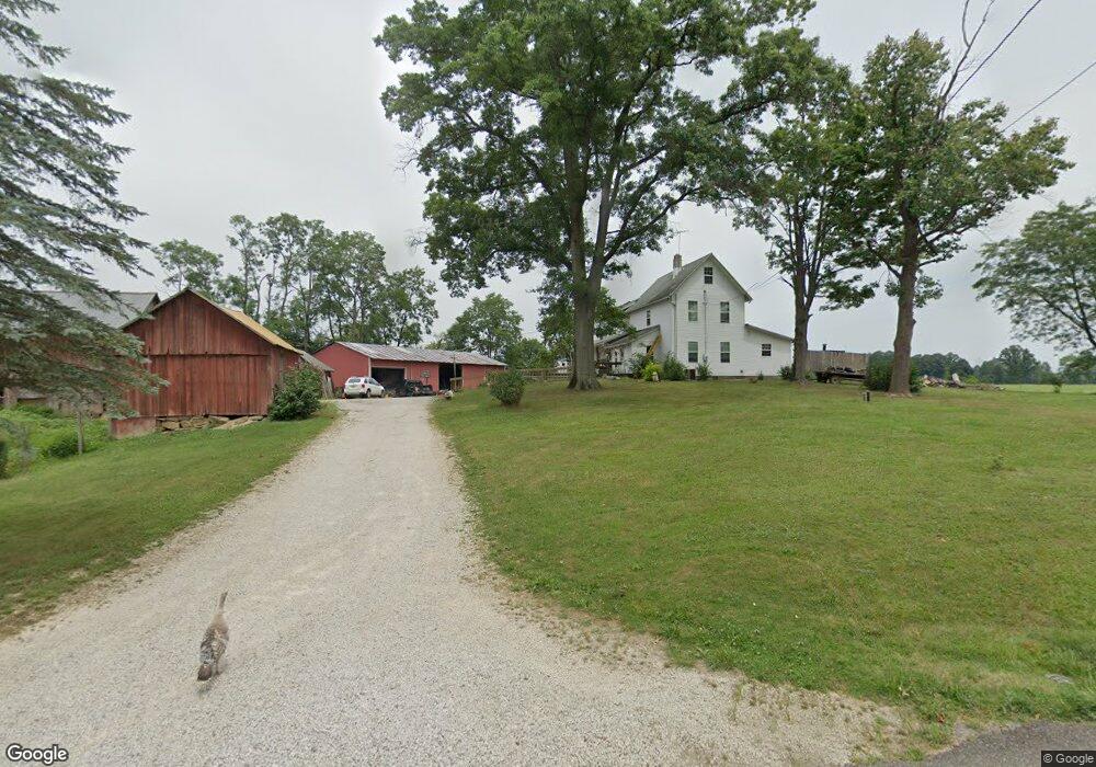
10721 Breit St NE Alliance, OH 44601
Estimated Value: $273,000 - $425,000
4
Beds
1
Bath
2,544
Sq Ft
$143/Sq Ft
Est. Value
About This Home
This home is located at 10721 Breit St NE, Alliance, OH 44601 and is currently estimated at $363,360, approximately $142 per square foot. 10721 Breit St NE is a home with nearby schools including Marlington High School.
Ownership History
Date
Name
Owned For
Owner Type
Purchase Details
Closed on
Aug 21, 1992
Current Estimated Value
Create a Home Valuation Report for This Property
The Home Valuation Report is an in-depth analysis detailing your home's value as well as a comparison with similar homes in the area
Home Values in the Area
Average Home Value in this Area
Purchase History
| Date | Buyer | Sale Price | Title Company |
|---|---|---|---|
| -- | $70,800 | -- |
Source: Public Records
Tax History Compared to Growth
Tax History
| Year | Tax Paid | Tax Assessment Tax Assessment Total Assessment is a certain percentage of the fair market value that is determined by local assessors to be the total taxable value of land and additions on the property. | Land | Improvement |
|---|---|---|---|---|
| 2025 | -- | $126,810 | $85,300 | $41,510 |
| 2024 | $992 | $126,810 | $85,300 | $41,510 |
| 2023 | $1,893 | $118,510 | $75,390 | $43,120 |
| 2022 | $1,825 | $57,890 | $14,770 | $43,120 |
| 2021 | $1,831 | $57,890 | $14,770 | $43,120 |
| 2020 | $1,735 | $51,420 | $16,030 | $35,390 |
| 2019 | $1,725 | $51,440 | $16,040 | $35,400 |
| 2018 | $1,648 | $51,440 | $16,040 | $35,400 |
| 2017 | $1,716 | $49,760 | $19,680 | $30,080 |
| 2016 | $1,753 | $50,600 | $19,680 | $30,920 |
| 2015 | $1,756 | $50,600 | $19,680 | $30,920 |
| 2014 | $1,519 | $42,300 | $12,190 | $30,110 |
| 2013 | $743 | $42,300 | $12,190 | $30,110 |
Source: Public Records
Map
Nearby Homes
- 0 Reeder Ave NE
- 12355 Edison St NE
- 12252 Snode St NE
- 10666 Wilma Ave NE
- 12415 Snode St NE
- 11960 Freshley Ave NE
- 13109 Edison St NE
- 0 Meadow St NE
- 13334 Cindy St NE
- 11480 Aebi Ave NE
- 1430 Westwood Ave
- 0 W Main St Unit 5090123
- 2377 Ansley St Unit 2377
- 2081 Marwood Cir
- 000 Klinger Ave
- 0 New Milford Rd Unit 5119787
- 2851 Patriots Path Unit 3D
- 14422 Sturbridge Rd NE
- 14920 Mccallum Ave NE
- 2435 Queensbury Rd
- 10888 Breit St NE
- 10888 Breit St NE
- 11224 Reeder Ave NE
- 11480 Reeder Ave NE
- 10926 Breit St NE
- 0 Lair Rd NE Unit 4040793
- 0 Lair Rd NE Unit 3983555
- 0 Lair Rd NE Unit 4420403
- 0 Lair Rd NE Unit 4287412
- 0 Lair Rd NE Unit 4249041
- 0 Lair Rd NE Unit 4209204
- 0 Lair Rd NE Unit 4135732
- 11292 Reeder Ave NE
- 11184 Reeder Ave NE
- 10950 Breit St NE
- 10980 Breit St NE
- 11267 Reeder Ave NE
- 11100 Reeder Ave NE
- 11025 Breit St NE
- 11299 Reeder Ave NE