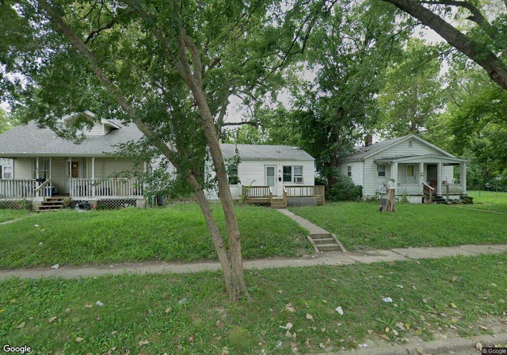
1073 E Curtis Ave Decatur, IL 62526
Hess Park NeighborhoodEstimated Value: $21,000 - $44,000
Studio
--
Bath
624
Sq Ft
$55/Sq Ft
Est. Value
About This Home
This home is located at 1073 E Curtis Ave, Decatur, IL 62526 and is currently estimated at $34,233, approximately $54 per square foot. 1073 E Curtis Ave is a home located in Macon County with nearby schools including Hope Academy.
Ownership History
Date
Name
Owned For
Owner Type
Purchase Details
Closed on
Jan 22, 2024
Sold by
Gonzalez Sebastian B
Bought by
Pumphrey Russ
Current Estimated Value
Purchase Details
Closed on
May 25, 2022
Sold by
Rock It Properties I Llc
Bought by
Gonzales Sebastian B
Purchase Details
Closed on
May 1, 2017
Sold by
Lmlj Llc
Bought by
Cns Properties Llc
Purchase Details
Closed on
Nov 18, 2016
Sold by
Fox Creek Property Management Llc
Bought by
Lmlj Llc
Purchase Details
Closed on
Dec 26, 2007
Sold by
Oconnor Patricia A and Hudson Mike T
Bought by
Jrrw Inc
Purchase Details
Closed on
Jul 1, 2002
Create a Home Valuation Report for This Property
The Home Valuation Report is an in-depth analysis detailing your home's value as well as a comparison with similar homes in the area
Home Values in the Area
Average Home Value in this Area
Purchase History
| Date | Buyer | Sale Price | Title Company |
|---|---|---|---|
| Pumphrey Russ | $5,000 | None Listed On Document | |
| Gonzales Sebastian B | $1,385,000 | None Listed On Document | |
| Cns Properties Llc | $60,000 | None Listed On Document | |
| Cns Properties Llc | $60,000 | None Listed On Document | |
| Lmlj Llc | -- | Attorney | |
| Jrrw Inc | -- | None Available | |
| -- | $1,000 | -- |
Source: Public Records
Tax History
| Year | Tax Paid | Tax Assessment Tax Assessment Total Assessment is a certain percentage of the fair market value that is determined by local assessors to be the total taxable value of land and additions on the property. | Land | Improvement |
|---|---|---|---|---|
| 2024 | $593 | $6,125 | $437 | $5,688 |
| 2023 | $588 | $5,909 | $422 | $5,487 |
| 2022 | $575 | $5,624 | $390 | $5,234 |
| 2021 | $541 | $5,253 | $365 | $4,888 |
| 2020 | $533 | $5,010 | $349 | $4,661 |
| 2019 | $533 | $5,010 | $349 | $4,661 |
| 2018 | $567 | $5,395 | $199 | $5,196 |
| 2017 | $580 | $5,539 | $204 | $5,335 |
| 2016 | $591 | $5,595 | $206 | $5,389 |
| 2015 | $562 | $5,496 | $202 | $5,294 |
| 2014 | $582 | $6,071 | $182 | $5,889 |
| 2013 | $601 | $6,299 | $189 | $6,110 |
Source: Public Records
Map
Nearby Homes
- 2428 N Dunn Dr Unit DU2428
- 2451 N Dunn Dr Unit DU2451
- 2463 Steele Ct
- 2430 Kirby Ct Unit KI2430
- 2550 N Easy St Unit EA2550
- 1149 Maze Ct
- 2522 Hedrick Ct Unit HE2522
- 2528 Hedrick Ct Unit HE2528
- 5 East Dr
- 1166 E Walnut St
- 1437 E Division St
- 415 E Division St
- 240 E Olive St
- 1135 E Locust St
- 1553 E Hickory St
- 1590 N Water St
- 2051 N Church St
- 1237 N Calhoun St
- 216 W Garfield Ave
- 1568 N Main St
- 1077 E Curtis Ave
- 2305 N Illinois St
- 2301 N Illinois St
- 1069 E Curtis Ave
- 2444 N Illinois St
- 1092 E Curtis Ave
- 1084 E Curtis Ave
- 1030 E Curtis Ave
- 2539 N Illinois St
- 1076 E Curtis Ave
- 959 E Curtis Ave
- 1068 E Mueller Ave
- 1036 E Mueller Ave
- 1028 E Mueller Ave
- 960 E Curtis Ave
- 1016 E Mueller Ave
- 1092 E Mueller Ave
- 953 E Curtis Ave
- 1104 E Mueller Ave
- 1112 E Mueller Ave
Your Personal Tour Guide
Ask me questions while you tour the home.