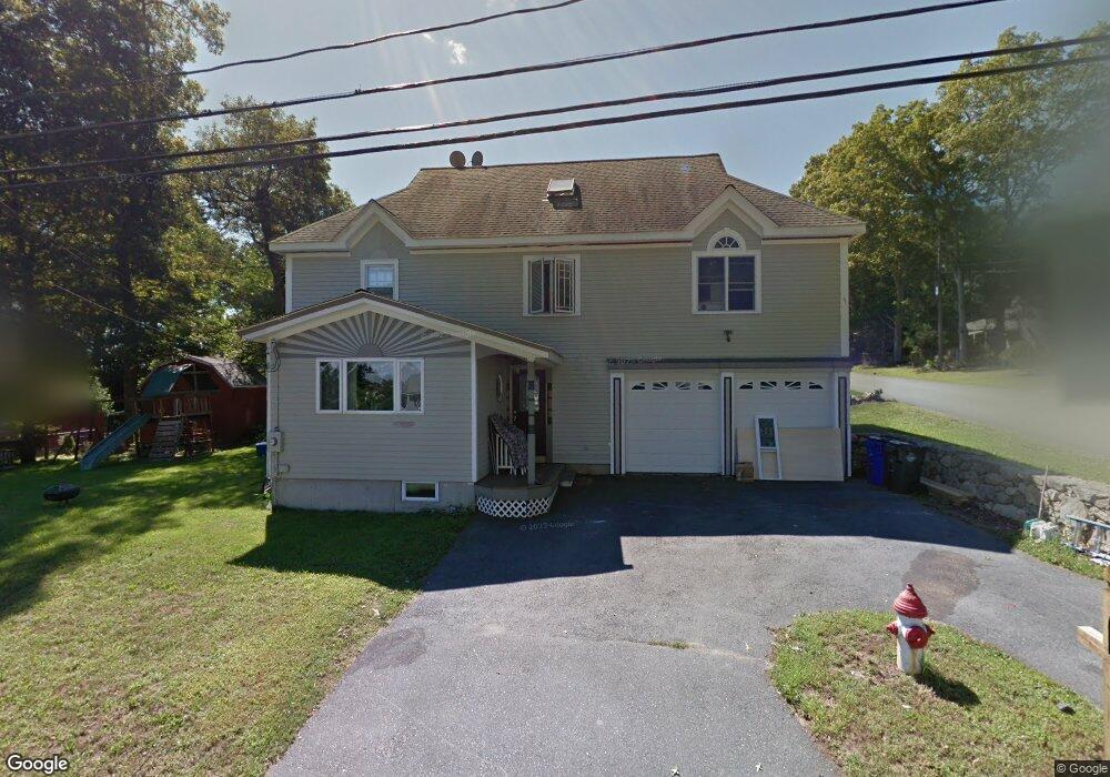
1073 Newhall St Fall River, MA 02721
Maplewood NeighborhoodEstimated Value: $481,000 - $555,000
3
Beds
3
Baths
2,220
Sq Ft
$231/Sq Ft
Est. Value
About This Home
This home is located at 1073 Newhall St, Fall River, MA 02721 and is currently estimated at $512,030, approximately $230 per square foot. 1073 Newhall St is a home located in Bristol County with nearby schools including Letourneau Elementary School, Matthew J. Kuss Middle School, and B M C Durfee High School.
Ownership History
Date
Name
Owned For
Owner Type
Purchase Details
Closed on
Aug 9, 1994
Sold by
Tharrett Maria I
Bought by
Baptista Jorge M and Baptista Mary Ann
Current Estimated Value
Home Financials for this Owner
Home Financials are based on the most recent Mortgage that was taken out on this home.
Original Mortgage
$71,700
Interest Rate
8.4%
Mortgage Type
Purchase Money Mortgage
Create a Home Valuation Report for This Property
The Home Valuation Report is an in-depth analysis detailing your home's value as well as a comparison with similar homes in the area
Home Values in the Area
Average Home Value in this Area
Purchase History
| Date | Buyer | Sale Price | Title Company |
|---|---|---|---|
| Baptista Jorge M | $75,500 | -- |
Source: Public Records
Mortgage History
| Date | Status | Borrower | Loan Amount |
|---|---|---|---|
| Closed | Baptista Jorge M | $71,700 |
Source: Public Records
Tax History
| Year | Tax Paid | Tax Assessment Tax Assessment Total Assessment is a certain percentage of the fair market value that is determined by local assessors to be the total taxable value of land and additions on the property. | Land | Improvement |
|---|---|---|---|---|
| 2025 | $4,455 | $389,100 | $129,500 | $259,600 |
| 2024 | $4,185 | $364,200 | $124,600 | $239,600 |
| 2023 | $4,292 | $349,800 | $118,600 | $231,200 |
| 2022 | $3,846 | $304,600 | $109,800 | $194,800 |
| 2021 | $3,846 | $278,100 | $109,600 | $168,500 |
| 2020 | $3,776 | $261,300 | $103,600 | $157,700 |
| 2019 | $3,693 | $253,300 | $101,600 | $151,700 |
| 2018 | $3,624 | $247,900 | $101,600 | $146,300 |
| 2017 | $3,396 | $242,600 | $98,700 | $143,900 |
| 2016 | $3,200 | $234,800 | $98,700 | $136,100 |
| 2015 | $3,757 | $287,200 | $98,700 | $188,500 |
| 2014 | $3,613 | $287,200 | $98,700 | $188,500 |
Source: Public Records
Map
Nearby Homes
- 1082 Hancock St
- 664 Norman St
- 206 Songbird Ln
- 0 Wood St
- 37 Bluejay St
- 84 Lark Ln
- 0 Hancock St
- 71 Blackbird St
- 3 Blackbird St
- 18 Mockingbird Ln
- 38 Hummingbird Ln
- 21 Nightingale Ln
- 0 Sheldon St
- 186 Spencer St
- 0 Stafford Rd Unit 1393774
- 185 Stafford Rd
- 495 Chicago St
- 447 Stafford Rd Unit E7
- 85 Watuppa Rd
- 507R Stafford Rd
Your Personal Tour Guide
Ask me questions while you tour the home.