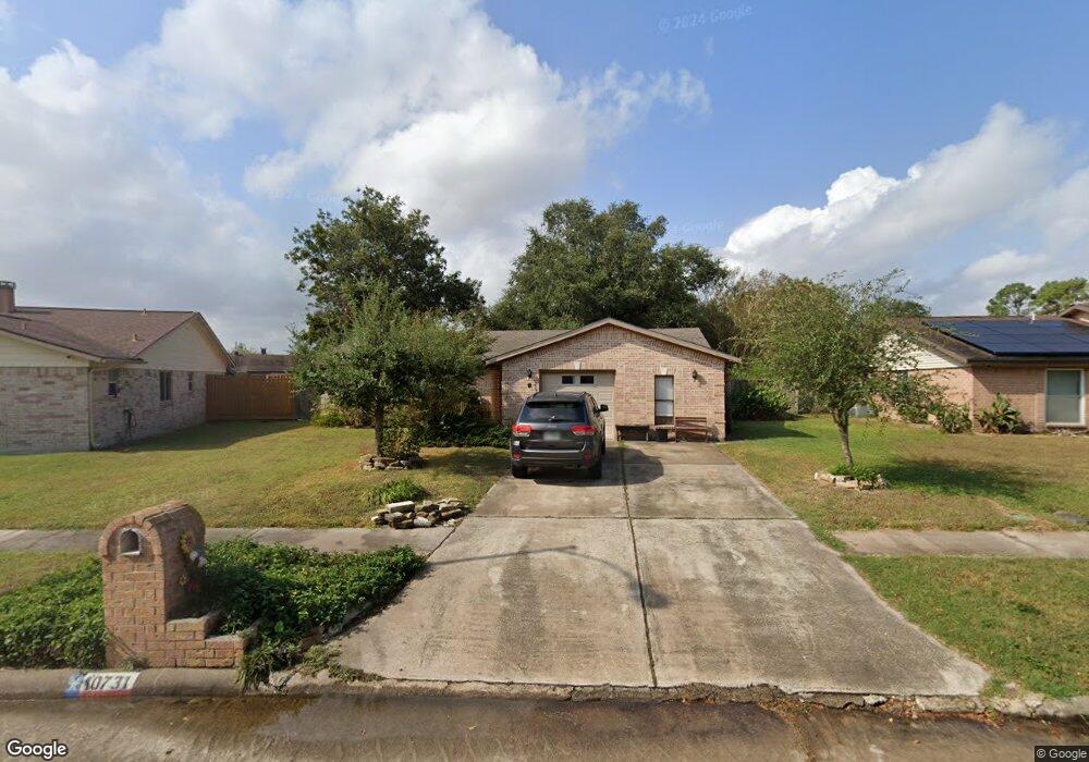
10731 Dusty Trail Dr Houston, TX 77086
North Houston NeighborhoodEstimated Value: $205,163 - $234,000
3
Beds
2
Baths
1,326
Sq Ft
$167/Sq Ft
Est. Value
About This Home
This home is located at 10731 Dusty Trail Dr, Houston, TX 77086 and is currently estimated at $221,041, approximately $166 per square foot. 10731 Dusty Trail Dr is a home located in Harris County with nearby schools including Kujawa EC/Pre-K/K School, Carmichael Elementary School, and Shotwell Middle School.
Ownership History
Date
Name
Owned For
Owner Type
Purchase Details
Closed on
Jul 7, 1998
Sold by
Kingery Gregory S
Bought by
Urbina Benny and Urbina Erlinda
Current Estimated Value
Home Financials for this Owner
Home Financials are based on the most recent Mortgage that was taken out on this home.
Original Mortgage
$57,474
Outstanding Balance
$11,813
Interest Rate
7.05%
Mortgage Type
FHA
Estimated Equity
$209,228
Create a Home Valuation Report for This Property
The Home Valuation Report is an in-depth analysis detailing your home's value as well as a comparison with similar homes in the area
Home Values in the Area
Average Home Value in this Area
Purchase History
| Date | Buyer | Sale Price | Title Company |
|---|---|---|---|
| Urbina Benny | -- | Fidelity National Title |
Source: Public Records
Mortgage History
| Date | Status | Borrower | Loan Amount |
|---|---|---|---|
| Open | Urbina Benny | $57,474 |
Source: Public Records
Tax History Compared to Growth
Tax History
| Year | Tax Paid | Tax Assessment Tax Assessment Total Assessment is a certain percentage of the fair market value that is determined by local assessors to be the total taxable value of land and additions on the property. | Land | Improvement |
|---|---|---|---|---|
| 2025 | $2,771 | $196,351 | $38,674 | $157,677 |
| 2024 | $2,771 | $199,213 | $38,674 | $160,539 |
| 2023 | $2,771 | $202,951 | $38,674 | $164,277 |
| 2022 | $3,508 | $170,947 | $32,775 | $138,172 |
| 2021 | $3,181 | $142,986 | $32,775 | $110,211 |
| 2020 | $3,215 | $135,579 | $32,775 | $102,804 |
| 2019 | $3,039 | $128,154 | $16,696 | $111,458 |
| 2018 | $1,054 | $121,627 | $16,696 | $104,931 |
| 2017 | $2,422 | $113,927 | $14,992 | $98,935 |
| 2016 | $2,202 | $103,392 | $14,992 | $88,400 |
| 2015 | $1,538 | $96,245 | $14,992 | $81,253 |
| 2014 | $1,538 | $74,242 | $14,992 | $59,250 |
Source: Public Records
Map
Nearby Homes
- 7218 Winding Trace Dr
- 10711 Heather Hill Dr
- 10614 Mackenzie Dr
- 7222 Northleaf Dr
- 10723 Mackenzie Dr
- 7227 Greenyard Dr
- 7023 Sandswept Ln
- 7002 Sandswept Ln
- 10307 Bammel North Houston Rd
- 7302 Seton Lake Dr
- 11007 Tobasa Ct
- 6911 Silver Star Dr
- 7307 Silver Star Dr
- 6722 Winding Trace Dr
- 6654 Brownie Campbell Rd
- 5010 Kale Ct
- 11006 Crinkleawn Dr
- 5103 Dartmoor Ridge Trail
- 6630 Brownie Campbell Rd
- 6822 Dusty Dawn Dr
- 10735 Dusty Trail Dr
- 10727 Dusty Trail Dr
- 7314 Sandswept Ln
- 7310 Sandswept Ln
- 7318 Sandswept Ln
- 10723 Dusty Trail Dr
- 7306 Sandswept Ln
- 10730 Dusty Trail Dr
- 7322 Sandswept Ln
- 7302 Sandswept Ln
- 10734 Dusty Trail Dr
- 10719 Dusty Trail Dr
- 7302 Winding Trace Dr
- 7306 Winding Trace Dr
- 10722 Dusty Trail Dr
- 7310 Winding Trace Dr
- 7230 Sandswept Ln
- 7238 Winding Trace Dr
- 7314 Winding Trace Dr
- 10715 Dusty Trail Dr