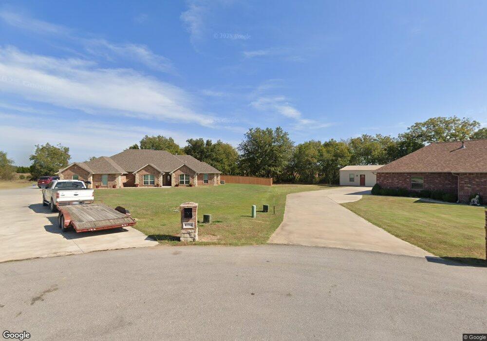
10731 N Kickapoo Ave Shawnee, OK 74804
Estimated Value: $347,000 - $383,000
3
Beds
2
Baths
2,877
Sq Ft
$125/Sq Ft
Est. Value
About This Home
This home is located at 10731 N Kickapoo Ave, Shawnee, OK 74804 and is currently estimated at $359,476, approximately $124 per square foot. 10731 N Kickapoo Ave is a home located in Pottawatomie County with nearby schools including Family Of Faith Christian School.
Ownership History
Date
Name
Owned For
Owner Type
Purchase Details
Closed on
Jul 1, 2011
Sold by
Henry Charles Bradford and Henry Kimberley D
Bought by
Orville R & Bettie S Austin Revocable Tr
Current Estimated Value
Purchase Details
Closed on
May 2, 2009
Sold by
Orville R And Bettie S Austin Revocable
Bought by
Huff James G and Huff Jackie L
Home Financials for this Owner
Home Financials are based on the most recent Mortgage that was taken out on this home.
Original Mortgage
$229,900
Interest Rate
4.5%
Mortgage Type
New Conventional
Create a Home Valuation Report for This Property
The Home Valuation Report is an in-depth analysis detailing your home's value as well as a comparison with similar homes in the area
Purchase History
| Date | Buyer | Sale Price | Title Company |
|---|---|---|---|
| Orville R & Bettie S Austin Revocable Tr | $425,000 | None Available | |
| Huff James G | $242,000 | Choice Title Ins |
Source: Public Records
Mortgage History
| Date | Status | Borrower | Loan Amount |
|---|---|---|---|
| Previous Owner | Huff James G | $229,900 |
Source: Public Records
Tax History
| Year | Tax Paid | Tax Assessment Tax Assessment Total Assessment is a certain percentage of the fair market value that is determined by local assessors to be the total taxable value of land and additions on the property. | Land | Improvement |
|---|---|---|---|---|
| 2025 | $3,069 | $27,949 | $2,630 | $25,319 |
| 2023 | $2,999 | $27,135 | $2,630 | $24,505 |
| 2022 | $2,964 | $27,135 | $2,630 | $24,505 |
| 2021 | $3,053 | $27,135 | $2,630 | $24,505 |
| 2020 | $3,186 | $27,871 | $2,630 | $25,241 |
| 2019 | $3,272 | $28,792 | $2,630 | $26,162 |
| 2018 | $2,859 | $25,112 | $1,381 | $23,731 |
| 2017 | $3,536 | $30,986 | $2,078 | $28,908 |
| 2016 | $2,779 | $29,511 | $2,078 | $27,433 |
| 2015 | $2,641 | $28,106 | $2,078 | $26,028 |
| 2014 | -- | $27,287 | $2,078 | $25,209 |
Source: Public Records
Map
Nearby Homes
- 41182 Hazel Dell Rd
- 41369 Webb St
- 41380 Webb St
- 41424 Steele St
- 41468 Steele St
- 41378 Steele St
- 41439 Steele St
- 41237 Steele St
- 41243 Steele St
- 41262 Steele St
- 41242 Steele St
- 41417 Steele St
- 41444 Steele St
- 41248 Steele St
- 41255 Steele St
- 41465 Steele St
- 41231 Steele St
- 41249 Steele St
- 41232 Steele St
- 41393 Steele St
- 10700 Corbin Dr
- 10686 Corbin Dr
- 0 Corbin Dr
- 41152 Tallen Rd
- 41165 Tallen Rd
- 10812 N Kickapoo Ave
- 10987 N Kickapoo Ave
- 41234 Hazel Dell Rd
- 41260 Hazel Dell Rd
- 40089 Hazel Dell Rd
- 40075 Hazel Dell Rd
- 41286 Hazel Dell Rd
- 00000 Hazel Dell Rd
- 0000 Hazel Dell Rd
- 41312 Hazel Dell Rd
- 41338 Hazel Dell Rd
- 0 W 1070 Rd Unit 1018626
- 41416 Hazel Dell Rd
- 11048 N Kickapoo Ave
- 11111 N Kickapoo Ave
Your Personal Tour Guide
Ask me questions while you tour the home.