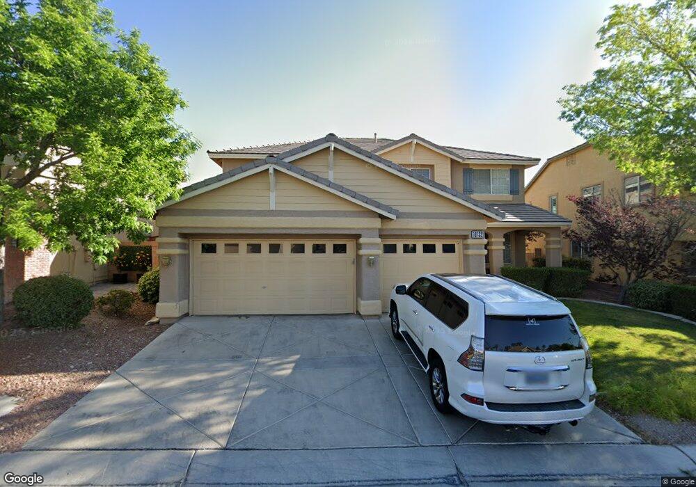
10732 Sprucedale Ave Las Vegas, NV 89144
Summerlin NeighborhoodEstimated Value: $746,956 - $891,000
5
Beds
4
Baths
3,320
Sq Ft
$251/Sq Ft
Est. Value
About This Home
This home is located at 10732 Sprucedale Ave, Las Vegas, NV 89144 and is currently estimated at $834,239, approximately $251 per square foot. 10732 Sprucedale Ave is a home located in Clark County with nearby schools including John W. Bonner Elementary School, Sig Rogich Middle School, and Palo Verde High School.
Ownership History
Date
Name
Owned For
Owner Type
Purchase Details
Closed on
Jul 23, 2008
Sold by
Chu Ruby M and Chu Vincent O
Bought by
Chu Ruby M and Chu Vincent O
Current Estimated Value
Purchase Details
Closed on
Apr 19, 2000
Sold by
Kaufman & Broad Of Nevada Inc
Bought by
Chu Vincent O and Chu Ruby M
Home Financials for this Owner
Home Financials are based on the most recent Mortgage that was taken out on this home.
Original Mortgage
$169,000
Outstanding Balance
$57,940
Interest Rate
8.24%
Estimated Equity
$776,299
Create a Home Valuation Report for This Property
The Home Valuation Report is an in-depth analysis detailing your home's value as well as a comparison with similar homes in the area
Home Values in the Area
Average Home Value in this Area
Purchase History
| Date | Buyer | Sale Price | Title Company |
|---|---|---|---|
| Chu Ruby M | -- | None Available | |
| Chu Vincent O | $259,990 | First American Title Co |
Source: Public Records
Mortgage History
| Date | Status | Borrower | Loan Amount |
|---|---|---|---|
| Open | Chu Vincent O | $169,000 |
Source: Public Records
Tax History Compared to Growth
Tax History
| Year | Tax Paid | Tax Assessment Tax Assessment Total Assessment is a certain percentage of the fair market value that is determined by local assessors to be the total taxable value of land and additions on the property. | Land | Improvement |
|---|---|---|---|---|
| 2025 | $5,214 | $184,569 | $76,650 | $107,919 |
| 2024 | $4,829 | $184,569 | $76,650 | $107,919 |
| 2023 | $4,829 | $159,285 | $56,700 | $102,585 |
| 2022 | $4,471 | $140,698 | $47,250 | $93,448 |
| 2021 | $4,140 | $132,809 | $43,750 | $89,059 |
| 2020 | $3,841 | $128,182 | $39,900 | $88,282 |
| 2019 | $3,600 | $124,402 | $37,450 | $86,952 |
| 2018 | $3,435 | $115,256 | $32,200 | $83,056 |
| 2017 | $3,814 | $116,149 | $32,200 | $83,949 |
| 2016 | $3,215 | $111,223 | $25,200 | $86,023 |
| 2015 | $3,209 | $105,018 | $20,300 | $84,718 |
| 2014 | $3,115 | $99,841 | $14,525 | $85,316 |
Source: Public Records
Map
Nearby Homes
- 10728 Balsam Creek Ave
- 10705 Sprucedale Ave
- 500 Joe Willis St
- 620 Bianca Bay St
- 10813 Elk Lake Dr
- 533 Via Santiago St
- 353 Amber Pine St Unit 203
- 424 Pine Haven St Unit 201
- 10524 Pine Gardens Ct Unit 203
- 10524 India Hawthorn Ave
- 10730 Amber Ridge Dr Unit 206
- 400 Amber Pine St Unit 203
- 644 Chase Tree St
- 10710 Destination Ln Unit 201
- 11001 Edina Ct
- 10600 Amber Ridge Dr Unit 203
- 10553 Pine Pointe Ave Unit 201
- 205 Derwent Place
- 161 Swale Ln
- 10716 Aire Dr
- 10728 Sprucedale Ave
- 10736 Sprucedale Ave
- 10729 New Boro Ave
- 10733 New Boro Ave
- 10725 New Boro Ave
- 10724 Sprucedale Ave
- 10740 Sprucedale Ave Unit n/a
- 10740 Sprucedale Ave
- 10733 Sprucedale Ave
- 10737 New Boro Ave
- 10721 New Boro Ave
- 10729 Sprucedale Ave
- 10729 Sprucedale Ave Unit None
- 10737 Sprucedale Ave
- 10720 Sprucedale Ave
- 10725 Sprucedale Ave
- 10744 Sprucedale Ave
- 10741 New Boro Ave
- 10717 New Boro Ave
- 10741 Sprucedale Ave