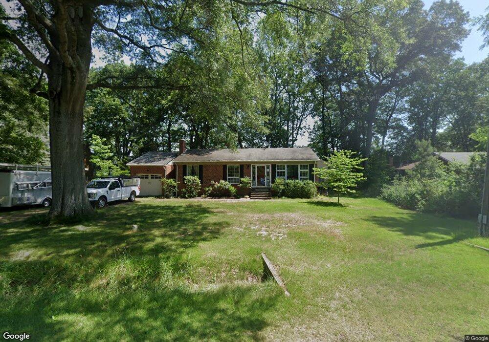
10735 Kasota Rd Chestertown, MD 21620
Estimated Value: $470,766 - $565,000
--
Bed
2
Baths
1,220
Sq Ft
$408/Sq Ft
Est. Value
About This Home
This home is located at 10735 Kasota Rd, Chestertown, MD 21620 and is currently estimated at $498,192, approximately $408 per square foot. 10735 Kasota Rd is a home located in Kent County with nearby schools including Center for Innovation, Kent County Middle School, and Kent County High School.
Ownership History
Date
Name
Owned For
Owner Type
Purchase Details
Closed on
Aug 6, 2019
Sold by
Mayo Lynn
Bought by
Lynn Mayo Living Trust
Current Estimated Value
Purchase Details
Closed on
Jan 25, 2007
Sold by
Ruth John K and Ruth Shirley A
Bought by
Mayo Lynn Marie and Nancy Mayo Breden
Home Financials for this Owner
Home Financials are based on the most recent Mortgage that was taken out on this home.
Original Mortgage
$297,600
Outstanding Balance
$178,843
Interest Rate
6.22%
Mortgage Type
Purchase Money Mortgage
Estimated Equity
$319,349
Purchase Details
Closed on
Feb 8, 1982
Sold by
Tobolski Michael J
Bought by
Ruth John K and Ruth Shirley A
Create a Home Valuation Report for This Property
The Home Valuation Report is an in-depth analysis detailing your home's value as well as a comparison with similar homes in the area
Home Values in the Area
Average Home Value in this Area
Purchase History
| Date | Buyer | Sale Price | Title Company |
|---|---|---|---|
| Lynn Mayo Living Trust | -- | None Available | |
| Mayo Lynn Marie | $372,000 | -- | |
| Mayo Lynn Marie | $372,000 | -- | |
| Ruth John K | $65,900 | -- |
Source: Public Records
Mortgage History
| Date | Status | Borrower | Loan Amount |
|---|---|---|---|
| Open | Mayo Lynn Marie | $297,600 | |
| Closed | Mayo Lynn Marie | $297,600 |
Source: Public Records
Tax History Compared to Growth
Tax History
| Year | Tax Paid | Tax Assessment Tax Assessment Total Assessment is a certain percentage of the fair market value that is determined by local assessors to be the total taxable value of land and additions on the property. | Land | Improvement |
|---|---|---|---|---|
| 2025 | $4,190 | $369,500 | $246,100 | $123,400 |
| 2024 | $4,120 | $363,300 | $0 | $0 |
| 2023 | $4,050 | $357,100 | $0 | $0 |
| 2022 | $3,944 | $350,900 | $246,100 | $104,800 |
| 2021 | $3,944 | $350,900 | $246,100 | $104,800 |
| 2020 | $3,979 | $350,900 | $246,100 | $104,800 |
| 2019 | $4,033 | $355,600 | $246,100 | $109,500 |
| 2018 | $4,033 | $355,600 | $246,100 | $109,500 |
| 2017 | $4,057 | $355,600 | $0 | $0 |
| 2016 | -- | $357,800 | $0 | $0 |
| 2015 | -- | $357,800 | $0 | $0 |
| 2014 | $4,130 | $357,800 | $0 | $0 |
Source: Public Records
Map
Nearby Homes
- 10751 Millbrook Dr
- LOTS 253-254 Carimon Rd
- 0 Beltram Rd
- 0 Cloquet Rd Unit MDKE2005966
- 0 Lenapah Rd
- 0 Tonopah Rd Unit MDKE2005470
- 0 Tonopah Rd Unit MDKE2005564
- 0 Buck Neck Rd Unit MDKE2005262
- 0 Clarissa Rd Unit MDKE2005786
- Parcel Buck Neck Ldg Rd
- 0 Towhee Rd
- 0 Spinnaker Rd
- 0 Kinglet Rd
- 0 Cogar Rd Unit MDKE2005472
- 0 Sandpiper Rd Unit MDKE2005542
- 0 Bunting Rd
- 0 Lot 24 & 25 Buck Neck Rd Unit MDKE2004828
- 0 Redfield Rd Unit MDKE2002842
- 0 Sheldrake Dr
- 23710 L Rd
- 10731 Kasota Rd
- 10723 Kasota Rd
- 10751 Kasota Rd
- 0 Kasota Rd Unit 1000083613
- 10726 Kasota Rd
- 10745 Kasota Rd
- 10769 Kasota Rd
- 10699 Kasota Rd
- 10688 Kasota Rd
- 10771 Carimon Rd
- 10785 Kasota Rd
- 23396 Clarissa Rd
- 10674 Kasota Rd
- 10767 Carimon Rd
- 23272 Clarissa Rd
- LOTS 225 & 226 Clarissa Rd
- Lot 142 & 143 Clarissa Rd
- 10790 Kasota Rd
- 10706 Mallard Point Rd
- 10774 Carimon Rd