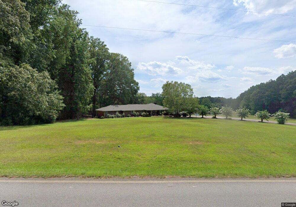
10737 Highway 100 Hogansville, GA 30230
Estimated Value: $303,000 - $433,797
3
Beds
2
Baths
2,070
Sq Ft
$182/Sq Ft
Est. Value
About This Home
This home is located at 10737 Highway 100, Hogansville, GA 30230 and is currently estimated at $375,949, approximately $181 per square foot. 10737 Highway 100 is a home located in Meriwether County with nearby schools including George E. Washington Elementary School.
Ownership History
Date
Name
Owned For
Owner Type
Purchase Details
Closed on
Mar 29, 2016
Sold by
Wheelus Stanley Carl Estat
Bought by
Wheelus Fredene Adcock
Current Estimated Value
Purchase Details
Closed on
Nov 4, 2008
Purchase Details
Closed on
Jun 20, 1996
Sold by
Wheelus Joyce J
Bought by
Wheelus Stanley Carl
Purchase Details
Closed on
Mar 14, 1985
Sold by
Wheelus Stanley
Bought by
Wheelus Joyce J
Purchase Details
Closed on
Jan 1, 1985
Bought by
Wheelus Stanley
Purchase Details
Closed on
Jan 1, 1963
Purchase Details
Closed on
Jan 1, 1962
Create a Home Valuation Report for This Property
The Home Valuation Report is an in-depth analysis detailing your home's value as well as a comparison with similar homes in the area
Home Values in the Area
Average Home Value in this Area
Purchase History
| Date | Buyer | Sale Price | Title Company |
|---|---|---|---|
| Wheelus Fredene Adcock | -- | -- | |
| -- | -- | -- | |
| Wheelus Stanley Carl | -- | -- | |
| Wheelus Joyce J | -- | -- | |
| Wheelus Stanley | -- | -- | |
| -- | -- | -- | |
| -- | -- | -- |
Source: Public Records
Tax History Compared to Growth
Tax History
| Year | Tax Paid | Tax Assessment Tax Assessment Total Assessment is a certain percentage of the fair market value that is determined by local assessors to be the total taxable value of land and additions on the property. | Land | Improvement |
|---|---|---|---|---|
| 2024 | $2,928 | $138,504 | $60,200 | $78,304 |
| 2023 | $2,119 | $111,904 | $60,200 | $51,704 |
| 2022 | $1,230 | $111,904 | $60,200 | $51,704 |
| 2021 | $1,187 | $111,904 | $60,200 | $51,704 |
| 2020 | $1,193 | $111,904 | $60,200 | $51,704 |
| 2019 | $1,140 | $111,904 | $60,200 | $51,704 |
| 2018 | $1,201 | $111,904 | $60,200 | $51,704 |
| 2017 | $1,268 | $111,904 | $60,200 | $51,704 |
| 2016 | $972 | $112,884 | $60,200 | $52,684 |
| 2015 | $970 | $112,884 | $60,200 | $52,684 |
| 2014 | $967 | $112,884 | $60,200 | $52,684 |
| 2013 | -- | $112,884 | $60,200 | $52,684 |
Source: Public Records
Map
Nearby Homes
- 5418 Forrest Rd
- 3535 Forrest Rd
- 7133 Forrest Rd
- 210 Perkins Place Dr Unit LOT 29
- 213 Perkins Place Dr Unit LOT 23
- 217 Perkins Place Dr Unit LOT 24
- 98.81 Ellis Rd
- 1314 Tenny Nelson Rd
- 5151 Primrose Rd
- 2860 Sewell Rd
- 1501 E Main St
- 120 Delta Downs Ct
- 6608 Highway 100
- 8444 Forrest Rd
- 516 Tenney Nelson Rd
- 603 Haflinger Rd Unit 22
- 133 Percheron Rd
- 133 Percheron Rd Unit 95
- 323 Lusitano Trace Unit 168
- 605 Haflinger Rd Unit 21
- 10600 Highway 100
- 10581 Georgia 100
- 10581 Highway 100
- 10818 Highway 100
- 10526 Georgia 100
- 10526 Highway 100
- 10515 Highway 100
- 10441 Highway 100
- 10426 Highway 100
- 10433 Georgia 100
- 11032 Georgia 100
- 10911 Highway 100
- 11032 Highway 100
- 11077 Georgia 100
- 11077 Highway 100
- 11212 Highway 100
- 10148 Highway 100
- 11281 Georgia 100
- 11281 Highway 100
- 10000 Georgia 100