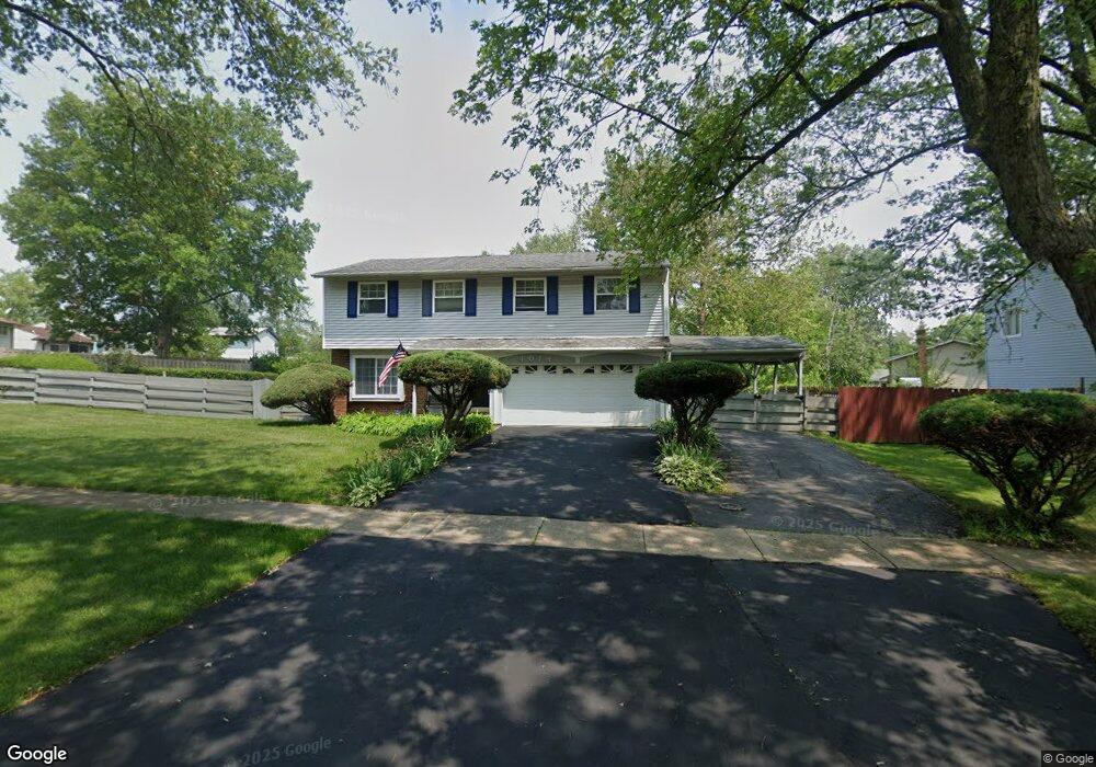
1074 Amherst Ln University Park, IL 60484
Estimated Value: $169,674 - $293,000
--
Bed
1
Bath
2,384
Sq Ft
$97/Sq Ft
Est. Value
About This Home
This home is located at 1074 Amherst Ln, University Park, IL 60484 and is currently estimated at $231,669, approximately $97 per square foot. 1074 Amherst Ln is a home located in Will County with nearby schools including Balmoral Elementary School, Crete-Monee Middle School, and Crete-Monee High School.
Ownership History
Date
Name
Owned For
Owner Type
Purchase Details
Closed on
Nov 18, 1993
Sold by
Va
Bought by
Morris Edward J and Morris Bernadine
Current Estimated Value
Home Financials for this Owner
Home Financials are based on the most recent Mortgage that was taken out on this home.
Original Mortgage
$52,500
Interest Rate
7.26%
Create a Home Valuation Report for This Property
The Home Valuation Report is an in-depth analysis detailing your home's value as well as a comparison with similar homes in the area
Home Values in the Area
Average Home Value in this Area
Purchase History
| Date | Buyer | Sale Price | Title Company |
|---|---|---|---|
| Morris Edward J | -- | -- |
Source: Public Records
Mortgage History
| Date | Status | Borrower | Loan Amount |
|---|---|---|---|
| Previous Owner | Morris Edward J | $52,500 |
Source: Public Records
Tax History Compared to Growth
Tax History
| Year | Tax Paid | Tax Assessment Tax Assessment Total Assessment is a certain percentage of the fair market value that is determined by local assessors to be the total taxable value of land and additions on the property. | Land | Improvement |
|---|---|---|---|---|
| 2024 | $6,562 | $68,280 | $8,402 | $59,878 |
| 2023 | $6,562 | $58,862 | $7,243 | $51,619 |
| 2022 | $5,747 | $51,778 | $6,371 | $45,407 |
| 2021 | $4,233 | $47,142 | $5,852 | $41,290 |
| 2020 | $5,232 | $45,614 | $5,662 | $39,952 |
| 2019 | $5,231 | $43,256 | $5,369 | $37,887 |
| 2018 | $4,749 | $41,581 | $5,255 | $36,326 |
| 2017 | $5,701 | $39,703 | $5,138 | $34,565 |
| 2016 | $5,356 | $37,609 | $4,941 | $32,668 |
| 2015 | $4,555 | $34,377 | $4,503 | $29,874 |
| 2014 | $4,555 | $33,903 | $4,441 | $29,462 |
| 2013 | $4,555 | $35,500 | $4,650 | $30,850 |
Source: Public Records
Map
Nearby Homes
- 1039 Abbot Ln
- 1032 Samson Dr
- 1109 Abbot Ln
- 1029 Samson Dr
- 1039 Barrow Ct
- 613 Farmview Rd
- 1244 Harvest Ln
- 537 Nathan Rd
- 1031 Blackhawk Dr
- 740 Mission St
- 543 Regent Rd
- 607 Sullivan Ln
- 903 Blackhawk Dr
- 608 Sullivan Ln
- 815 Blackhawk Dr
- 655 Sullivan Ln
- 807 Blackhawk Dr
- 662 Sullivan Ln
- 735 Union Dr
- 610 Sandra Dr
- 1072 Amherst Ln
- 1048 Ashridge Ln
- 1080 Amherst Ln
- 1077 Amherst Ln
- 1057 Abbott Ln
- 1079 Amherst Ln
- 1075 Amherst Ln
- 1082 Amherst Ln
- 1055 Abbott Ln
- 1073 Amherst Ln
- 1081 Amherst Ln
- 1059 Abbott Ln
- 1055 Abbot Ln
- 1066 Amherst Ln
- 1044 Ashridge Ln
- 1071 Amherst Ln
- 1053 Abbott Ln Unit 1
- 1047 Ashridge Ln
- 1069 Amherst Ln