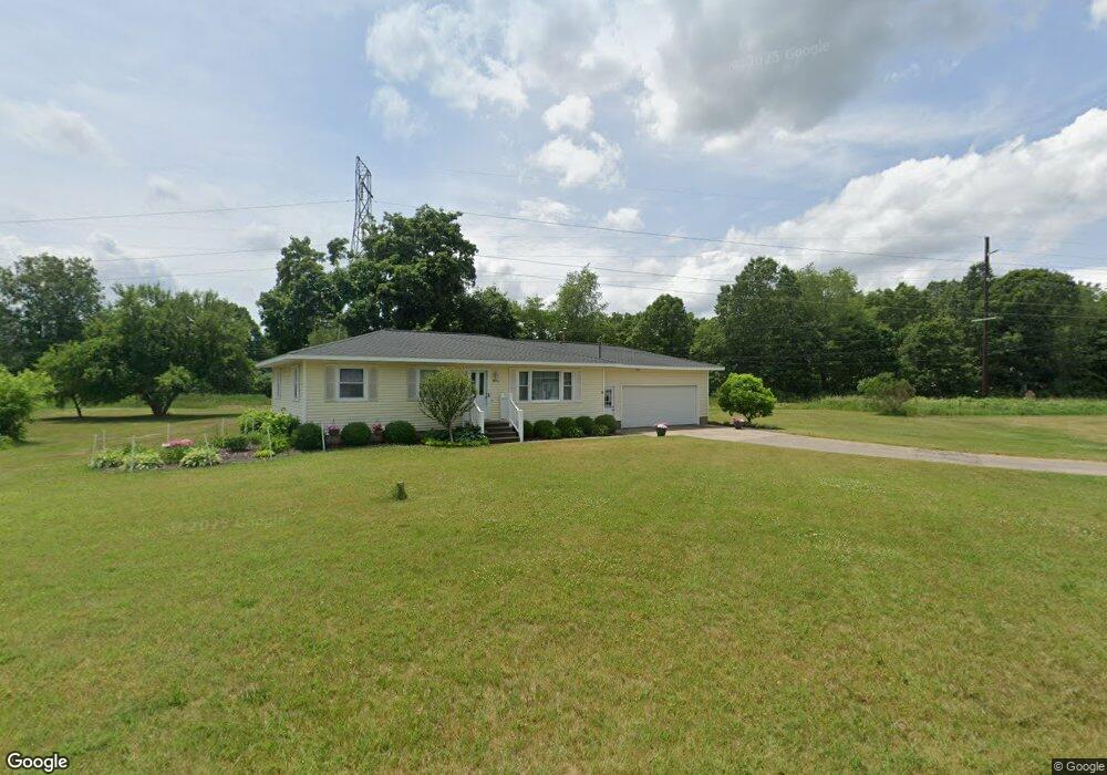
1074 Aster St Wayland, MI 49348
Estimated Value: $251,289 - $293,000
3
Beds
1
Bath
1,092
Sq Ft
$247/Sq Ft
Est. Value
About This Home
This home is located at 1074 Aster St, Wayland, MI 49348 and is currently estimated at $269,322, approximately $246 per square foot. 1074 Aster St is a home located in Allegan County with nearby schools including Wayland High School and St. Therese Catholic School.
Ownership History
Date
Name
Owned For
Owner Type
Purchase Details
Closed on
Sep 11, 2008
Sold by
Clack Donald
Bought by
Baumgard Kimberly S
Current Estimated Value
Home Financials for this Owner
Home Financials are based on the most recent Mortgage that was taken out on this home.
Original Mortgage
$87,203
Outstanding Balance
$58,085
Interest Rate
6.55%
Mortgage Type
Purchase Money Mortgage
Estimated Equity
$211,237
Purchase Details
Closed on
Nov 7, 2005
Sold by
Dias Wayne and Dias Anna Belle
Bought by
Dias Wayne H and Dias Anna B
Create a Home Valuation Report for This Property
The Home Valuation Report is an in-depth analysis detailing your home's value as well as a comparison with similar homes in the area
Home Values in the Area
Average Home Value in this Area
Purchase History
| Date | Buyer | Sale Price | Title Company |
|---|---|---|---|
| Baumgard Kimberly S | $89,900 | Michigan Bankers Title | |
| Dias Wayne H | -- | -- |
Source: Public Records
Mortgage History
| Date | Status | Borrower | Loan Amount |
|---|---|---|---|
| Open | Baumgard Kimberly S | $87,203 |
Source: Public Records
Tax History Compared to Growth
Tax History
| Year | Tax Paid | Tax Assessment Tax Assessment Total Assessment is a certain percentage of the fair market value that is determined by local assessors to be the total taxable value of land and additions on the property. | Land | Improvement |
|---|---|---|---|---|
| 2025 | $1,772 | $95,300 | $17,600 | $77,700 |
| 2024 | $1,616 | $90,600 | $17,600 | $73,000 |
| 2023 | $1,616 | $82,200 | $17,600 | $64,600 |
| 2022 | $1,616 | $76,400 | $14,000 | $62,400 |
| 2021 | $1,511 | $70,900 | $14,000 | $56,900 |
| 2020 | $1,484 | $68,100 | $14,000 | $54,100 |
| 2019 | $1,441 | $58,800 | $14,000 | $44,800 |
| 2018 | $1,390 | $56,900 | $14,000 | $42,900 |
| 2017 | $0 | $54,700 | $14,000 | $40,700 |
| 2016 | $0 | $44,000 | $14,000 | $30,000 |
| 2015 | -- | $44,000 | $14,000 | $30,000 |
| 2014 | -- | $44,100 | $14,000 | $30,100 |
| 2013 | $1,568 | $42,500 | $14,000 | $28,500 |
Source: Public Records
Map
Nearby Homes
- 3610 Garden St
- 3770 Division Ave S
- 545 N Main St
- 3570 Windsor Woods Dr
- 1143 Regina Trail
- 3685 Calkins Ct
- 219 Alpine St
- 4674 12th St
- 319 Alpine St
- 212 E Superior St
- 146 Hanlon Ct
- 110 E Sycamore St
- 621 S Main St
- 401 Anderson Dr
- 3897 Division St
- 330 Lotz Ct
- 835 Wild Flower Ct
- 3282 Stonehill Ct
- 3296 Stonehill Ct
- 3214 7th St
- 1069 Aster St
- 3636 Lilac St
- 1067 Aster St
- 1058 Aster St
- 3637 Urban Depot Ct
- 3632 Lilac St
- 3633 Urban Depot Ct
- 3633 Lilac St
- 1070 Serenity Ridge Dr Unit 10
- 3645 Urban Depot Ct
- 1074 Serenity Ridge Dr Unit 11
- 1056 Aster St
- 1066 Serenity Ridge Dr Unit 9
- 1059 Aster St
- 3629 Urban Depot Ct
- 3630 Lilac St
- 1062 Serenity Ridge Dr Unit 8
- 3631 Lilac St
- 1055 Aster St
- 1078 Serenity Ridge Dr Unit 12