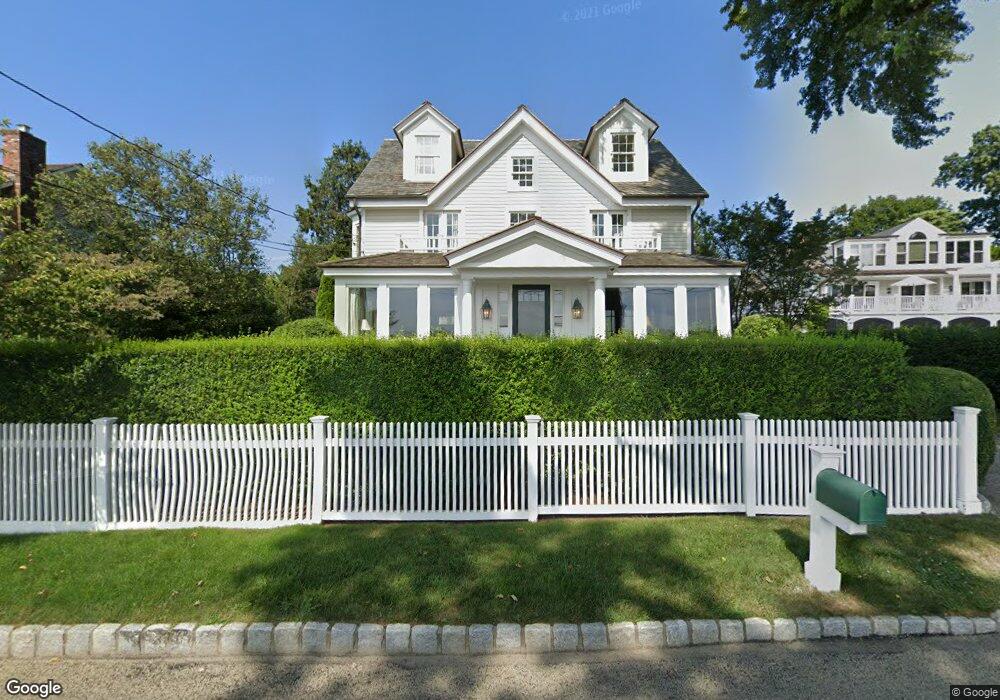
1074 Harbor Rd Southport, CT 06890
Southport NeighborhoodEstimated Value: $3,367,000 - $5,057,000
5
Beds
5
Baths
3,504
Sq Ft
$1,194/Sq Ft
Est. Value
About This Home
This home is located at 1074 Harbor Rd, Southport, CT 06890 and is currently estimated at $4,184,376, approximately $1,194 per square foot. 1074 Harbor Rd is a home located in Fairfield County with nearby schools including Mill Hill School, Roger Ludlowe Middle School, and Fairfield Ludlowe High School.
Ownership History
Date
Name
Owned For
Owner Type
Purchase Details
Closed on
Dec 10, 1992
Sold by
Bayne Berkeley G
Bought by
Soper John M
Current Estimated Value
Create a Home Valuation Report for This Property
The Home Valuation Report is an in-depth analysis detailing your home's value as well as a comparison with similar homes in the area
Home Values in the Area
Average Home Value in this Area
Purchase History
| Date | Buyer | Sale Price | Title Company |
|---|---|---|---|
| Soper John M | $100,000 | -- |
Source: Public Records
Mortgage History
| Date | Status | Borrower | Loan Amount |
|---|---|---|---|
| Open | Soper John M | $1,000,000 | |
| Closed | Soper John M | $600,000 | |
| Closed | Soper John M | $140,000 |
Source: Public Records
Tax History Compared to Growth
Tax History
| Year | Tax Paid | Tax Assessment Tax Assessment Total Assessment is a certain percentage of the fair market value that is determined by local assessors to be the total taxable value of land and additions on the property. | Land | Improvement |
|---|---|---|---|---|
| 2025 | $48,673 | $1,714,440 | $1,289,470 | $424,970 |
| 2024 | $47,833 | $1,714,440 | $1,289,470 | $424,970 |
| 2023 | $47,164 | $1,714,440 | $1,289,470 | $424,970 |
| 2022 | $46,701 | $1,714,440 | $1,289,470 | $424,970 |
| 2021 | $46,256 | $1,714,440 | $1,289,470 | $424,970 |
| 2020 | $51,908 | $1,937,600 | $1,393,560 | $544,040 |
| 2019 | $51,908 | $1,937,600 | $1,393,560 | $544,040 |
| 2018 | $51,075 | $1,937,600 | $1,393,560 | $544,040 |
| 2017 | $50,029 | $1,937,600 | $1,393,560 | $544,040 |
| 2016 | $49,312 | $1,937,600 | $1,393,560 | $544,040 |
| 2015 | $48,489 | $1,956,010 | $1,205,960 | $750,050 |
| 2014 | $47,727 | $1,956,010 | $1,205,960 | $750,050 |
Source: Public Records
Map
Nearby Homes
- 260 Willow St
- 944 Pequot Ave
- 305 S Gate Ln
- 2 Elmwood Dr Unit 2
- 828 Sasco Hill Rd
- 775 Sasco Hill Rd
- 1131 Sasco Hill Rd
- 154 Gorham Rd
- 153 Pease Ave
- 28 Mill Hill Rd Unit 28
- 972 S Pine Creek Rd
- 342 Greens Farms Rd
- 1410 S Pine Creek Rd
- 85 Patrick Dr
- 100 Overhill Rd
- 88 Overhill Rd
- 220 Lansdowne
- 97 Field Point Dr
- 53 Hilltop Dr
- 844 Mill Hill Terrace
- 1088 Harbor Rd
- 1100 Harbor Rd
- 1110 Harbor Rd
- 1036 Harbor Rd
- 275 Willow St
- 247 Willow St
- 1000 Harbor Rd
- 221 Willow St
- 293 Willow St
- 181 Willow St
- 208 Willow St
- 222 Willow St
- 194 Willow St
- 260 Willow St Unit RENT
- 968 Harbor Rd
- 178 Willow St
- 340 Willow St
- 340 Willow St Unit + 3 Lots
- 935 Harbor Rd
- 300 Willow St